


Jakobsweg Stage 4 Berwang - Haldensee


The Jakobsweg Tirol-Allgäu
This alpine Jakobsweg route, both scenically and culturally very attractive, leads off the main roads over three Alpine passes, namely the Fernpass, the old Gaichtpass, and the...
The Jakobsweg Tirol-Allgäu
This alpine Jakobsweg route, both scenically and culturally very attractive, leads off the main roads over three Alpine passes, namely the Fernpass, the old Gaichtpass, and the Jochpass. It crosses some of the most attractive hiking and holiday areas in Tirol and southern Oberallgäu on ancient Roman, trade, and pilgrimage routes.
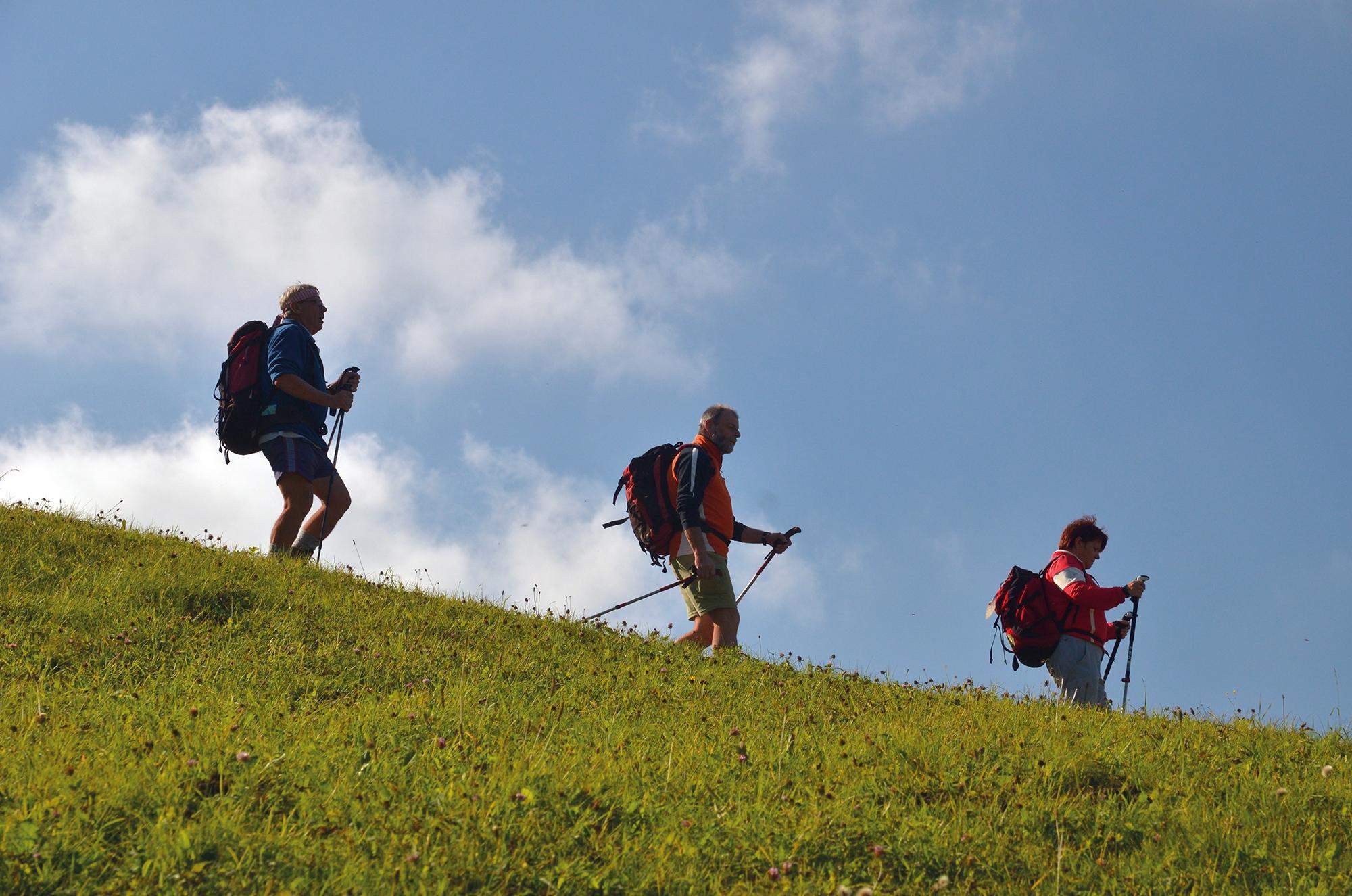
Jakobs pilgrims can undoubtedly look forward to a particularly impressive route here. All the more so because it mostly leads through rural and tranquil mountain regions in which people were deeply shaped for centuries by faith and the fear of natural forces. Therefore, these regions are particularly rich in churches and chapels with numerous art-historical treasures, often from very different eras. In combination with magnificent panoramic views, constantly changing perspectives, and the meditative, occasionally strenuous hiking in wind and weather through these alpine natural landscapes, this "camino" becomes a path engaging all the senses, full of intense experiences, encounters, insights – and perhaps also new realizations about oneself.
Integration into the Jakobweg network of Austria and Germany
The Jakobsweg Tirol-Allgäu connects in Stams to the German-Austrian Jakobsweg from Munich along the Isar, Loisach, Leutascher Ache, and Inn, as well as the two Austrian Jakobswege that unite in Innsbruck: the route from Lofer/Salzburg to Innsbruck and the route from Lienz to Innsbruck. From Innsbruck, this bundled Jakobsweg thread continues via Stams to Arlberg or from Stams on the Tirol-Allgäu route.
Pilgrim stamps and pilgrim pass
In the Jakobs chapels and the churches listed in the text, there are stamp points along the Jakobsweg. These pilgrim stamps are lovely souvenirs for your own pilgrim diary. In the internationally recognized pilgrim pass, they serve as proof of the completed route. The pilgrim pass also enables overnight stays in special pilgrim accommodations, although there are still few of these on this route. It is available for a processing fee from the Jakobs pilgrim associations.


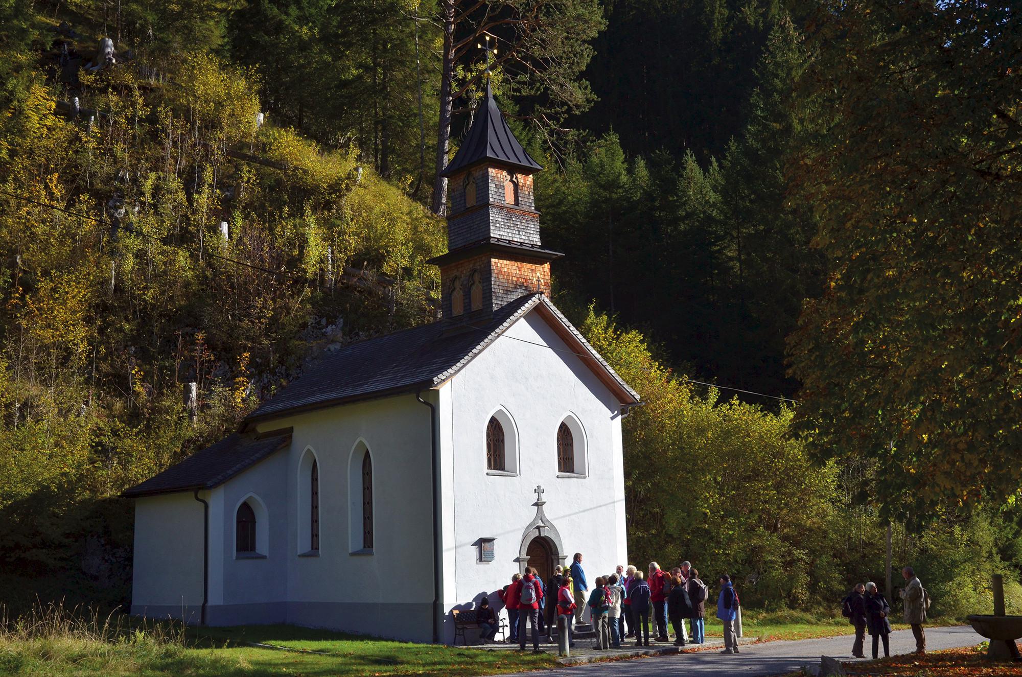


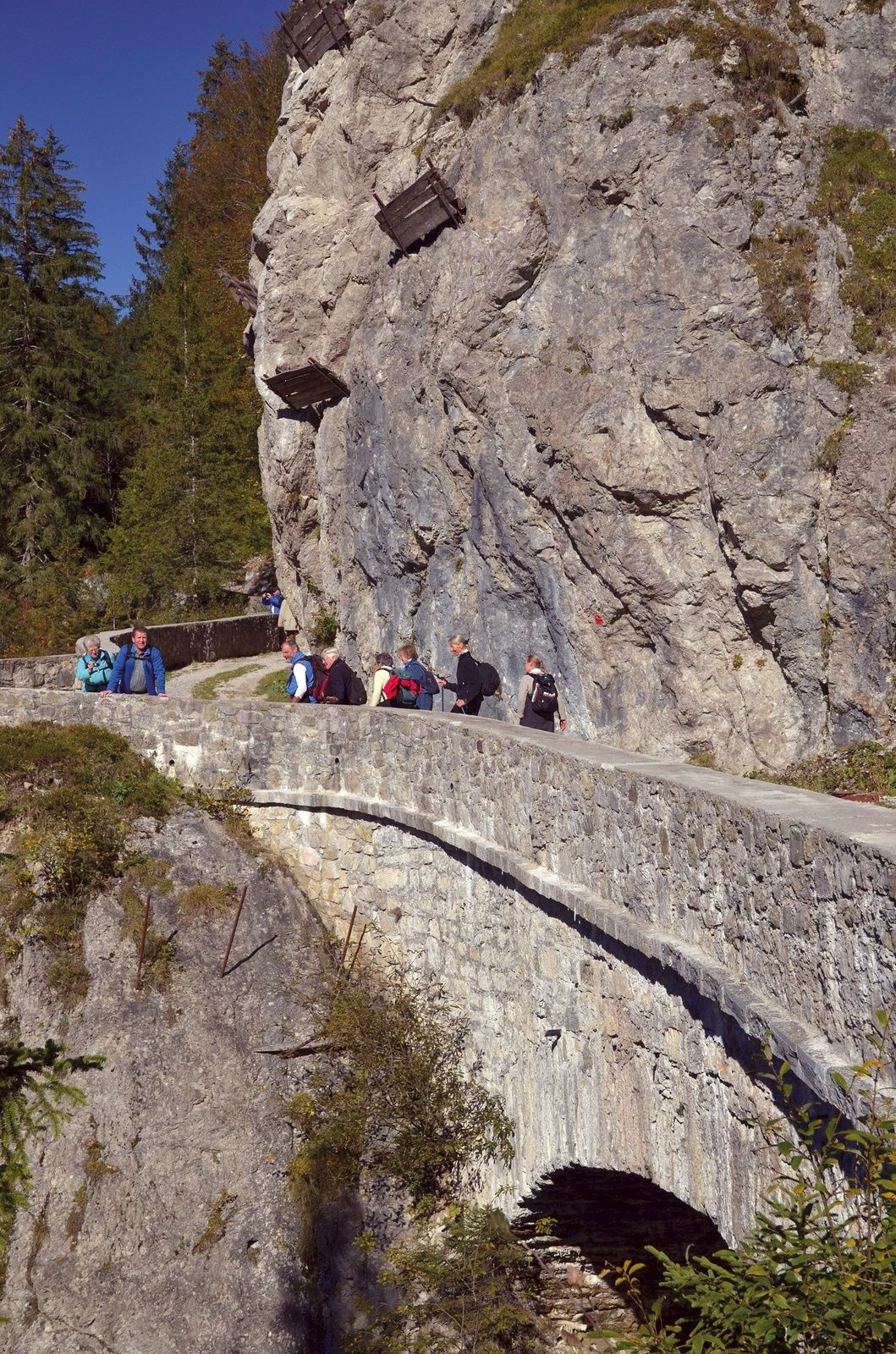

From the Jakobs Church turn right towards Rinnen, at the edge of the village continue parallel to the road through meadows down to Moossee, to the valley station of the Thanellerkar lift and to the beautifully restored Sebastians Chapel (17th century) in Rinnen. Continue downhill towards Rieden. At the next junction, do not turn left (Rauth/Waterfall), but continue straight downhill towards Rieden. The forest road passes a small waterfall, along the reservoir and steeply downhill to a fork in the road. To the left, you can reach Rieden directly via a very steep forest road; the pilgrim path follows the mountain bike route in a wide right bend downhill to Riedener See and the village with a pretty chapel. Continue on the marked hiking trail towards Weißenbach, finally to the state road and across the Lech bridge to Weißenbach, which is ideal for dining, shopping, and overnight stays. Stamp point in the municipal office. Between the church and the Golden Lamm guesthouse, the marked Jakobsweg runs from the bridge along the Weißenbach towards the old Gaichtpass road to the beautiful Mariahilf Chapel (1714) under the Gaicht, which is still a popular pilgrimage site today. It was enlarged in 1860 at the expense of the innkeeper Johann Martin Lutz from the Post guesthouse. The last complete renovation was completed in 2002. The old trade route to Gaichtpass, equipped with interesting information boards, winds uphill in switchbacks over elaborately restored arch bridges, crosses the new pass road once, and leads to the hamlet of Gaicht (1117 m) in the Tannheimer Tal with the chapel "Maria Heimsuchung", built in 1695 on the site of a Gothic chapel. The oldest house in the Tannheimer Tal is also in Gaicht. Following the pilgrim path towards Nesselwängle, you reach the wood/parking area (Schneetal) through the underpass of the federal road to the bike/hiking trail Tannheimer Tal on the left of the Nesselwängler Ache and thus reach the valley station of the Krinnenalplift (Schmitte) with dining options. Those who hike into the center of Nesselwängle for dining and to visit the St. Antonius Chapel will later reach the Krinnenalplift via the Mühlenweg and then return to the Jakobsweg. The continuation of the path first leads through meadows, then along the shore of Haldensee to the end of the lake. There, before the beach and parking lot, go straight ahead, past the serviced Tauscher’s Alm, and continue to Haldensee. The small Jakob Chapel (stamp point), built in 1642, has stood in the middle of the village since 1703.
Да
Personal pilgrim equipment must be safe and functional and meet the respective technical standard. The backpack should not exceed a weight of 15 kg. Every pilgrim is recommended to inform and prepare themselves extensively through specialist literature or the internet.
It should be noted that there is an increased risk of accidents and injuries on pilgrim paths. Despite careful route planning, a basic risk always remains. Preparing for the tour through endurance training, appropriate technical training, and mental preparation reduces the risk of accidents and dangers. But please never forget that the weather in the mountains can change very quickly.
On the A7 via Kempten to Reutte, via Heiterwang and Bichlbach to Berwang. From Salzburg/Vienna or Italy on the Inntal motorway via Innsbruck to Telfs, then via Fernpass, Lermoos, and Bichlbach to Berwang. Coming from Arlberg, St. Moritz, or Meran via Landeck, Imst, Fernpass, Lermoos, and Bichlbach to the stage destination.
Berwang is reachable by bus from Bichlbach station, which – like Lermoos (see last stage) – is well connected by train via the Außerfern Railway and the train connection from/to Garmisch-Partenkirchen. Regional timetable: www.vvt.at
Public parking spaces in Berwang - partly fee-based
Chapels in Rinnen, Rieden, Weißenbach and Gaicht. Riedener See, outdoor pool in Weißenbach, outdoor pool at Haldensee, Jakob Chapel in Haldensee. Extraordinary hotel
"Liebes Rot Flüh", where you can dine in the evening accompanied by thunder rumbling and the sound of mountain streams.
Веб-камеры во время экскурсии
-
Sonnalmbahn
-
Tannheim
-
Höfen Flugplatz
-
Höfen Flugplatz
-
Neunerköpfle Mittelstation
-
Haldensee - Neunerköpfle
-
Wängle - Panoramahotel Talhof
-
Weißenbach - Hotel Florence
-
Grän - Almdorf Tirol
-
Neunerköpfle Mittelstation
-
Neunerköpfle Mittelstation
-
Neunerköpfle Mittelstation
-
Neunerköpfle Mittelstation
-
Neunerköpfle Mittelstation
-
Neunerköpfle Mittelstation
-
Neunerköpfle Mittelstation
-
Egghof Sunjet
-
Egghof Sunjet
-
Egghof Sunjet
-
Egghof Sunjet
-
Egghof Sunjet
-
Egghof Sunjet
-
Egghof Sunjet
-
Panoramarestaurant Hahnenkamm
-
Sonnalmbahn
-
Sonnalmbahn
-
Sonnalmbahn
-
Sonnalmbahn
-
Sonnalmbahn
-
Grän - Hotel Bergblick
-
Füssener Jöchle Bergstation
-
Füssener Jöchle Bergstation
-
Füssener Jöchle Bergstation
-
Füssener Jöchle Bergstation
-
Füssener Jöchle Bergstation
-
Tannheimertal
-
Füssener Jöchle Bergstation
-
Füssener Jöchle Bergstation
-
Haller
-
Haller
Популярные экскурсии по окрестностям
-
4,2
Three-lake route (awarded the Tyrolean Hiking Trail Seal of Quality)
среднийПоход 14,8 км -
4,6
3-Seen Rundtour Vilsalpsee / Schrecksee / Traualpsee
среднийПоход 17,1 км -
4,5
Mountain hike to the Aggenstein
тяжелыйПоход 15,3 км -
4,0
From Tannheim to the Sulzspitze
среднийПоход 15,6 км -
4,8
Around Weißensee
светПоход 6,12 км -
5,0
Hiking tour to Breitenberg
тяжелыйПоход 15,6 км -
4,8
To the Bad Kissinger Hut via the Gräner Höhenweg
среднийПоход 13,0 км -
5,0
Gemeinde Grän, Tirol/Österreich Aggenstein Rundtour über Höhenweg
среднийПоход 9,84 км -
4,5
Traumhafte Panorama Plansee-Umrundung
светПоход 13,8 км -
4,2
Schloß Neuschwanstein und Schwanensee Schwangau, Bayern
среднийПоход 9 км
Походы и трекинг


Не пропустите предложения и вдохновение для вашего следующего отпуска
Ваш адрес электронной почты был добавлен в список рассылки.