


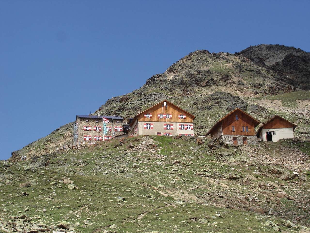
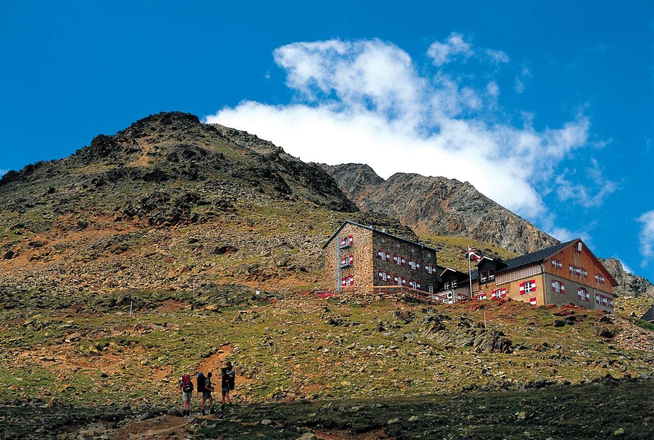
Breslauer Hut - Wildspitze


From the Breslauer Hut over the Rofenkargletscher to Wildspitze, descent over the Mitterkarjoch back to the Breslauer Hut, walking time: approx. 6 1/2 to 7 hours.
From the Breslauer Hut over the Rofenkargletscher to Wildspitze, descent over the Mitterkarjoch back to the Breslauer Hut, walking time: approx. 6 1/2 to 7 hours.

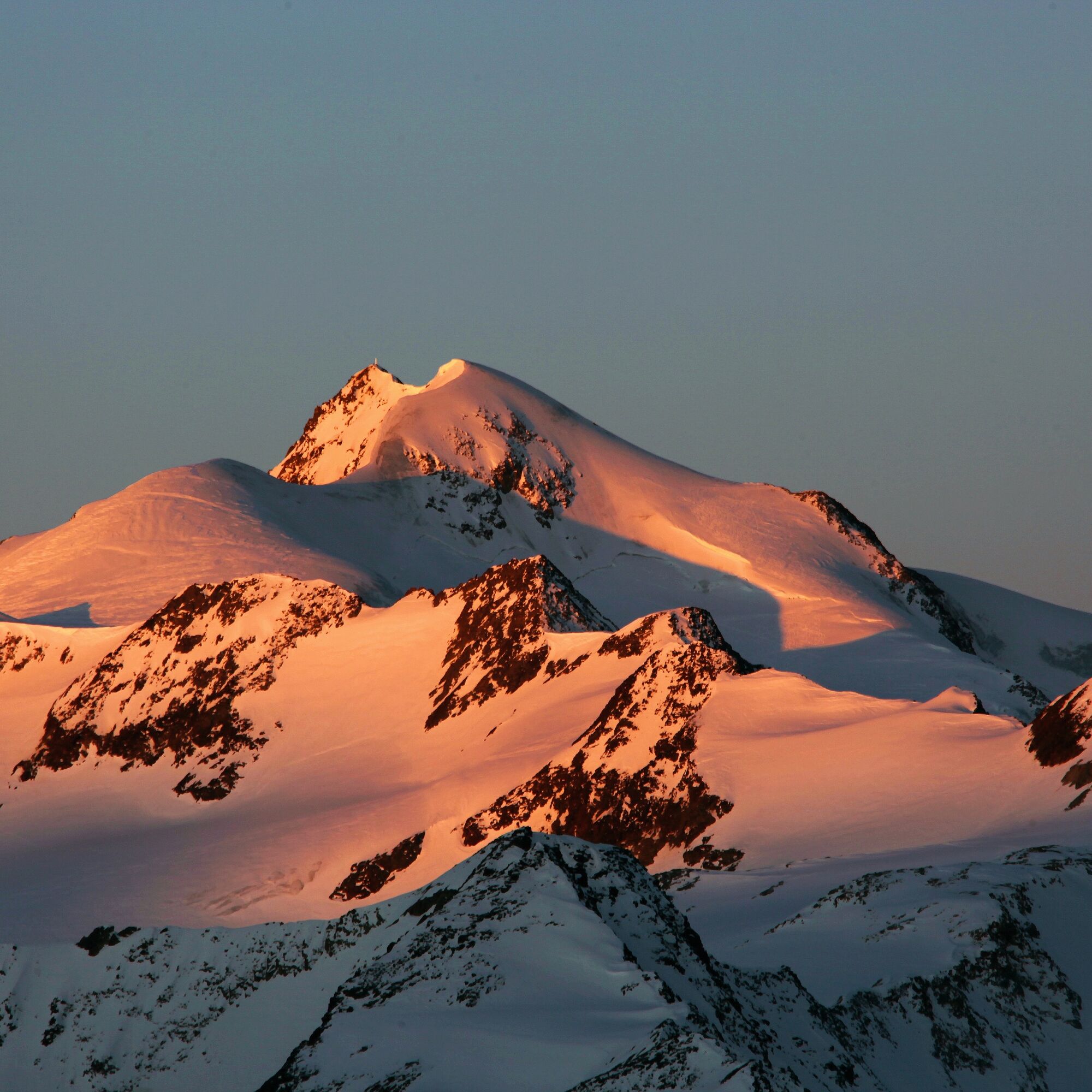
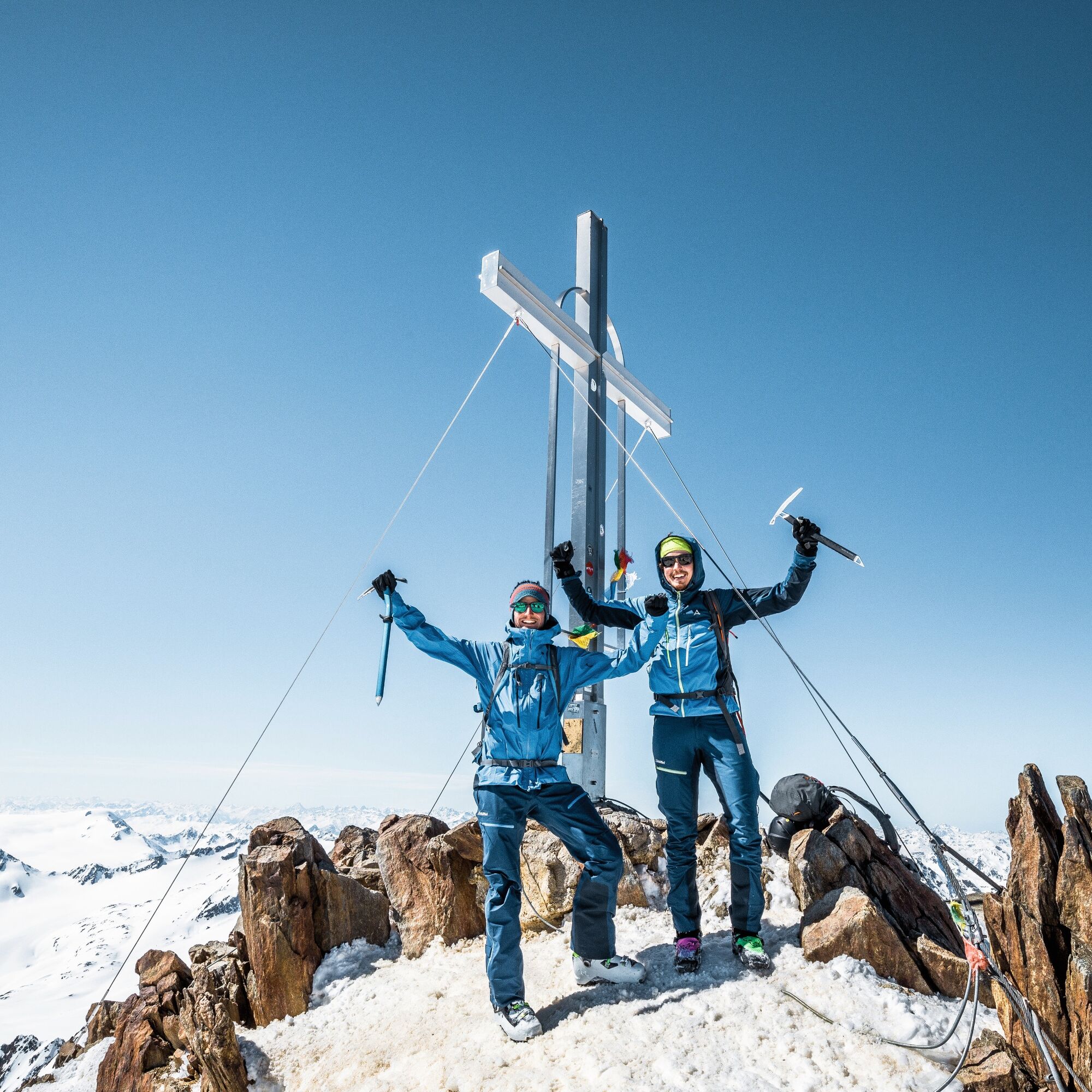
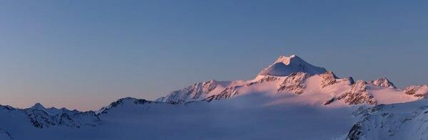
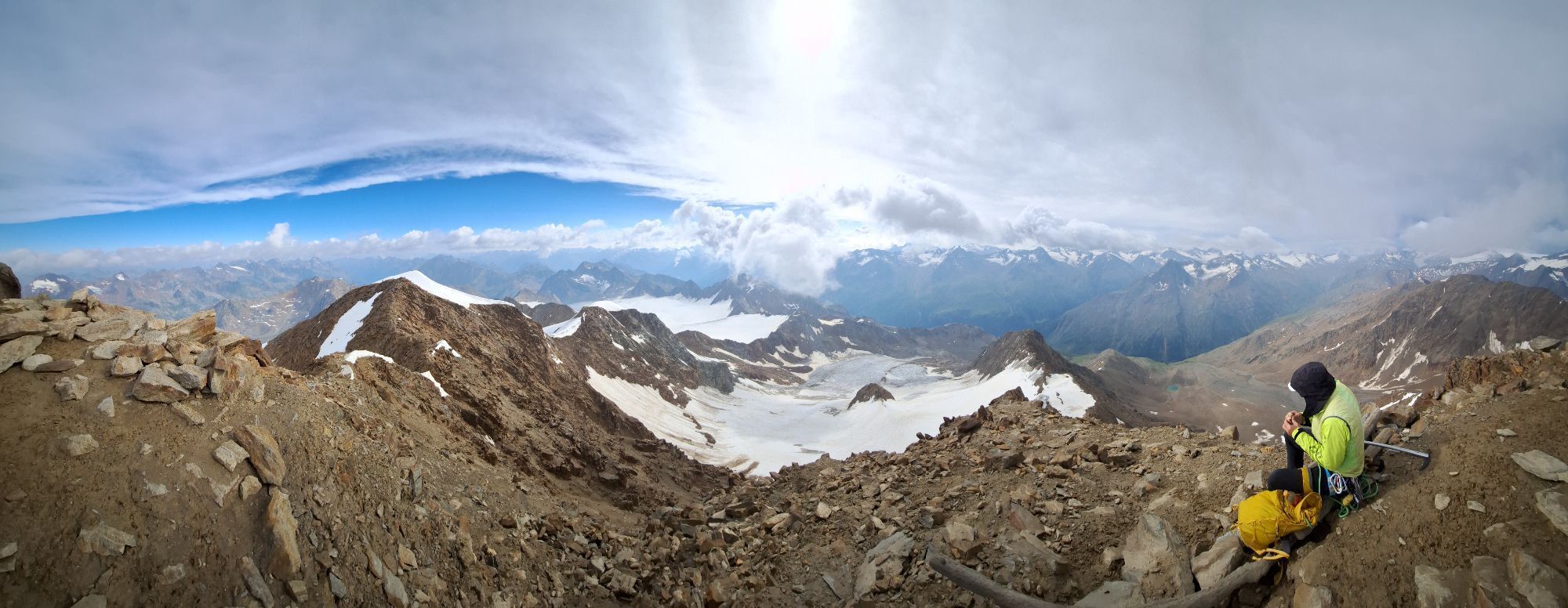
Wildspitze (3,768 m)
Starting point: Breslauer Hut
1) From the Breslauer Hut via the "normal route":
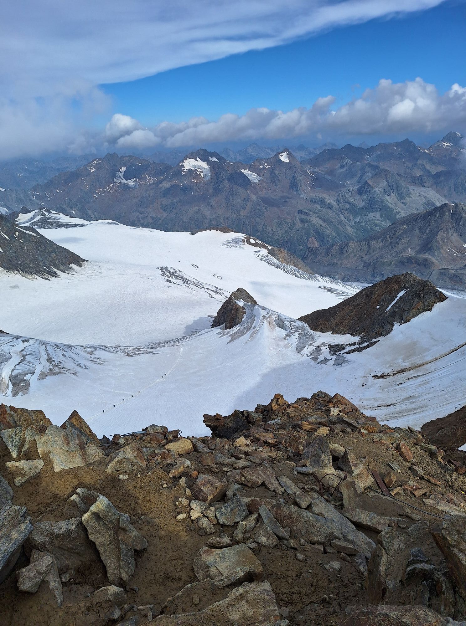
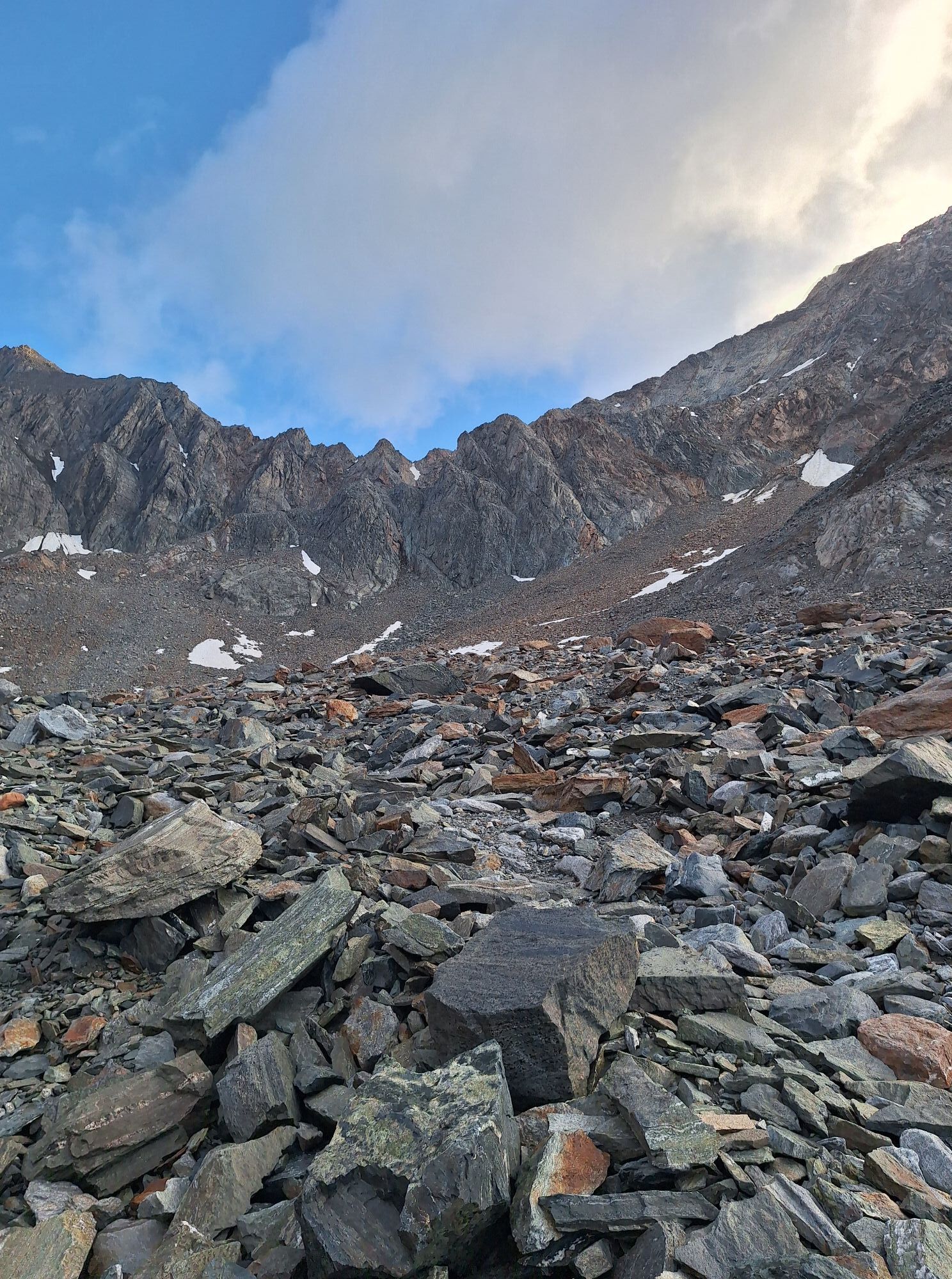
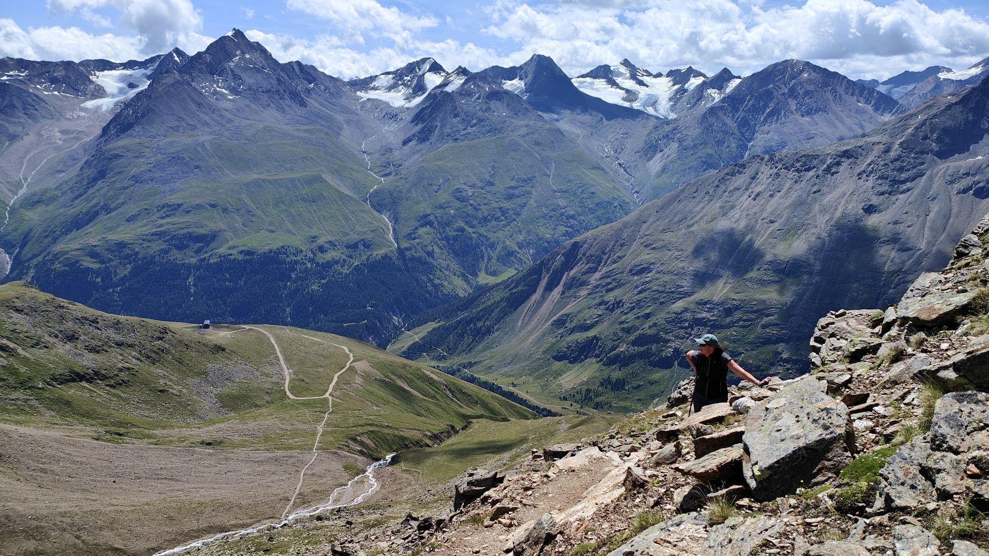
Along the marked path (partly marked by "stone cairns") into the Mitterkarferner. Over this, quite steeply at the end to the Mitterkarjoch. Further over the Taschachferner (some glacier crevasses) and the often icy snow ridge to the south summit.
Duration: approx. 4 h
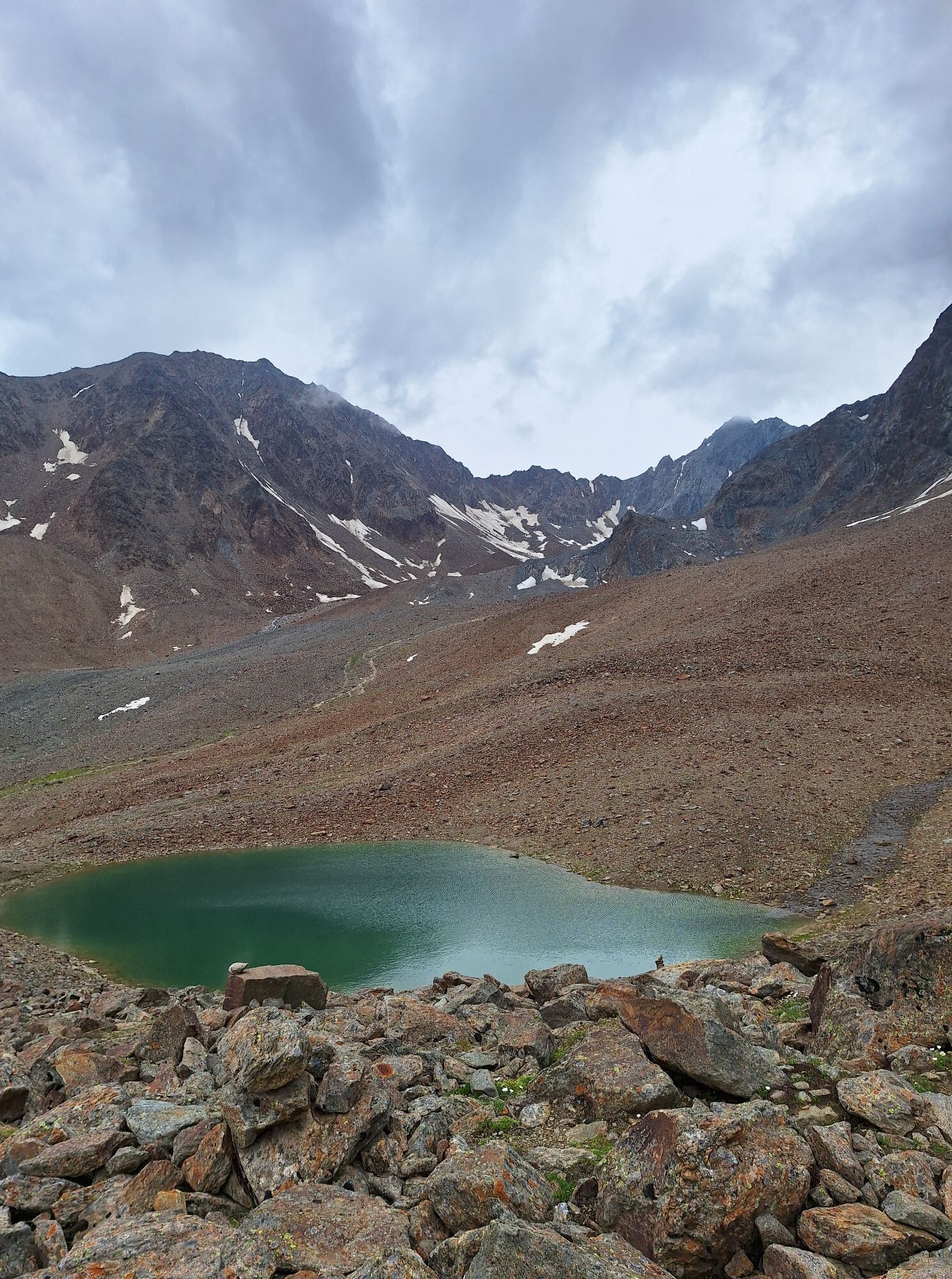
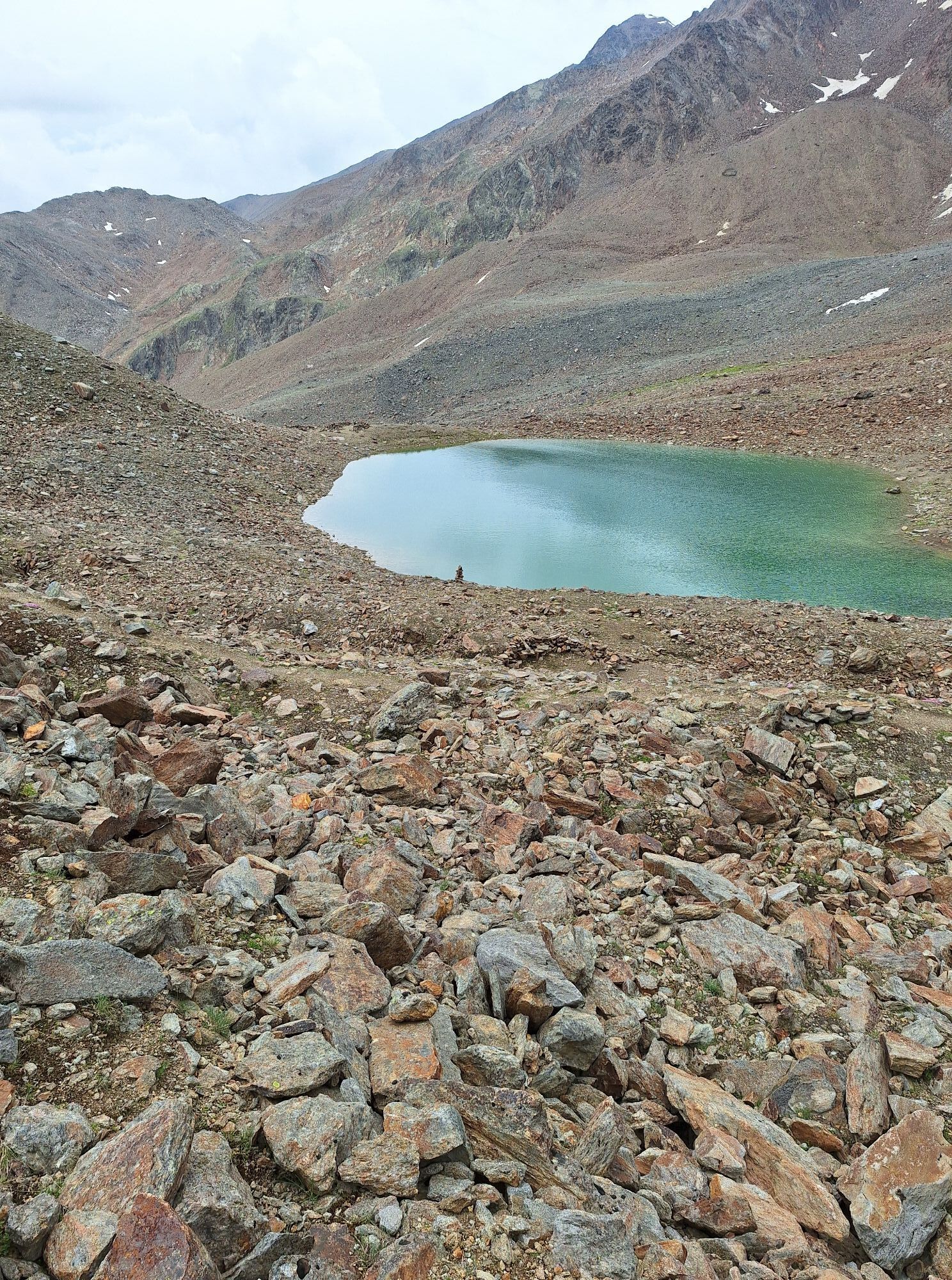
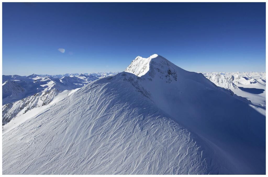
2) From the Breslauer Hut via the Rofenkargletscher:
From the hut heading north on a good path to the Rofenkargletscher. Over the partly heavily crevassed glacier towards the rock island (3,468 m) and past it on the right, finally in a westerly direction to the Urkundsattel. Over snow and ice up to the rocks and over these (steep but not too difficult) to the south summit.
Duration: approx. 4 h
3) From the Breslauer Hut via the Ötztaler Urkund:
Follow the path a few meters towards the Mitterkarferner, then after about 5 minutes turn right and ascend in switchbacks up to the Urkundholm (3,140 m). Continue over trail traces to the southeast ridge and over this in exposed climbing (one section grade III) to the Ötztaler Urkund (3,556 m). Short descent and over snowfield to the Urkundsattel. Over snow and ice up to the rocks and over these (steep but not too difficult) to the south summit.
Duration: total ascent approx. 4 h
Да
Appropriate equipment such as breathable and weather-appropriate outdoor clothing, ankle-high hiking boots, wind, rain and sun protection, hat, possibly gloves, is required for all hikes and routes. Carrying a first aid kit, a mobile phone and possibly a hiking map, as well as sufficient provisions for hikes without refreshment possibilities, is necessary.
For climbers free from fear of heights, sure-footed and highly experienced in high alpine terrain; excellent physical condition, extensive mountain experience, alpine climbing equipment, securing and orientation tools, good weather conditions recommended. Please check the current weather report at: https://www.oetztal.com/de/sommer.html
The car drive into the ÖTZTAL. Located in Tyrol, the Ötztal branches southwards as the longest side valley of the Eastern Alps. Travelling by car leads visitors via the Inn valley to the valley entrance and further along the Ötztal. In addition to the toll motorway, country roads can also be used. With the route planner, your trip can be determined quickly and conveniently: Route planner: https://www.google.at/maps
Travel comfortably and safely by train to the Ötztal station. The final stop or exit point is the ÖTZTAL station. Afterwards, travel comfortably and quickly by public transportation or local taxi services throughout the valley to your desired destination! The current bus schedule is available at: http://fahrplan.vvt.at
In the mountaineering village Vent, the following parking options are available:
- In summer in front of the village (parking meter, coins or EC card only) and at the valley station of the chairlift (at the mountain railway cash desk)
- In winter only at the valley station of the chairlift.
Cost: €5.00 per day/car
More information about hiking in the Ötztal: https://www.oetztal.com/wandern
Reservation of hut sleeping places necessary!
Популярные экскурсии по окрестностям
-
3,1
Tiefenbachglacier - Mountaineering Village Vent
среднийПоход 10,8 км -
5,0
Kreuzspitze
тяжелыйПоход 11,6 км -
4,5
Vent - Wilder Mann - Breslauer Hütte - Stableinalm
среднийПоход 7,25 км -
5,0
From Vent to the Similaun at 3,606 m
тяжелыйВысокая экскурсия 29,2 км -
4,5
Nederkogl
тяжелыйПоход 6,22 км -
4,8
Vent - Martin Busch Hut - Similaun Hut
среднийПоход 13,7 км -
4,5
Lake Gaislachsee
среднийПоход 4,04 км -
5,0
07. 19.07.19 - Langeggbahn-Rotkogel–Schwarzsee-Schwarzkogel-Giggijochbahn
среднийПоход 6,67 км -
5,0
Vent - Similaun Hut - Ötzi Discovery Site
среднийПоход 14,9 км -
5,0
Stabele - Brunnenbergalm
среднийПоход 5,52 км

Походы и трекинг


Не пропустите предложения и вдохновение для вашего следующего отпуска
Ваш адрес электронной почты был добавлен в список рассылки.