


Circular Trail Grillenparz


Фотографии наших пользователей
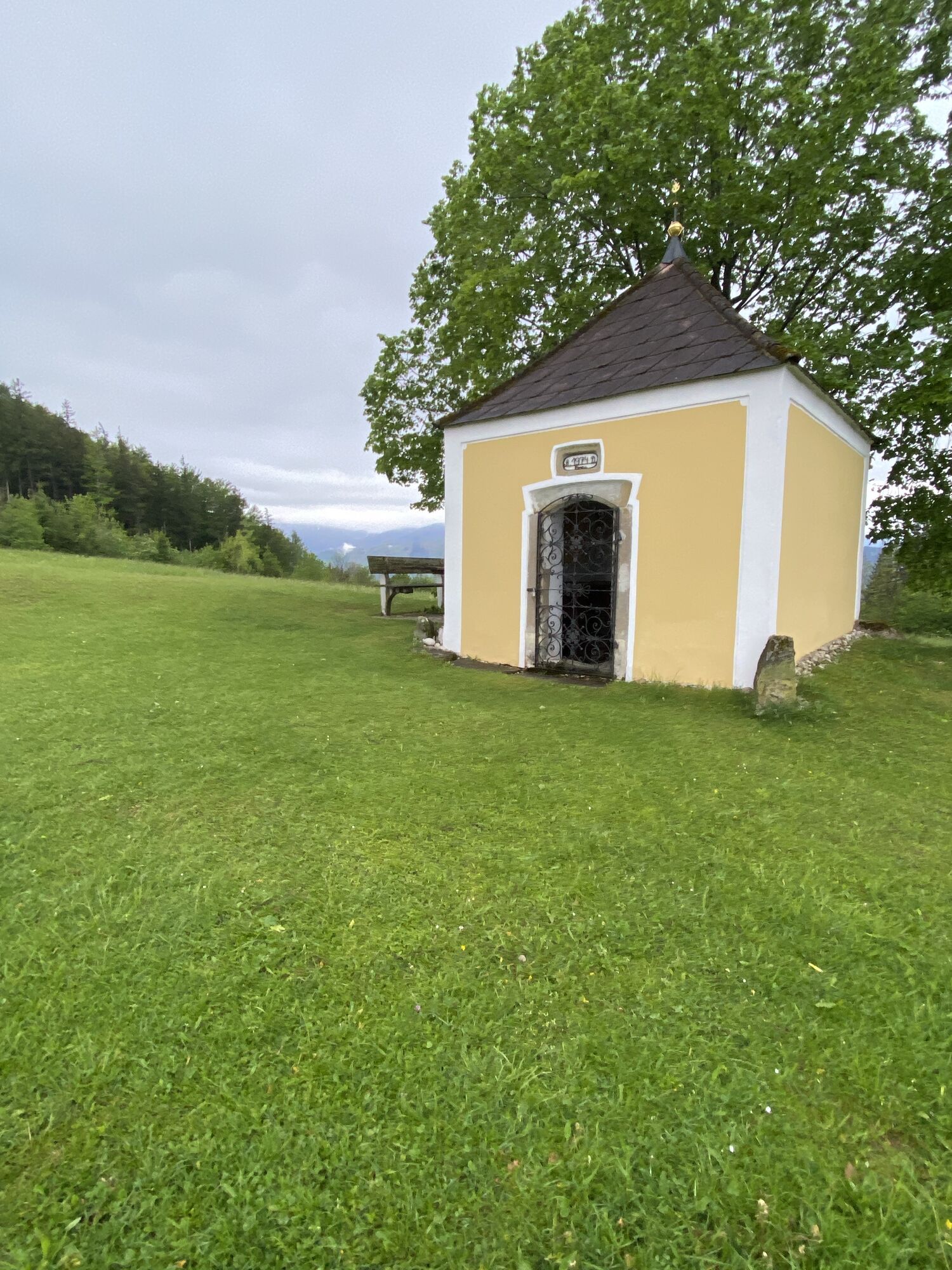
To climb Schlierbach's local mountain, go to the back of the monastery and follow the meadow path to the Calvary Chapel, past the Haslinger houses, past the Schmickinger Chapel to the Grillenparz and back...
To climb Schlierbach's local mountain, go to the back of the monastery and follow the meadow path to the Calvary Chapel, past the Haslinger houses, past the Schmickinger Chapel to the Grillenparz and back via the Schaumberg.
Trail number: K80


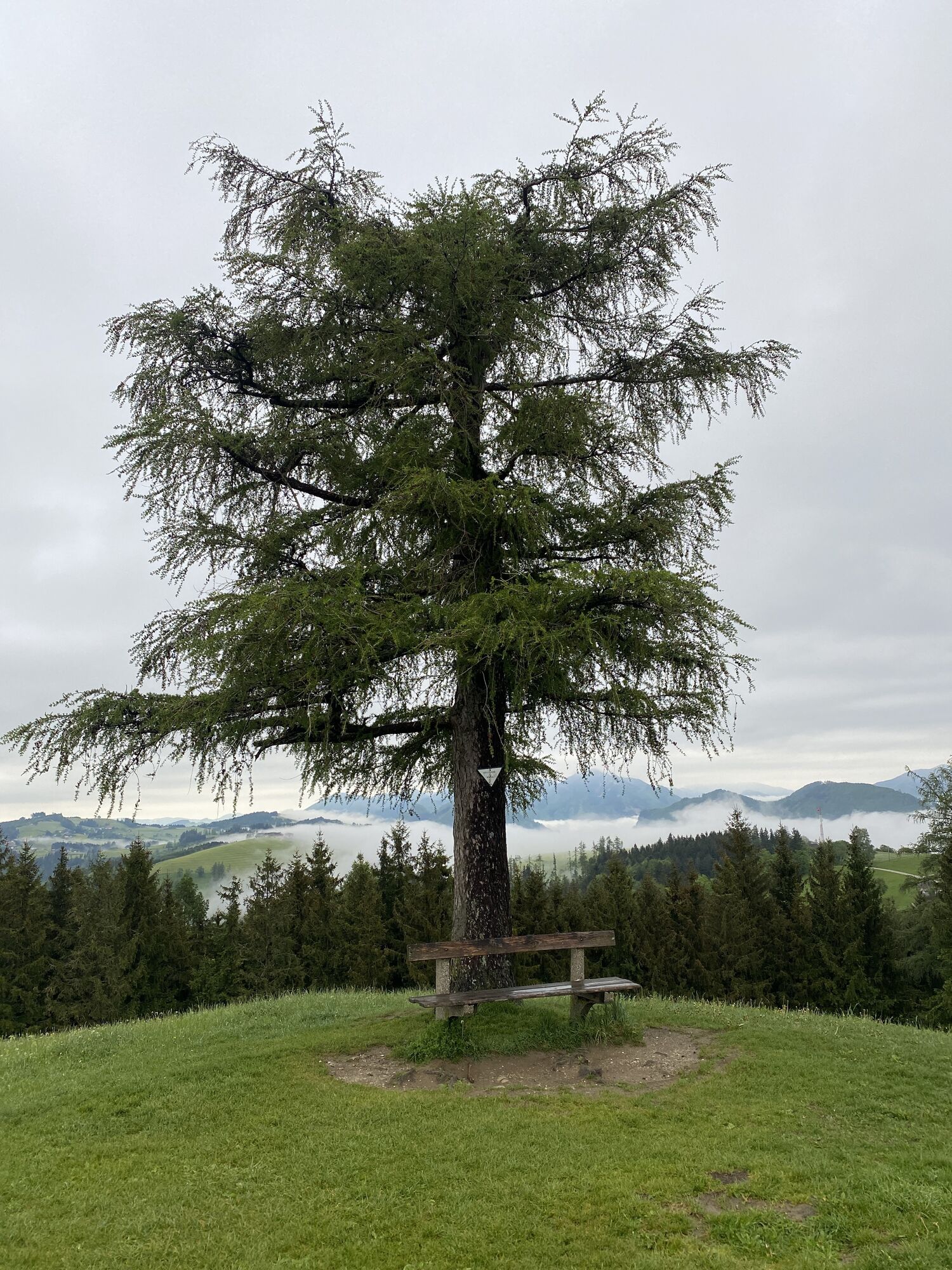
To climb Schlierbach's local mountain, go to the back of the monastery and follow the meadow path to the Calvary Chapel, past the Haslinger houses to the end of the asphalt road. From there, a meadow and forest path leads up into the wooded slope of the Grillenparz. Once you have reached the Schmickinger Chapel, there is only a short climb to the summit.
There you will be rewarded with the magnificent view all the way to the hilly Mühlviertel. On the descent over meadow paths you will enjoy a magnificent view of the Tote Gebirge. Over the Schaunberg you will then come through the forest to the Jausenstation Zeisl, where you can already see the towers of Schlierbach Abbey.
From Vienna/Salzburg: A1 towards Linz > A9 Pyhrnautobahn - exit Inzersdorf.
From Linz: A9 Pyhrn motorway - exit Inzersdorf
From Graz: A9 Pyhrnautobahn > exit Klaus > federal road B 138
Arrival with the Pyhrnbahn, there are stops in Schlierbach, Kirchdorf/Krems and Micheldorf.
Details at www.ooevv.at
Schlierbach/parking near the center of the village
Climate-friendly to the National Park Region - railway station Schlierbach: By train you can reach the starting point for this hike in about 1 hour from Linz and in about 2.5 hours from Vienna.
Популярные экскурсии по окрестностям
-
4,6
Windhagkogel (1334m)
среднийПоход 10,4 км -
4,4
Meisenkögerl
светПоход 3,29 км -
4,6
4 Gipfel Tour im Almtal Bräumauer, Maisenkögerl, Hutkogel und Hochsalm
среднийПоход 9,80 км -
4,1
Nackter Kalbling & Pfannstein & Rauher Kalbling
среднийПоход 12,0 км -
4,3
Mittagstein und Hochsalm
среднийПоход 9,53 км -
4,3
Dürres Eck - Gaisberg - Hochbuchberg
среднийПоход 11,2 км -
4,6
Pfaffenmauer - Schoberstein - Gipfel der Lust Gasthof Klausriegler, Oberösterreich/Österreich
среднийПоход 9,72 км -
4,1
Kremsmauer, Pyramide von Steyrling mit Andi
Поход 10,5 км -
4,1
Eiskogel (1087m) und Pernecker Kogel (1080m) ab Parkplatz Kronbauer
светПоход 4,77 км -
4,7
Kleiner und Großer Landsberg (3.7.2019) mit Sonnenuntergang
среднийПоход 3,51 км
Походы и трекинг


Не пропустите предложения и вдохновение для вашего следующего отпуска
Ваш адрес электронной почты был добавлен в список рассылки.