


VIA.VINUM. - CIRCULAR ROUTE GÖTTLESBRUNN - ARBESTHAL


The circular hike connects two of the most important wine-growing villages in the heart of the region. At several stations, you learn what distinguishes Carnuntum viticulture and get a fabulous overview...
The circular hike connects two of the most important wine-growing villages in the heart of the region. At several stations, you learn what distinguishes Carnuntum viticulture and get a fabulous overview of the vast wine landscape.
With the free mobile app "Hiking Trails Römerland Carnuntum", hikers listen to entertaining stories – history, legends, traditions and much more – about the region. Download the app on your smartphone, either online as a WebApp or as a native app, for which an internet connection is not necessary on site. Your position is displayed on a map while hiking – so you stay on the right path! Google Play Store or App Store

Start Göttlesbrunn – Schüttenberg
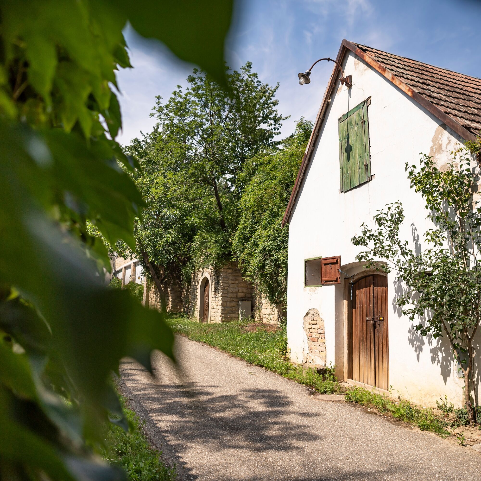
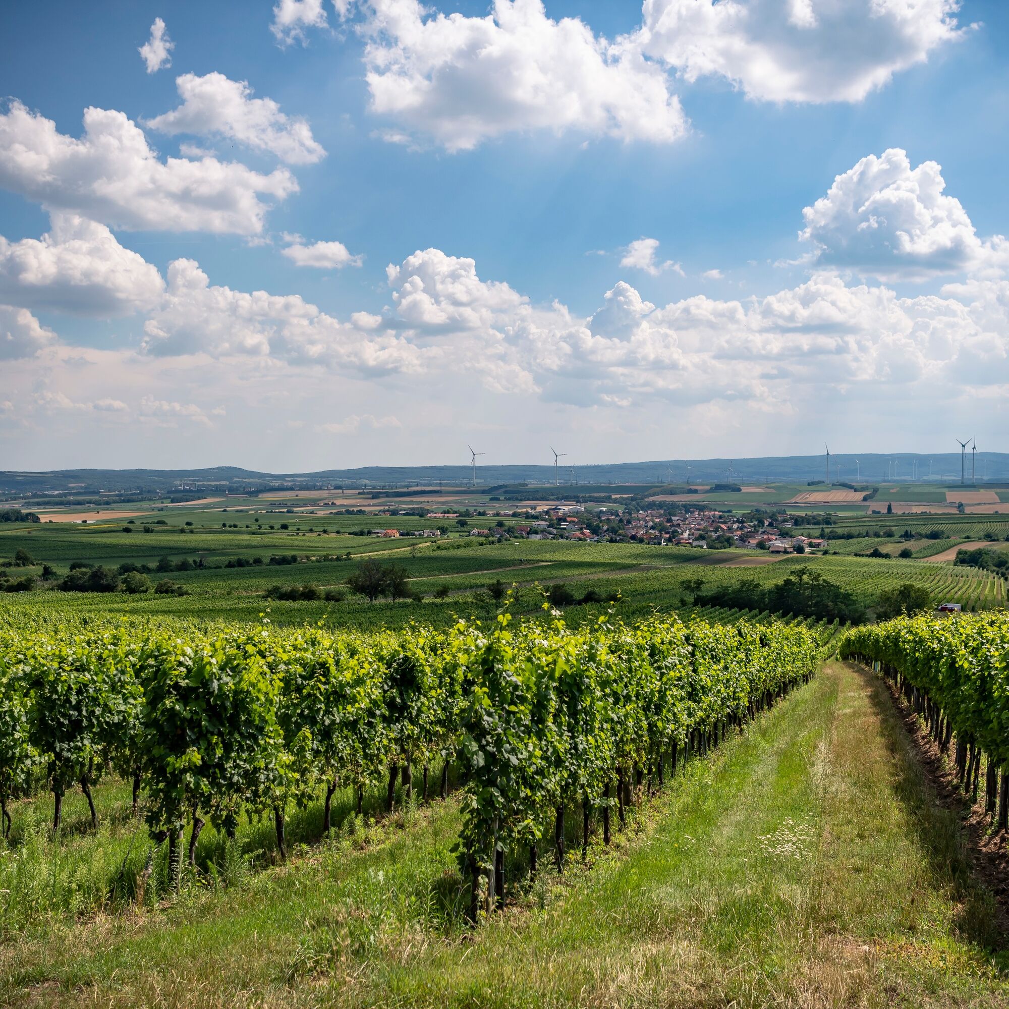
The circular hike begins, fittingly on the theme of wine, in the center of the village of Göttlesbrunn, one of the strongholds of viticulture in Römerland Carnuntum. Starting at the main square of the municipality, you stroll through the quiet streets of the village to the north. At the first larger intersection, there is the option to shorten the circular hike via the Göttlesbrunn cellar lane and over the three vineyards to Arbesthal. The main path, over the Schüttenberg, branches right here over a bridge and leads further to the edge of the village, from where it again branches left from the main road. Leaving the houses behind, you find yourself among fields and vineyards that stretch at the back of the farmhouses over the ridge slopes. On the paved farm road, you go at a leisurely climb towards Schüttenberg, and after a short time, a panoramic view opens over the extensive wine-growing region around Göttlesbrunn and Arbesthal. Sunny ridge lines follow shaded forest strips that separate the vineyards. Among ancient fruit trees, the climb increases slightly for a short section before the farm road changes to a winding forest path. Passing vineyards with old viticulture huts, the path reaches a clearing at the highest point of the ridge with a junction to the hiking round from the village Höflein. Following the meadow course and through a short forest section downhill, you reach the junction to the rest area and wine info point Schüttenberg.
Schüttenberg
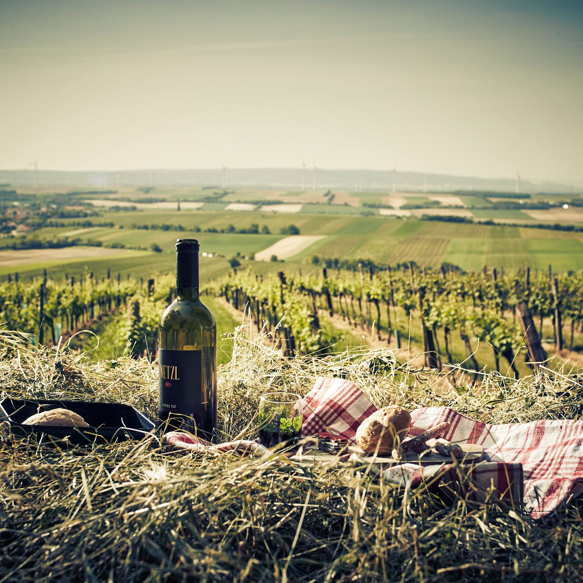
The ascent is rewarded here with a shaded rest area amid the vineyards. From a small viewing plateau, there is a unique panoramic view over the entire wine-growing community. Göttlesbrunn and the next destination of the hike – Arbesthal – can be precisely determined by looking through two mounted wine bottles.
With the game of spin the bottle, you interactively learn everything about the cultivation and wine varieties of the region.
Schüttenberg – cellar lane Arbesthal
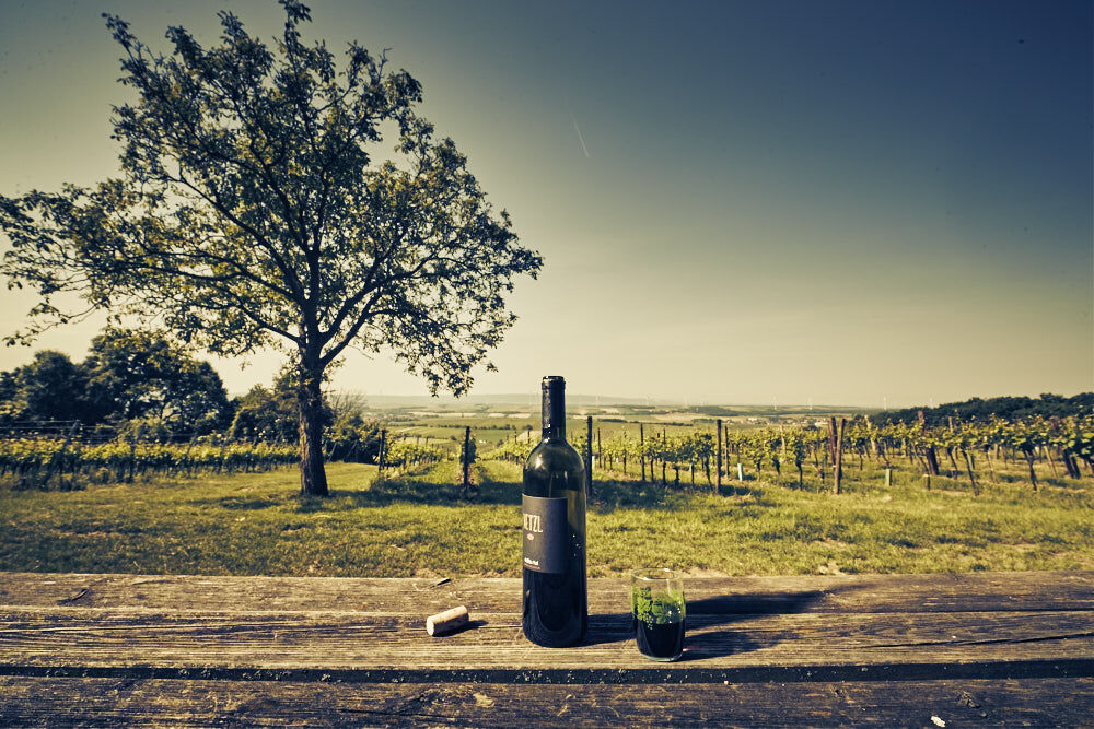
Following the branch path back from the rest area, you continue the hike. Again on paved farm roads, you first go briskly downhill the hillside without losing sight of the panoramic view over the wide wine landscape. The exciting variety of wine terraces offers numerous photo motifs.
After about 30 minutes on foot, you reach a crossroads where the shortcut via the Göttlesbrunn cellar lane joins and a branch to the Hirmeier chapel diverges. A few meters later, you come to the rest area of the three vineyards – a wonderful opportunity for another break. Here, you learn a lot about the region's viticulture and can enjoy another panoramic view beyond the region.
Then it goes to Arbesthal along a forest road on the edge of the forest and fields at whose foot the village lies. Soon a paved farm road branches left, which leads directly into the cellar lane at the main street.
Cellar lane Arbesthal - Göttlesbrunn
The wine educational trail in the cellar lane playfully shows the path the wine takes from cultivation to the wine cellar, whereby even wine connoisseurs are guaranteed to learn new aspects.
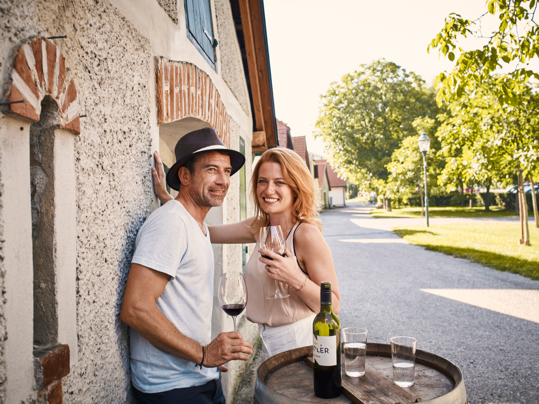
Along the way through Arbesthal, vintners and inns offer an ideal opportunity for an extended break, enjoying house wines and regional cuisine.
In the heart of the village, at the crossroads near the parish church, you continue the walk together with the hiking round from Stixneusiedl towards Göttlesbrunn. The Göttlesbrunnerbach accompanies the paved path through the sunny fields between the villages to the Winzer Globe. The impressive artwork symbolizes the wine-growing community, which with its high-quality wine from numerous vintners also represents a small world in itself.
The last section of the hike leads back into the center of Göttlesbrunn. A dedicated info and guidance system shows visitors the vintners and inns of the village, where, according to the motto "wine hiking", one should definitely end the day.
Да
A4 East Motorway, exit Bruck/Leitha West, to Göttlesbrunn-Arbesthal, Höflein or Stixneusiedl
ÖBB to Bruck/Leitha, then Postbus to Göttlesbrunn-Arbesthal or Höflein; ÖBB to Sarasdorf.
Rest areas & cozy snack spots: along the route are many rest areas and scenic benches. Especially beautiful is the rest area at Schüttenberg in Göttlesbrunn. In the cellar lane Arbesthal, the playground offers comfortable seating.
Популярные экскурсии по окрестностям
-
4,7
Hiking in the National Park: ECKARTSAUER DONAURUNDE
светПоход 8,31 км -
4,7
Eckartsauer Donaurunde
светПоход 8,96 км -
4,3
Danube Cycle Path Stage 8 North Bank: Vienna/North Bridge - Hainburg
среднийВелосипедная дорожка большой протяженности 50,4 км -
3,9
VIA.SILENTIUM. - Maria Theresia Rundwanderweg
среднийПоход 9,31 км -
2,0
Nationalpark Tour Donau Auen
светВелоспорт 42,6 км -
4,5
Eckartsau - Lobau - Rundwanderung
светгулять 8,13 км -
4,5
Ochsenbründlrunde
светПоход 8,34 км -
4,5
Scheiterberg Hochfilzerhütte (10. Juni 2021) Mannersdorf am Leithagebirge, Niederösterreich
Поход 4,68 км -
Jakobsweg Römerland Carnuntum: Wolfsthal - Schwechat
светПаломнический маршрут 61,8 км -
4,5
Rundwanderung Naturpark Donauauen
светПоход 12,9 км
Походы и трекинг


Не пропустите предложения и вдохновение для вашего следующего отпуска
Ваш адрес электронной почты был добавлен в список рассылки.