


Brünnstein


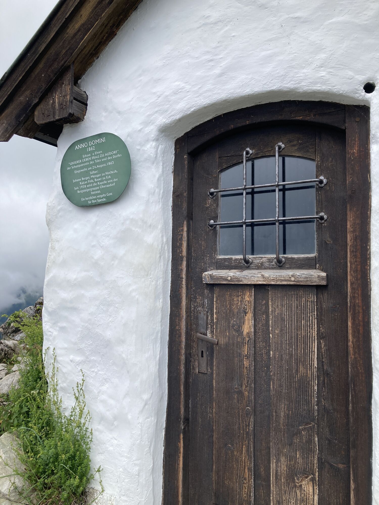


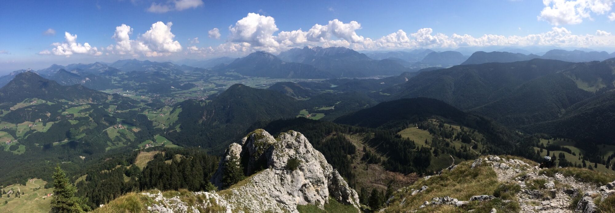
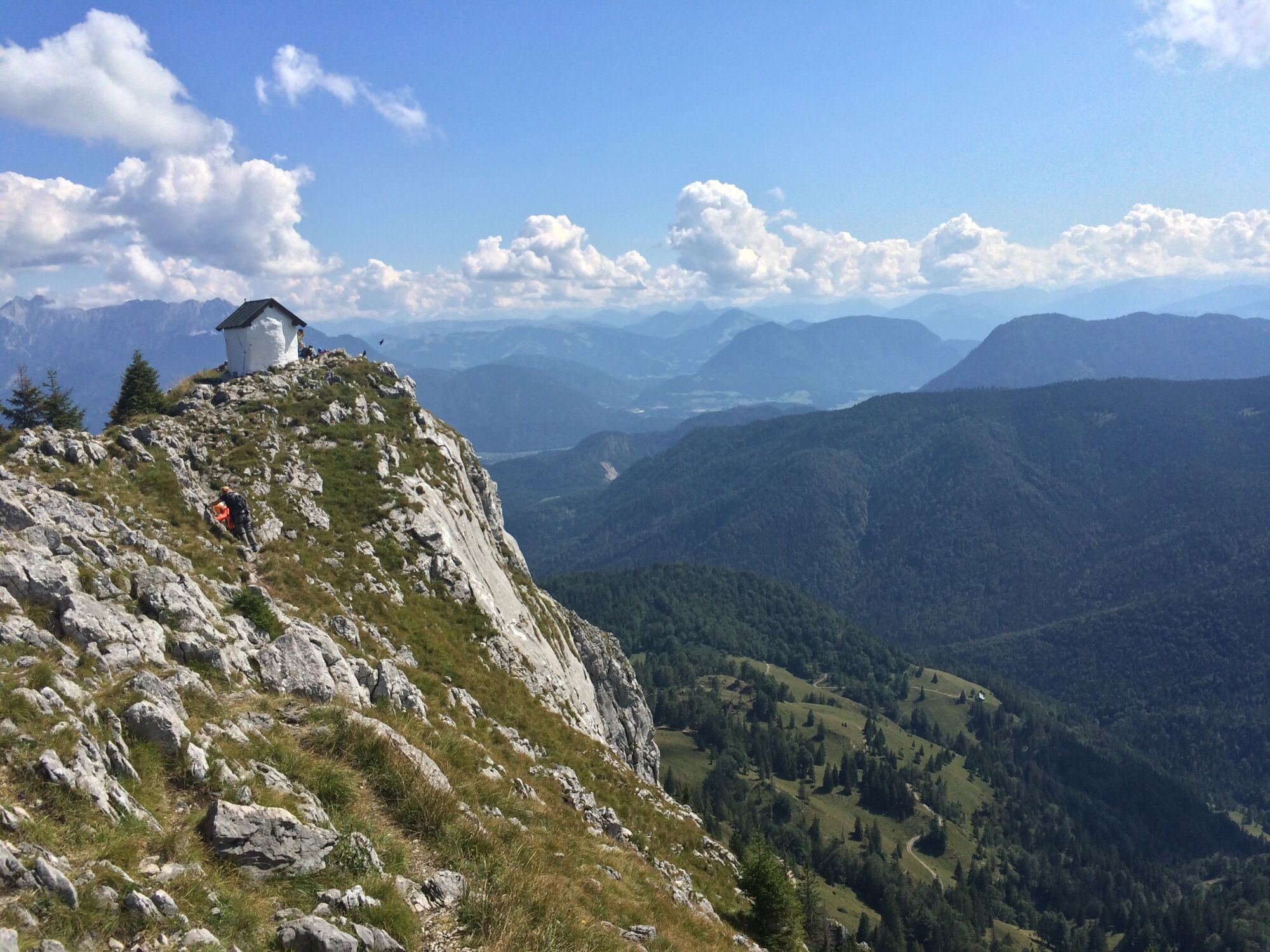
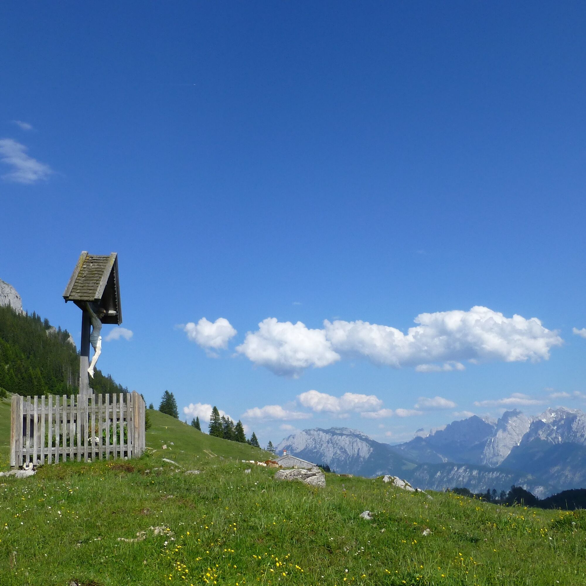
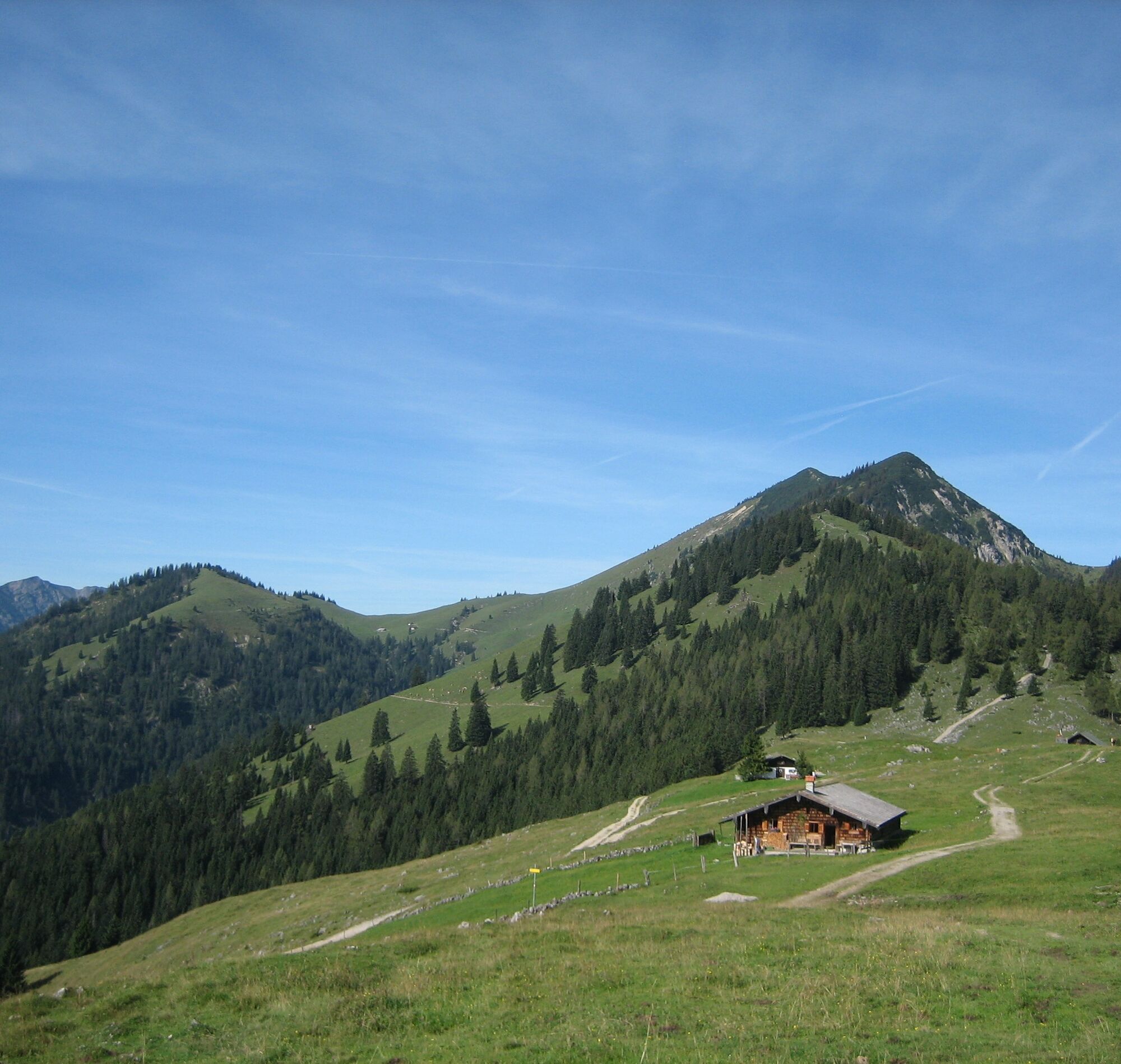
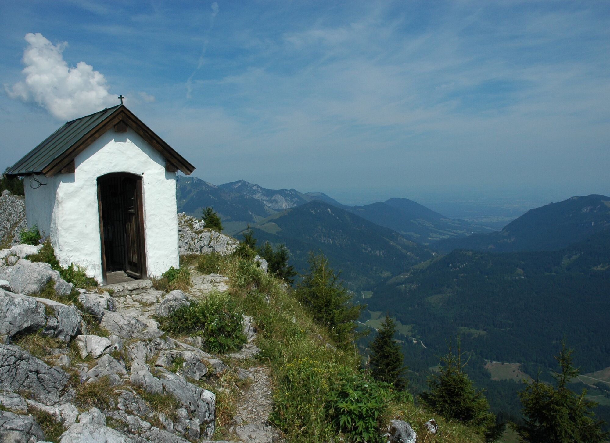
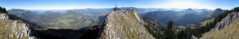
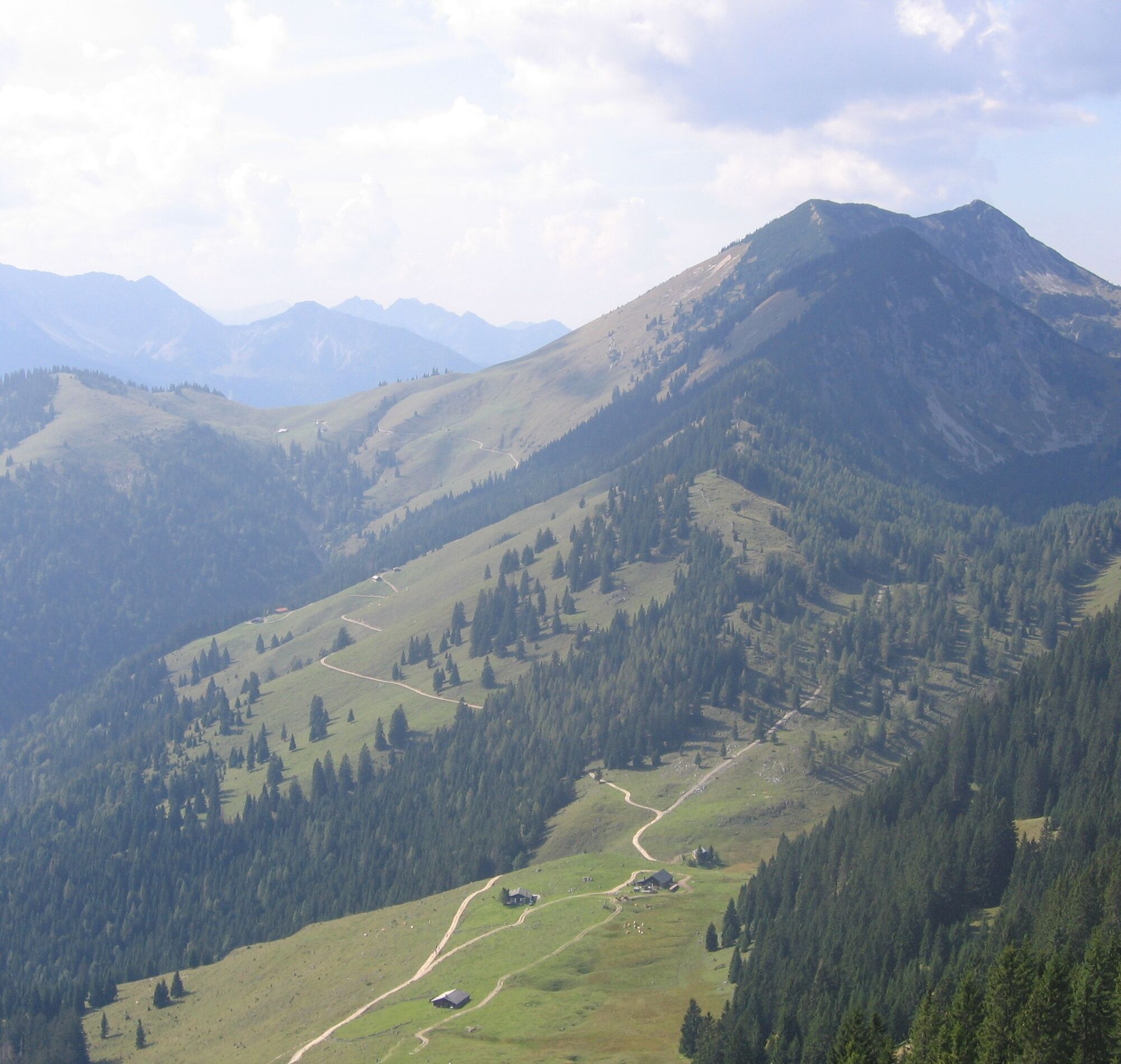
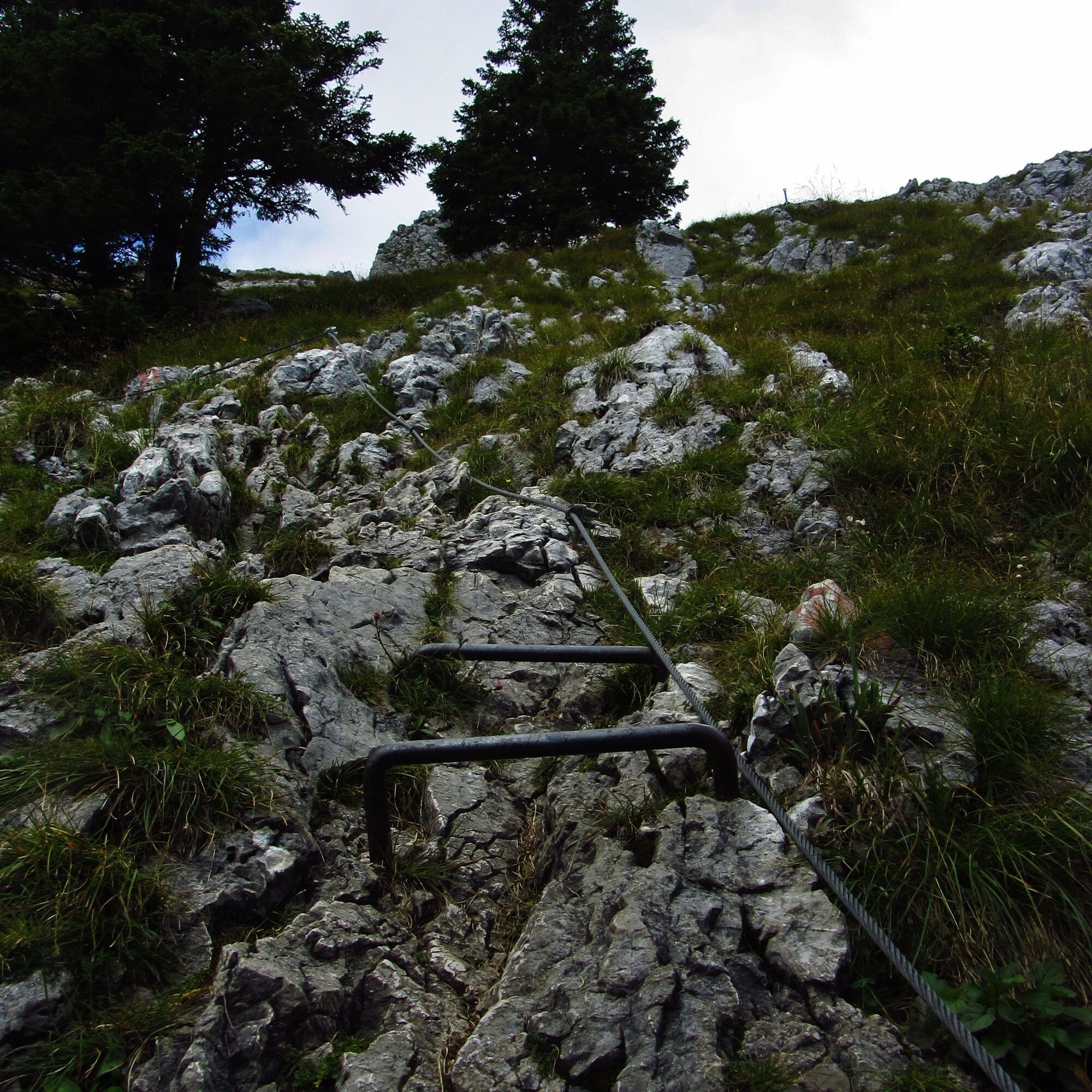
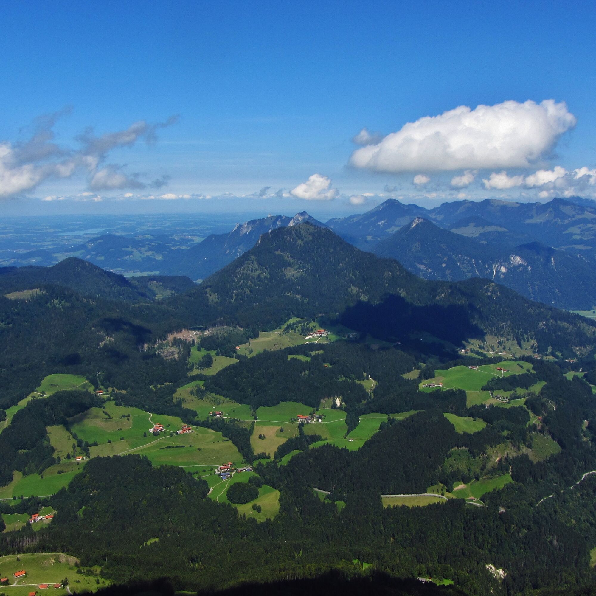
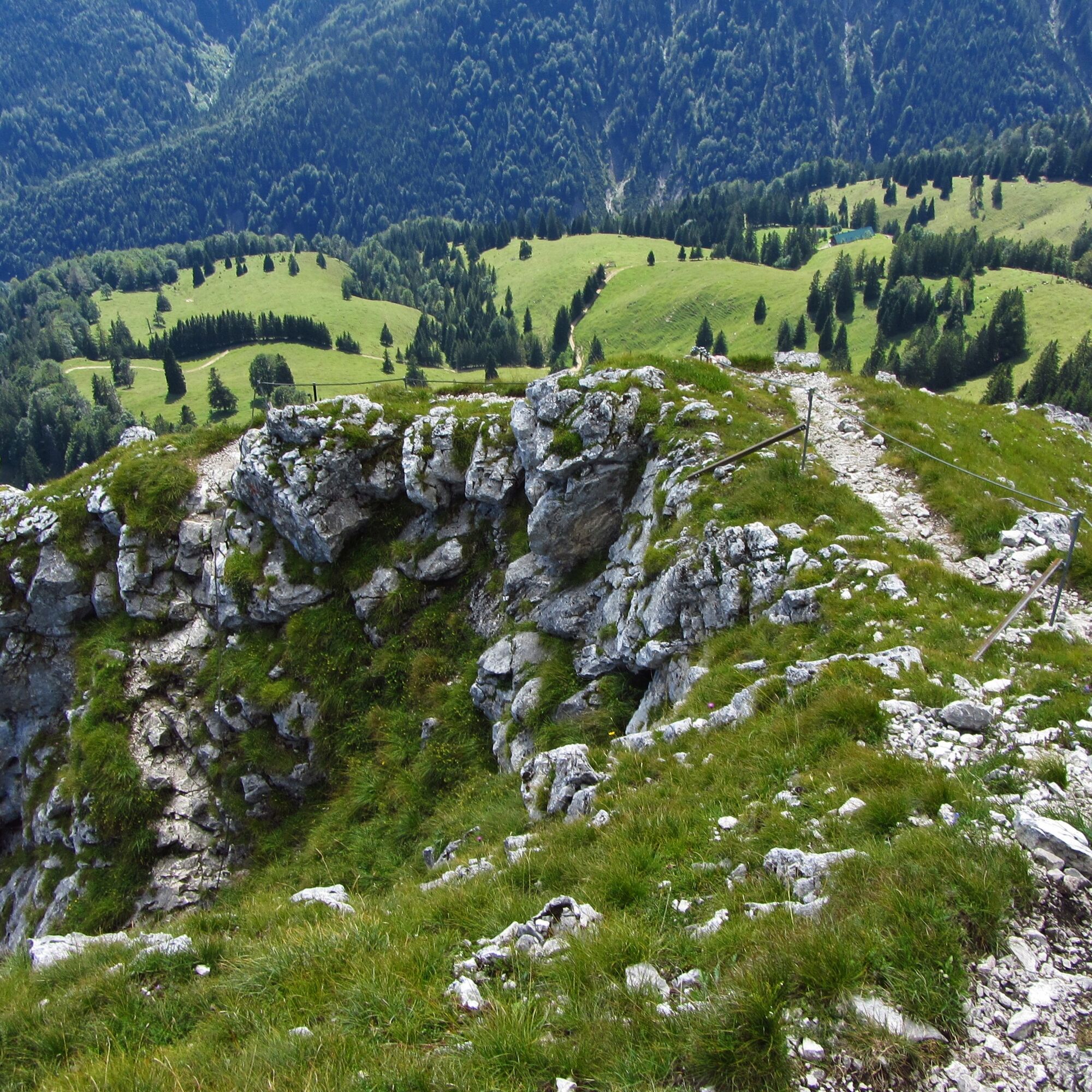
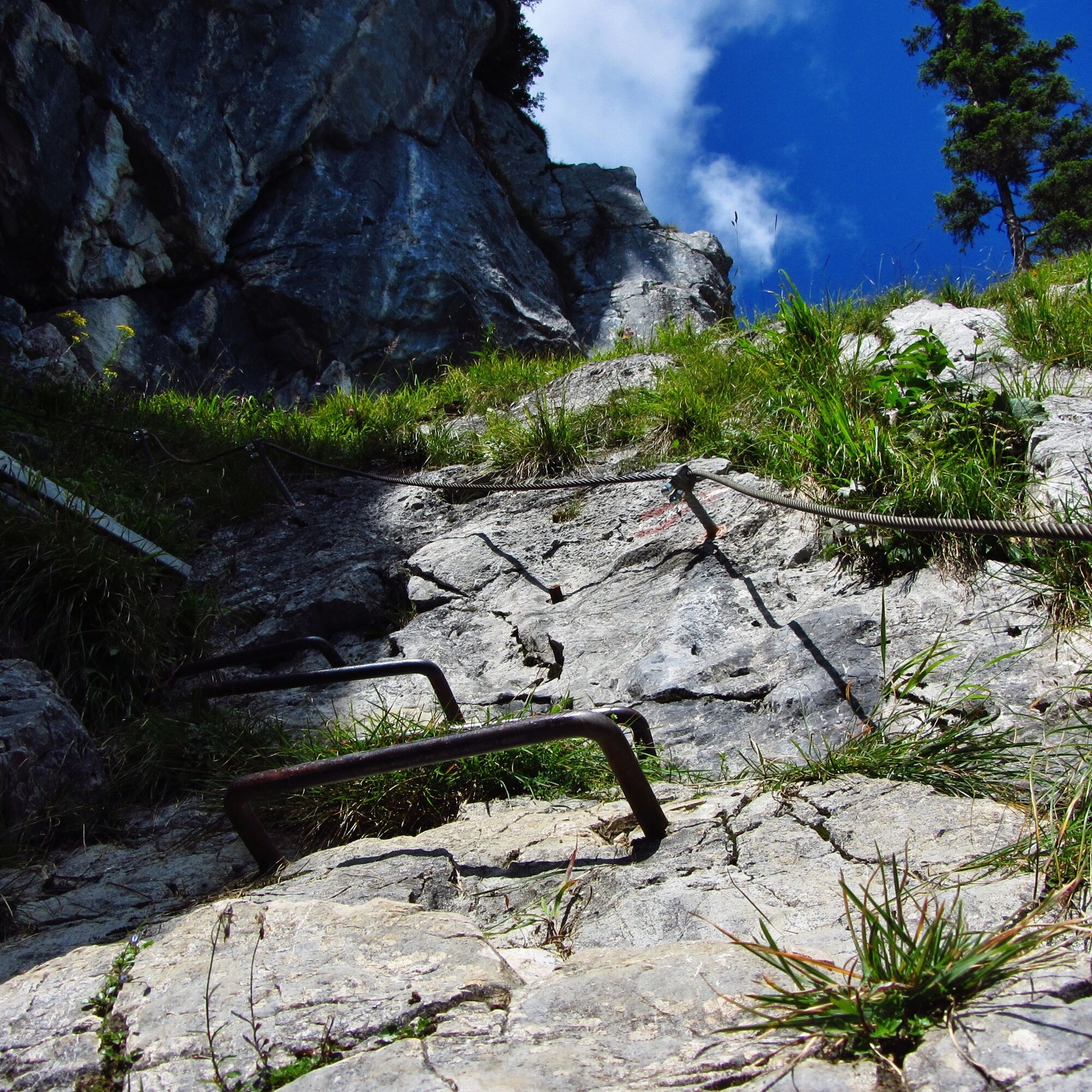

We reach the starting point of our route by car. We drive on the Alpenstraße towards Tatzlwurm. About 1 km before Tatzlwurm, a narrow but well-developed road branches off to Rosengasse. In partly steep switchbacks, we reach the starting point of our Brünnstein route. From Rosengasse we follow the signposted path no. 651 over Seeonalm to Himmelmoosalm, which lies idyllically in a picture-book landscape on the southern slope in a hollow. Here we turn left and reach the last section to the summit. Short passages require the use of hands, difficult spots are equipped with a cable safety. But once on the summit, we are rewarded for our efforts. Brünnstein is an impressive limestone reef that rises three hundred meters above the surrounding alpine pastures. The view from the summit is magnificent – it extends from the rugged rocks of the Wilder Kaiser to the snow-covered peaks of the Central Alps. The return to the starting point goes back along our ascent path.
Да
Да
Да
We recommend sturdy footwear and possibly poles for the descent. Please bring provisions, a mobile phone, change of clothes, and a first aid kit.
All information without guarantee. Hiking and riding on the routes described here is at your own risk.
A8 to Weyarn exit, via state road 2072 and B307 to Bayrischzell. Continue via Sudelfeld and Grafenherberg to Rosengasse.
Trains of the Bayerische Regiobahn (BRB) run hourly from Munich to Bayrischzell, from there with the Wendelstein Ring Line to Tatzelwurm. Afterwards, it is still 3-4 km to the starting point of the route. Therefore, travel by public transport is only conditionally recommended.
Here you can find the current timetable information.
Bayrischzell at the mountain inn Rosengasse
Веб-камеры во время экскурсии
-
Hocheck
-
Talstation Hocheck
-
Hocheck
-
Hocheck
-
Hocheck
-
Hocheck
-
Speckalm
-
Kitzlahner 4er Sessellift Berg
-
Kitzlahner 4er Sessellift Berg
-
Kitzlahner 4er Sessellift Berg
-
Kitzlahner 4er Sessellift Berg
-
Kitzlahner 4er Sessellift Berg
-
Loipenzentrum Stocker
-
Sudelfeld - Walleralm
-
Sudelfeld - Waldkopf
-
Kitzlahner 4er Sessellift Berg
Популярные экскурсии по окрестностям
-
4,7
Breitenstein
среднийПоход 9,13 км -
3,9
Jägerkamp und Benzingspitze
среднийПоход 8 км -
4,6
Musikantensteig zur Naunspitze
среднийПоход 8,96 км -
4,7
Wendelstein
среднийПоход 11,2 км -
4,0
Seeberg
среднийПоход 14,5 км -
4,7
Wildalpjoch und Käserwand
среднийПоход 7,16 км -
4,5
To the Wendelstein via the König-Maximilian-Weg
среднийПоход 12,4 км -
4,7
Wanderung zu Rotwand Hütte
среднийЗимние походы 12,1 км -
4,4
Heuberg und Kitzstein
среднийПоход 8,51 км -
4,1
Am Jenbach zur Wirtsalm
среднийПоход 5,09 км
Походы и трекинг


Не пропустите предложения и вдохновение для вашего следующего отпуска
Ваш адрес электронной почты был добавлен в список рассылки.