


CESANA T.SE From Sansicario To Monte Fraiteve (No. 44)


The route connects San Sicario Alto (hamlet of Cesana Torinese) to Monte Fraiteve, the highest peak located on the watershed between Sauze d'Oulx and Sestriere, at the extremity of the Susa and Chisone...
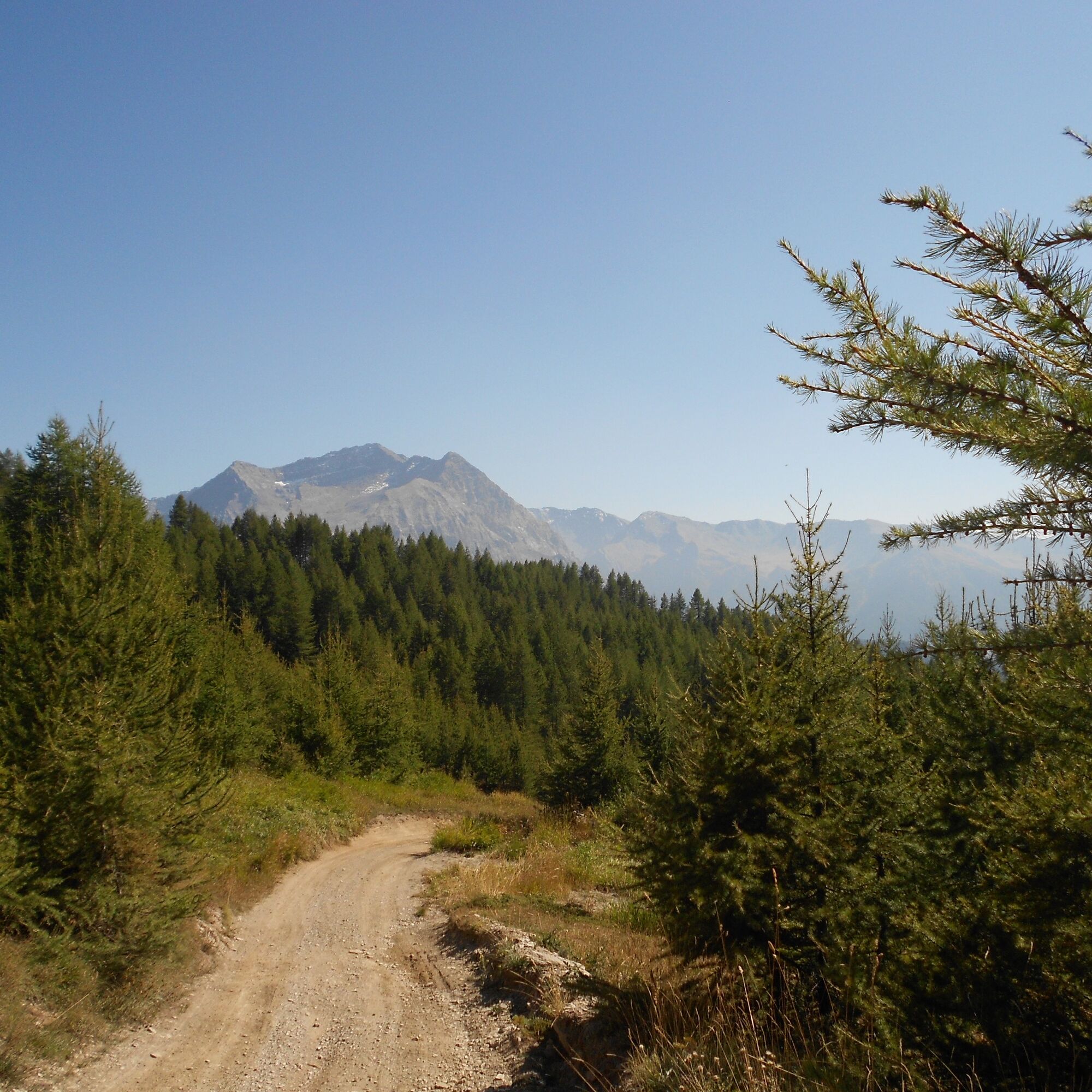
The route connects San Sicario Alto (hamlet of Cesana Torinese) to Monte Fraiteve, the highest peak located on the watershed between Sauze d'Oulx and Sestriere, at the extremity of the Susa and Chisone valleys, clearly recognisable by the presence of telecommunication antennae on the summit. The first part of the route up to Soleil Beuf is very steep, but is comforted by the fact that it runs through the woods; the second part towards Monte Rotta, still in the woods, is a pleasant, gentle climb; from here on towards the summit, continuing to climb first through a sparse larch wood and then across the alpine meadow, is a very scenic itinerary, at times enriched at the top by rocky outcrops; there are also a few refuges serving the ski lifts. From the summit, the view sweeps 360°, overlooking the Susa and Chisone Valleys, as well as towards France with its glaciers.

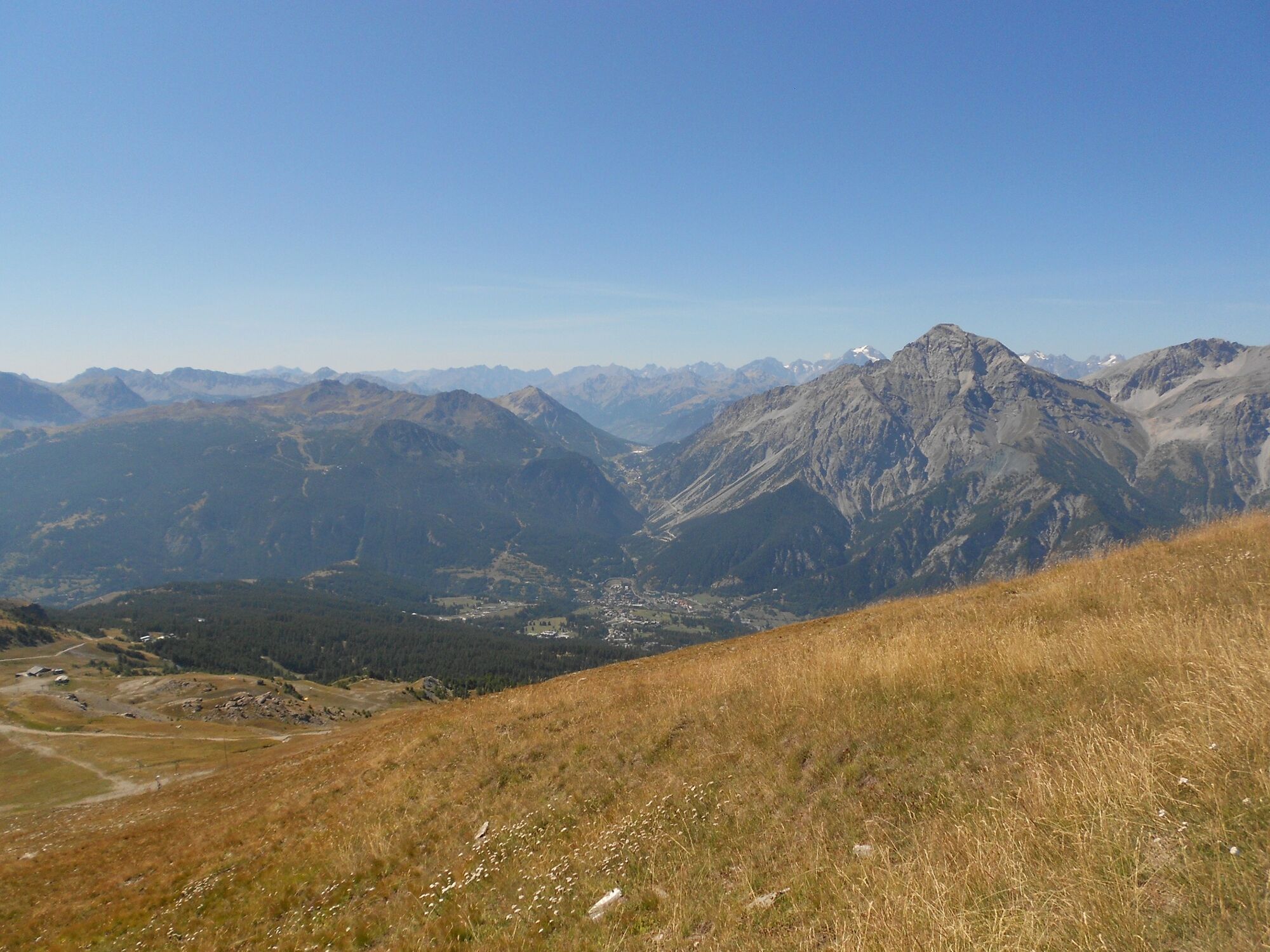
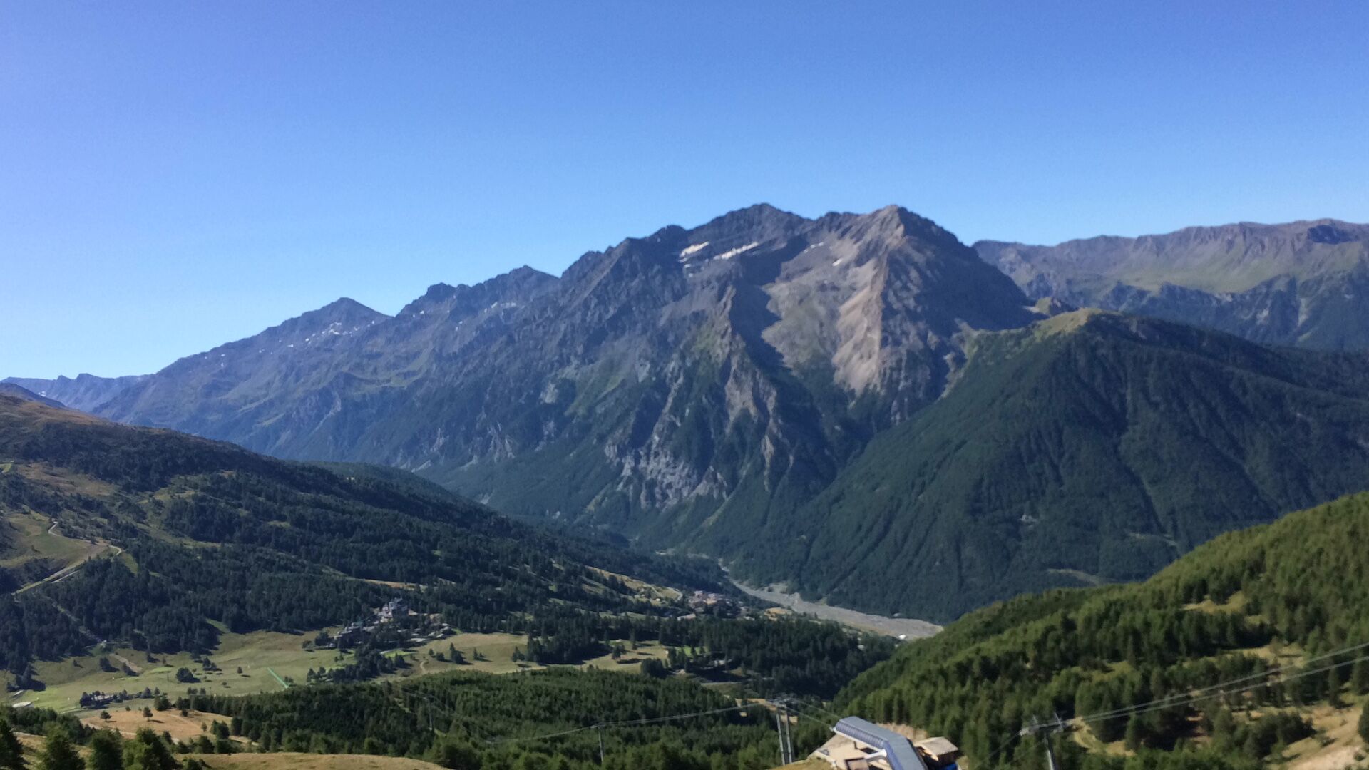
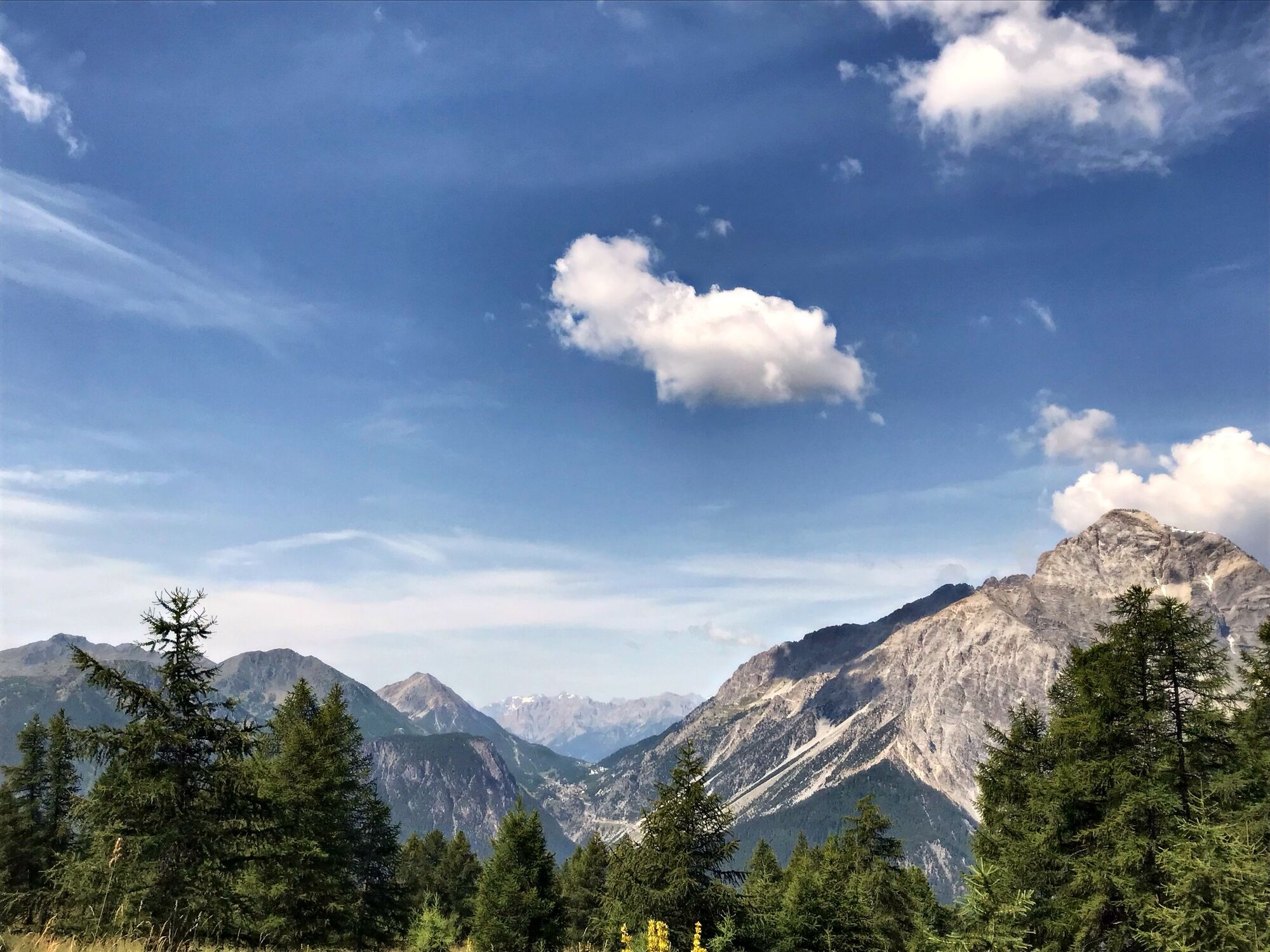
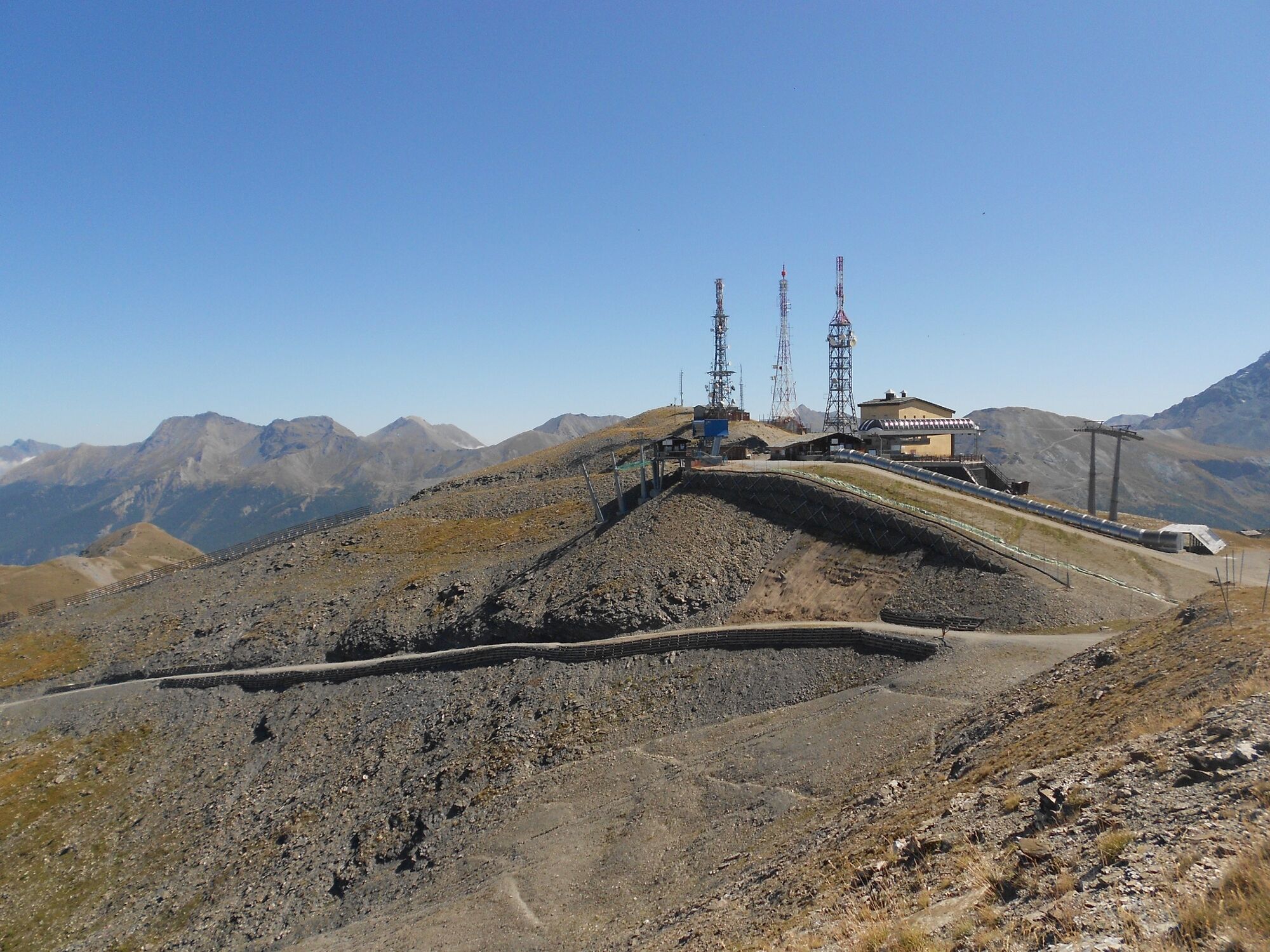
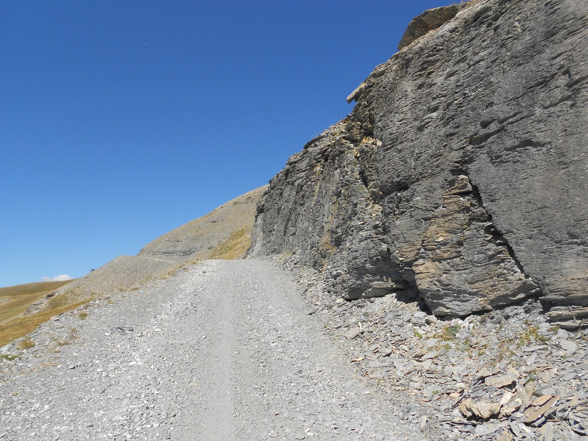
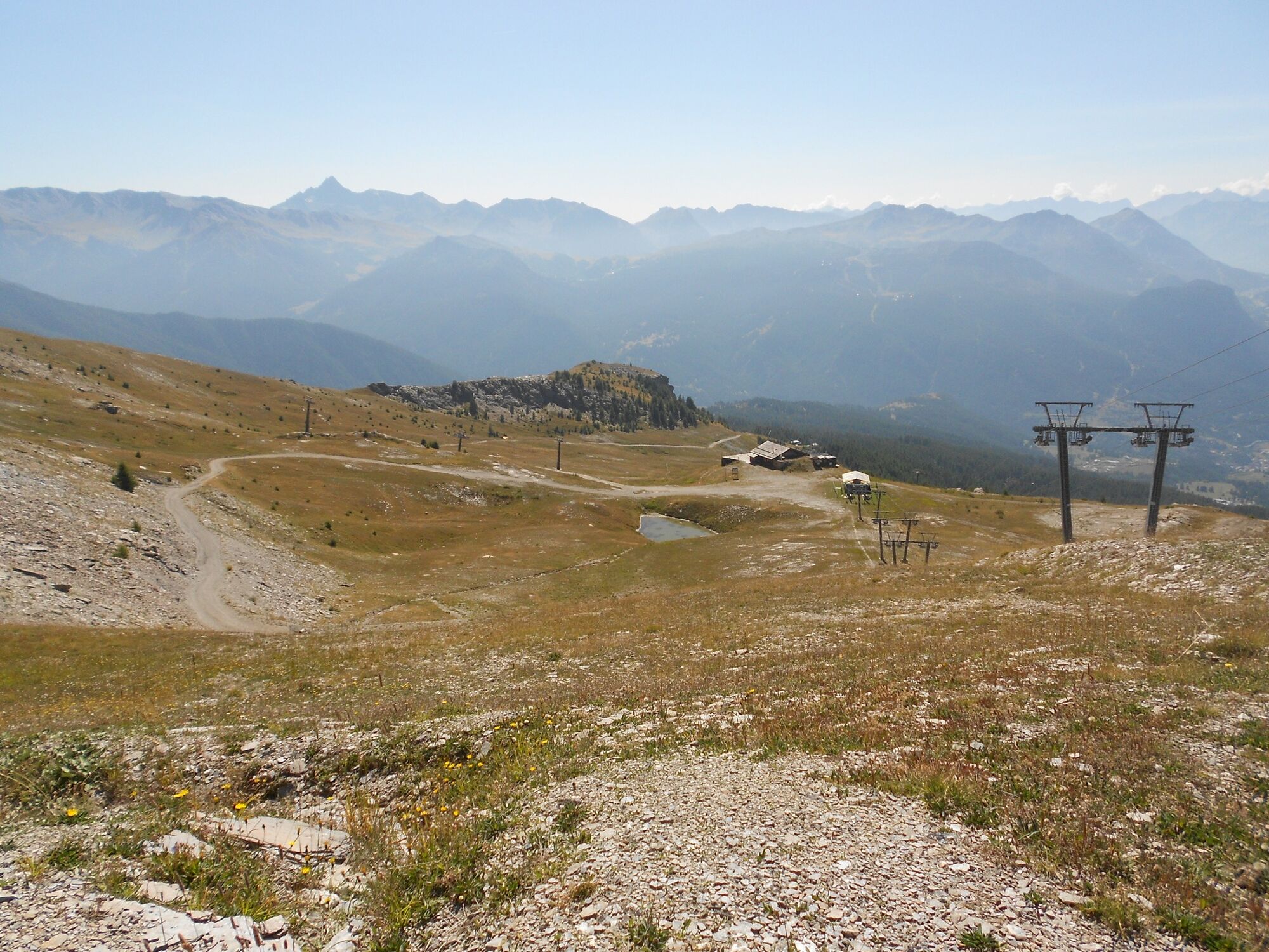
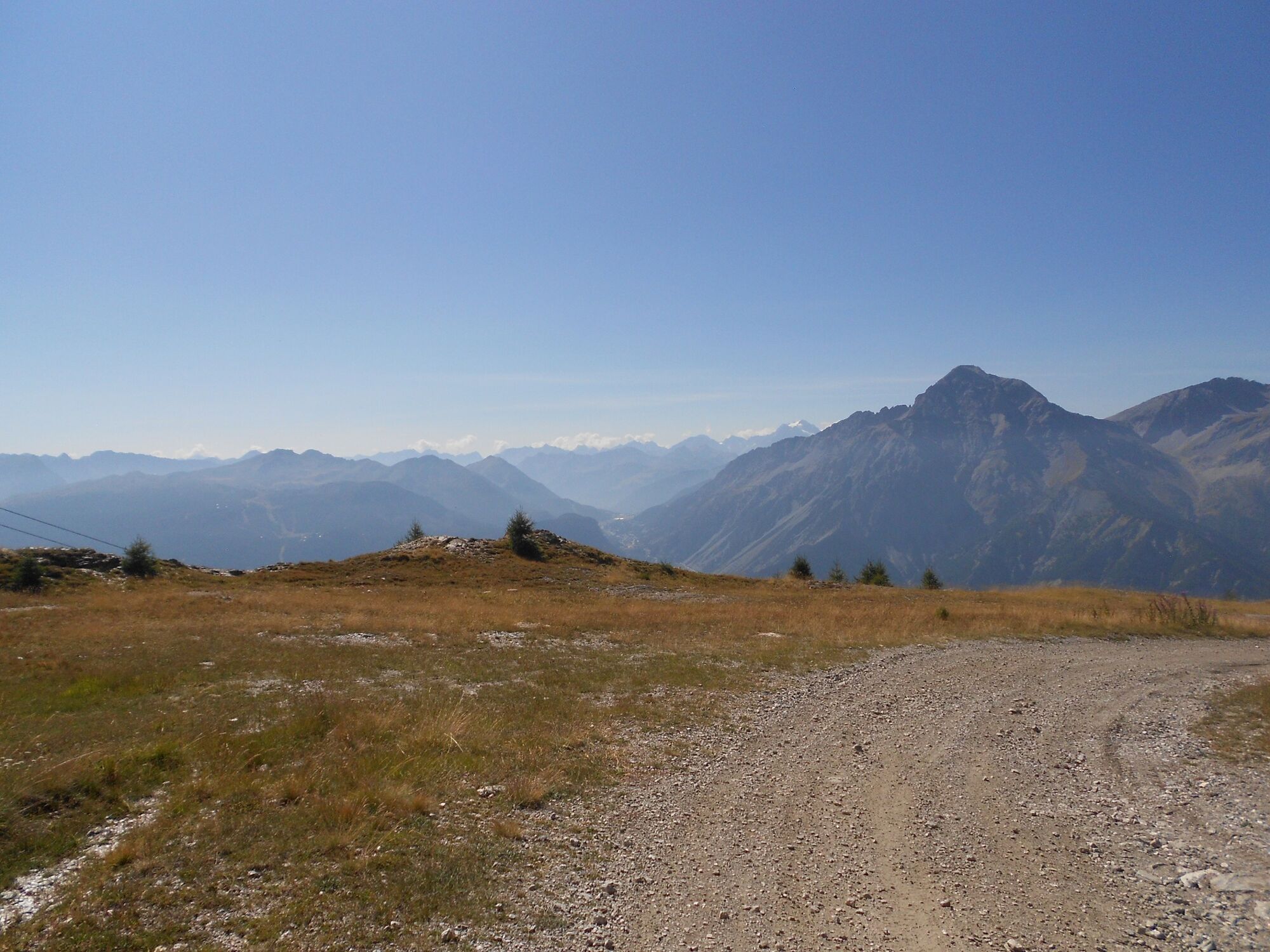
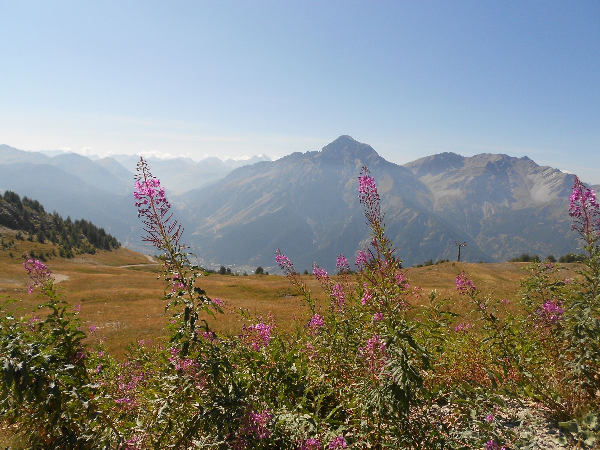
The excursion starts from San Sicario Alto, which can be reached from Cesana Torinese (6 km.) along the provincial road towards Sestriere and turning left after a couple of kilometres; having started the climb and passed San Sicario Borgo, proceed until you reach a series of numbered hairpin bends; just after the sign for the 4th hairpin bend, turn right to access the "La Sellette" lifts, where you can leave your car in the large car park where the hike begins at an altitude of 1,720 metres. Passing right in front of the start of this chairlift, take the uphill carriageway near a stream, ignoring the forks to the left that lead back to the village. From here begins a climb, sometimes steep and sometimes very steep, on straight stretches and a series of hairpin bends, all in the middle of the forest; after skirting a ski slope on the left with snow cannons, and a subsequent clearing, ignore the path to the right towards Champlas Seguin, turning instead to the left and passing in front of the "Roccia Rotonda" facilities, reaching after km. 2,200 from the start and at an altitude of 2,040 metres, the Soleil Beuf resort with a restaurant of the same name. Taking the wide slope that turns slightly uphill to the right and ignoring the carriage road to the left (alternatively, you can take the steep track of the Olympic ski slope, which comes out on the carriage road further up), you begin to follow a diagonal slope for about km. 1.300, staying in the middle of the forest, until a plateau on the right at an altitude of 2,110 metres, where there is a characteristic frame and a picnic table; here the view is beautiful with Chaberton in the foreground. Ignoring the descending track, we take the carriage road to the left that comes from Monte Rotta, which we retrace for about 150 metres and then abandon at an altitude of about 2,140 m, turning left towards Roccia Rotonda and Col Basset; the carriage road, which from Soleil Beuf was a "hybrid" (one side paved and one dirt), becomes a dirt road again. At an altitude of about 2,200 metres, the 'Sentiero Bordin' is met coming from the right, and continuing on the carriage road, still lined with larches, at an altitude of 2,250 metres, a path branches off to the left.250 metres, a path branches off to the left to reach, for possible refreshment, the Baita Mavie hut, with its characteristic structure made of beams and losa roofs, located in an extremely panoramic position. Continuing from there, the arrival point of the "La Sellette" chairlift is reached on the left. After a hairpin bend to the right, passing by the slopes of Roccia Rotonda, where the larch trees are now sporadic, and from where the Fraiteve antennae can already be seen, you pass under the Roccia Rotonda lift, which ends slightly above the road, and you reach, at an altitude of about 2,420 m and 5.800 km from the start, the Martin Refuge on the ridge to the left, from where the chairlift to Monte Fraiteve starts. Here the road turns abruptly to the right, passing over a tiny pond, and then left again, to then pass under a footbridge at an altitude of about 2,550 m, above which is the Pourcel Chapel, which can be reached by taking a right turn after a short distance on the road. From here begins a long, practically straight stretch uphill, at the beginning of which the antennas are again visible (also the remains of a shelter just below), and also very close by: it would be enough to make a cut across the prairie to reach them; however, it is advisable to proceed along the road, which in addition to being very scenic is also interesting, being in places dug into the slope made up of markedly stratified rocks that are very dark at the end. At the end of this diagonal, near a collar at an altitude of 2,630 metres that looks out towards the Vallone di Rio Nero, another immediately begins to the right, which, halfway up the slope, reaches the base of Monte Fraiteve, and with a final ascent amidst the plants that climb both slopes, the summit is reached at an altitude of 2,702 metres. There is a 360° view: the Upper Chisone Valley with its Argentera and Thuras secondary valleys, Montgenevre and the French glaciers, the Susa Valley.
Да
Да
Wear clothing and footwear appropriate to the environment and season.
By car from Turin, follow signs for Tangenziale Nord in the direction of Trafori - Frejus. Take the A32 motorway towards Bardonecchia and exit at Oulx -Monginevro-Sestriere.
Continue on the S.S 24 towards Cesana Torinese and then on the S.P 23 towards Sestriere.
After 2 km turn left at the signpost for San Sicario. Go past the first village of San Sicario Borgo and after about 3 km park in the direction of the Telecabina Ski-Lodge lift facility
Parking possibilities in the vicinity of the Ski-Lodge gondola lift
- Before embarking on any excursion, it is advisable to consult weather bulletins or ask the local tourist offices for information.
- It is good practice not to undertake a hike alone, always inform yourself of your destination.
- Do not throw rubbish into the environment but take it with you, collecting any rubbish left by others.
- The walking times given are approximate and may vary depending on weather conditions and your own abilities.
No water point
Soleil Boeuf refreshment point open in summer, check opening and availability before setting off on the hike
Популярные экскурсии по окрестностям
-
5,0
CESANA T.SE To Fenils (No. 48)
светПоход 4,29 км -
5,0
BARDONECCHIA Col des Acles - Passo della Mulattiera
тяжелыйПоход 6,57 км -
SESTRIERE Assietta Road
среднийГорный велосипед 43,3 км -
BARDONECCHIA Punta Colomion - Passo della Mulattiera - Pian del Colle Ring
тяжелыйГорный велосипед 25,1 км -
CESANA T.SE Val Thuras Valley
среднийПоход 7,58 км -
La Via dei Saraceni (Sauze d'Oulx)
среднийГорный велосипед 33,6 км -
BARDONECCHIA Punta Colomion - Puys - Beaulard Ring
среднийГорный велосипед 24,7 км -
SAUZE DI CESANA Argentera Valley
среднийГорный велосипед 30,7 км -
Val Thuras and Tornior bivacco (Cesana T.se)
среднийГорный велосипед 37,5 км -
CESANA T.SE Thures - Cima Bosco
среднийПоход 10,6 км

Походы и трекинг


Не пропустите предложения и вдохновение для вашего следующего отпуска
Ваш адрес электронной почты был добавлен в список рассылки.