


Richardette - Monte Genevris (track n°8)


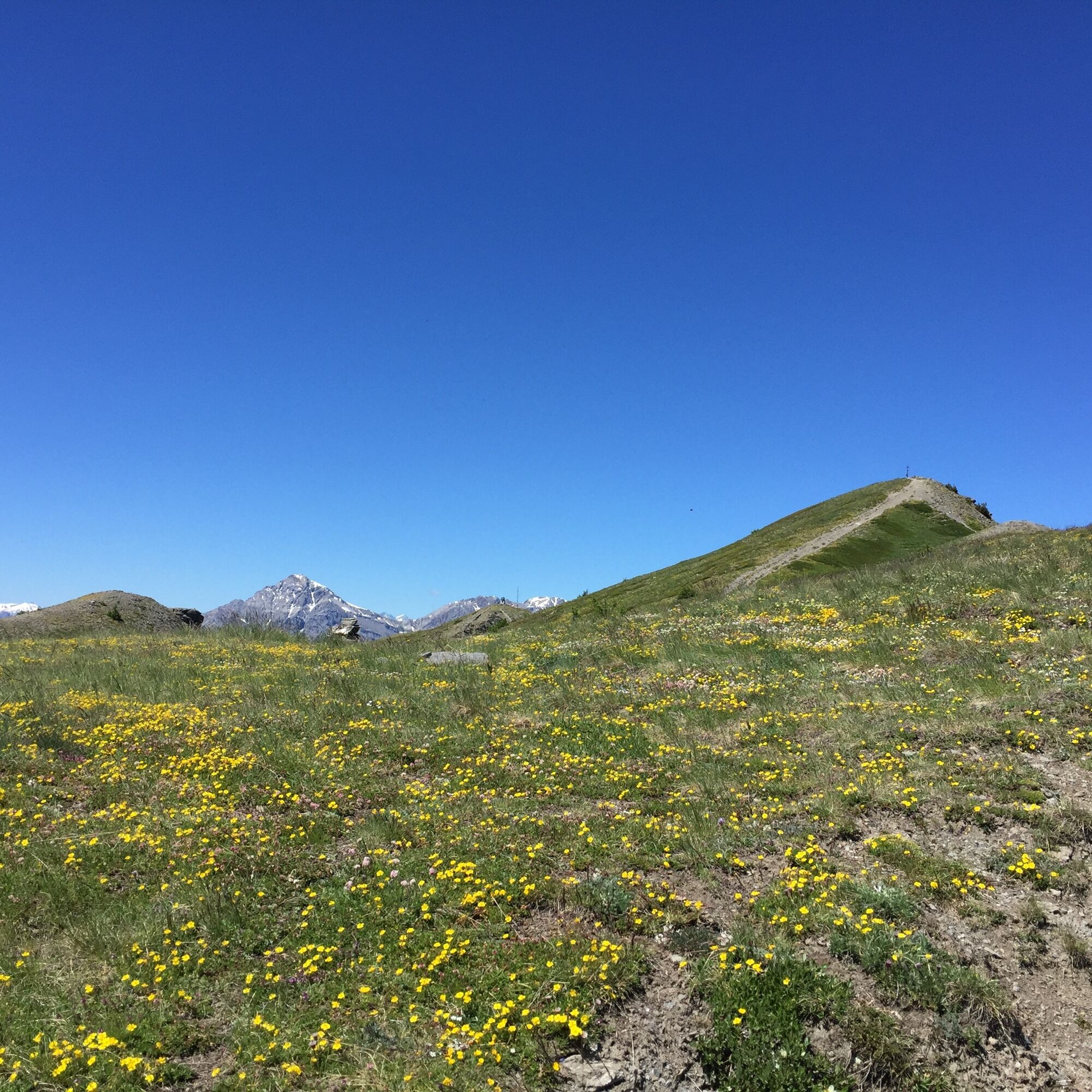
This historic path is certainly one of the most fascinating destinations in Sauze d'Oulx and the view from the top is priceless.
It starts from the hamlet of Richardette and leads to the Faro degli Alpini/Monte...
This historic path is certainly one of the most fascinating destinations in Sauze d'Oulx and the view from the top is priceless.
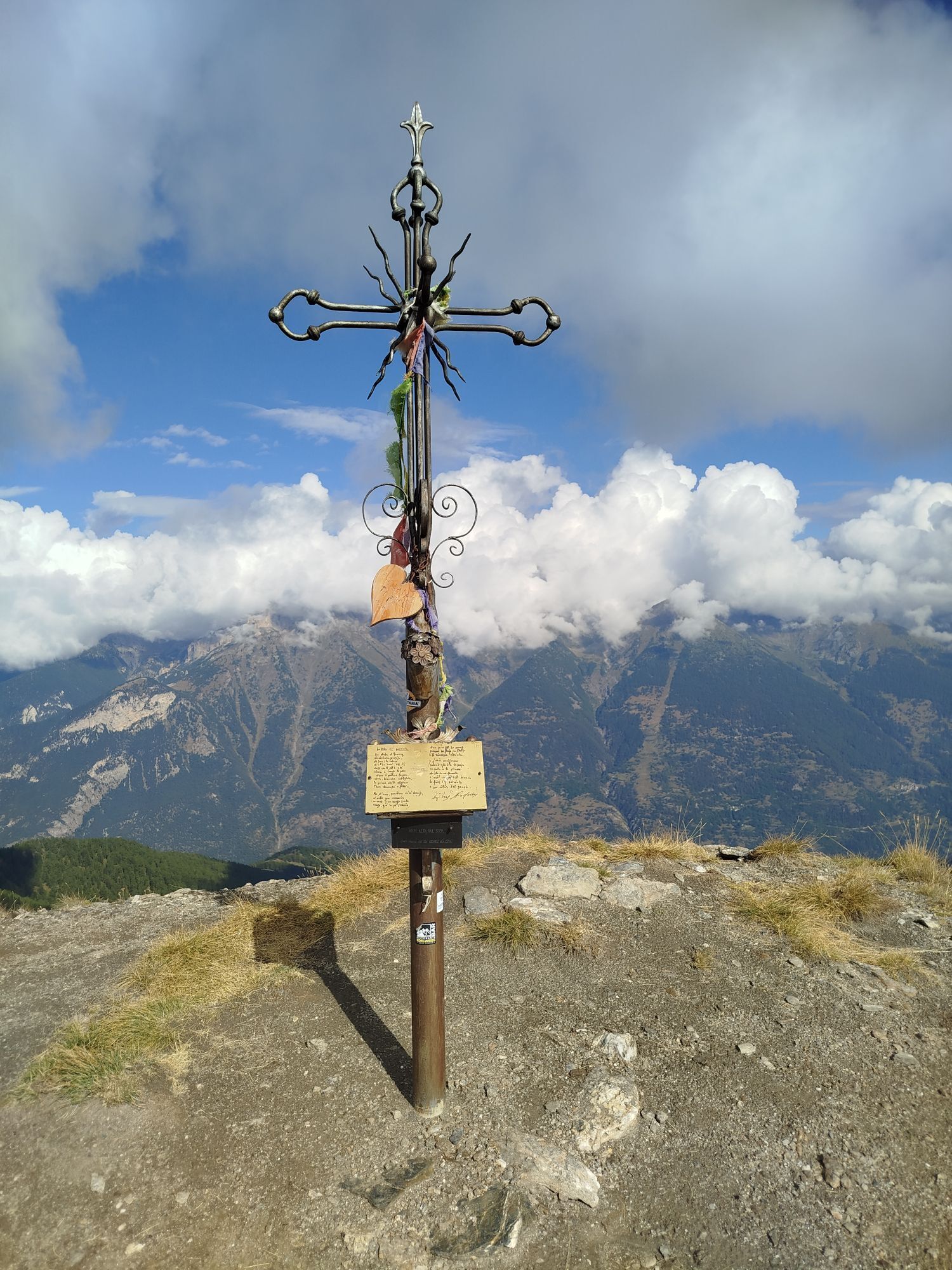
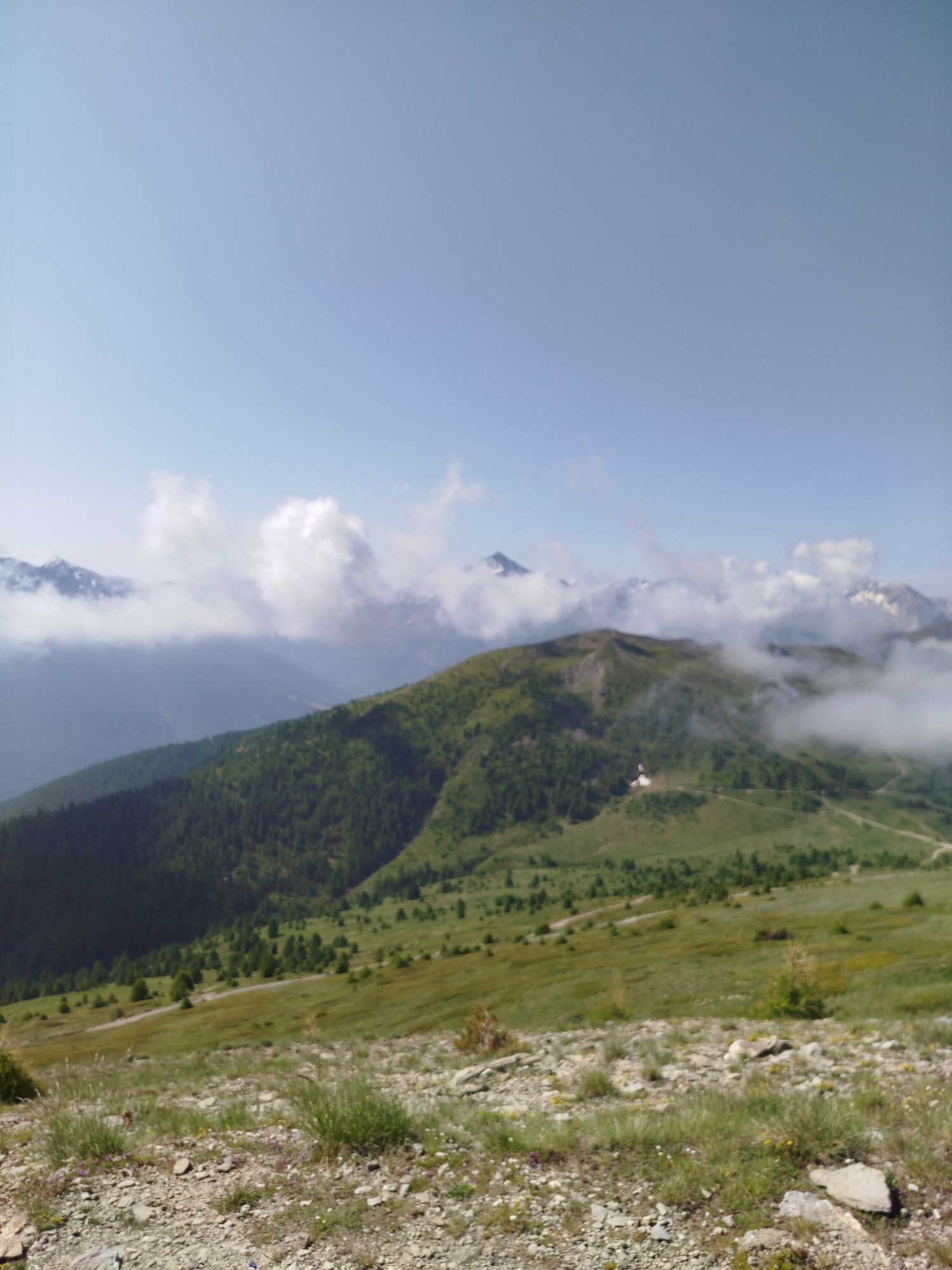
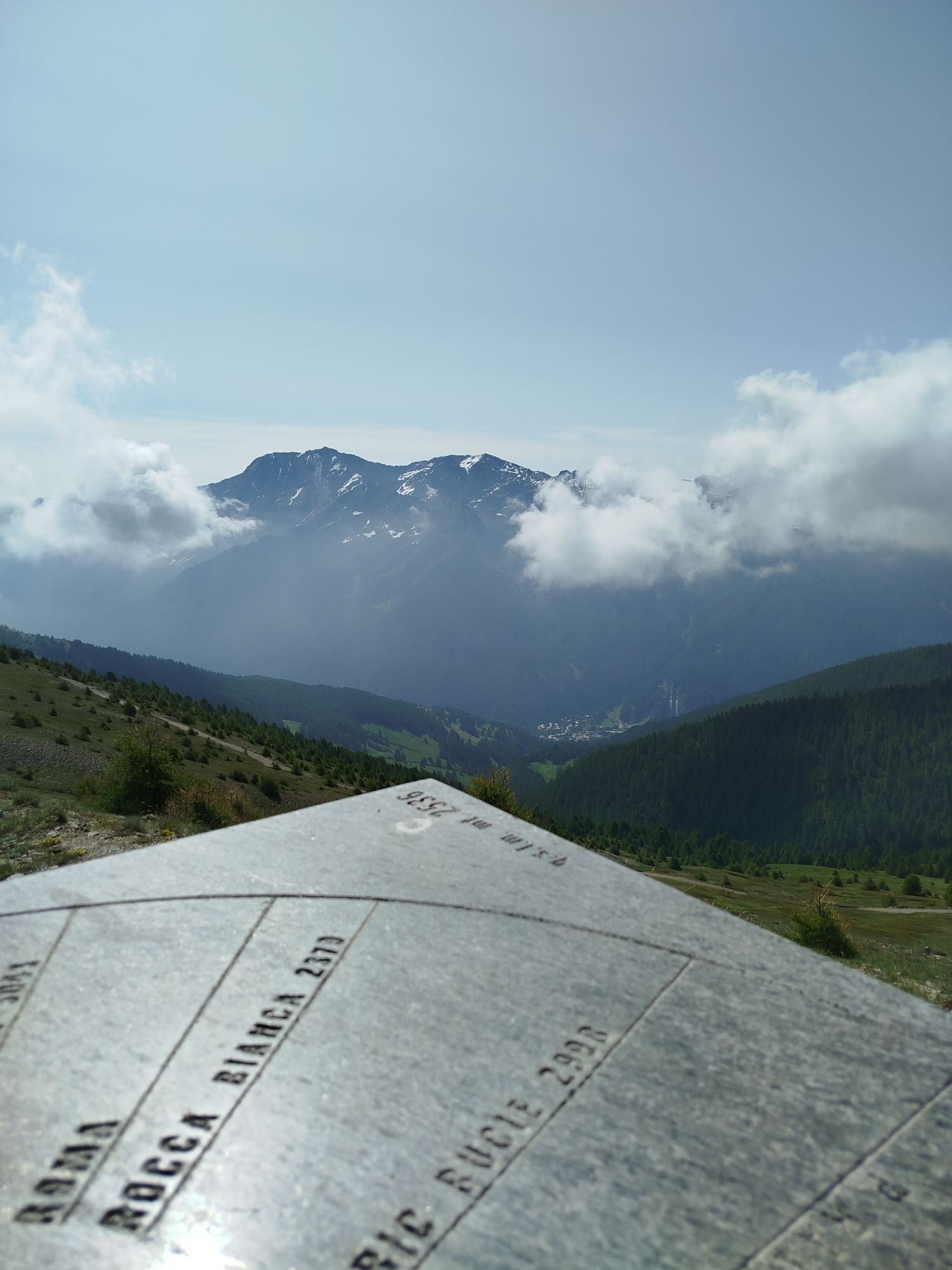
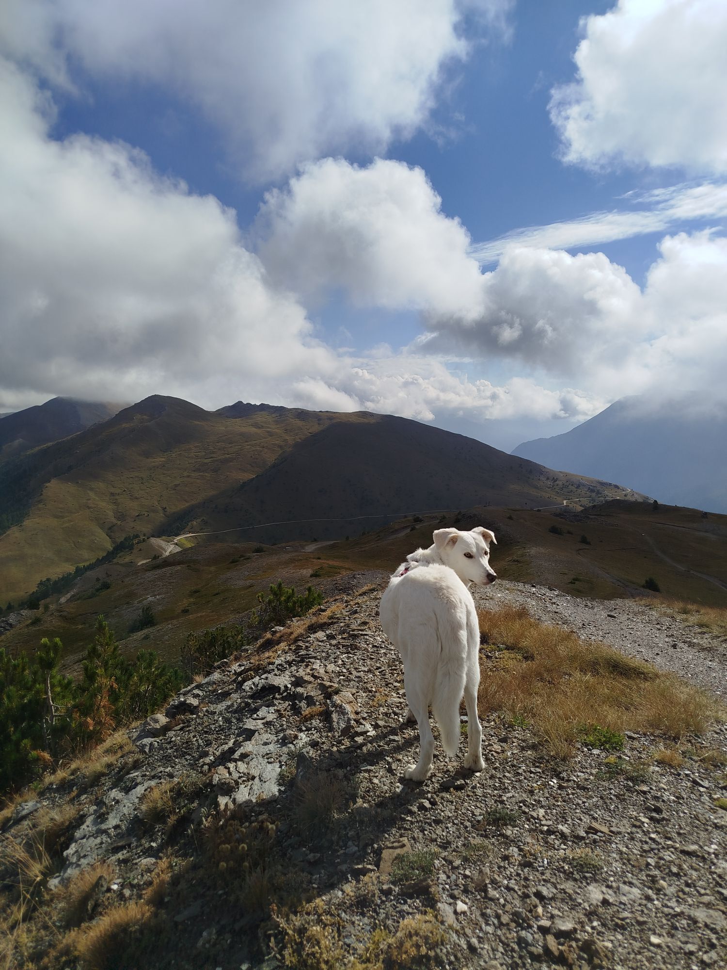
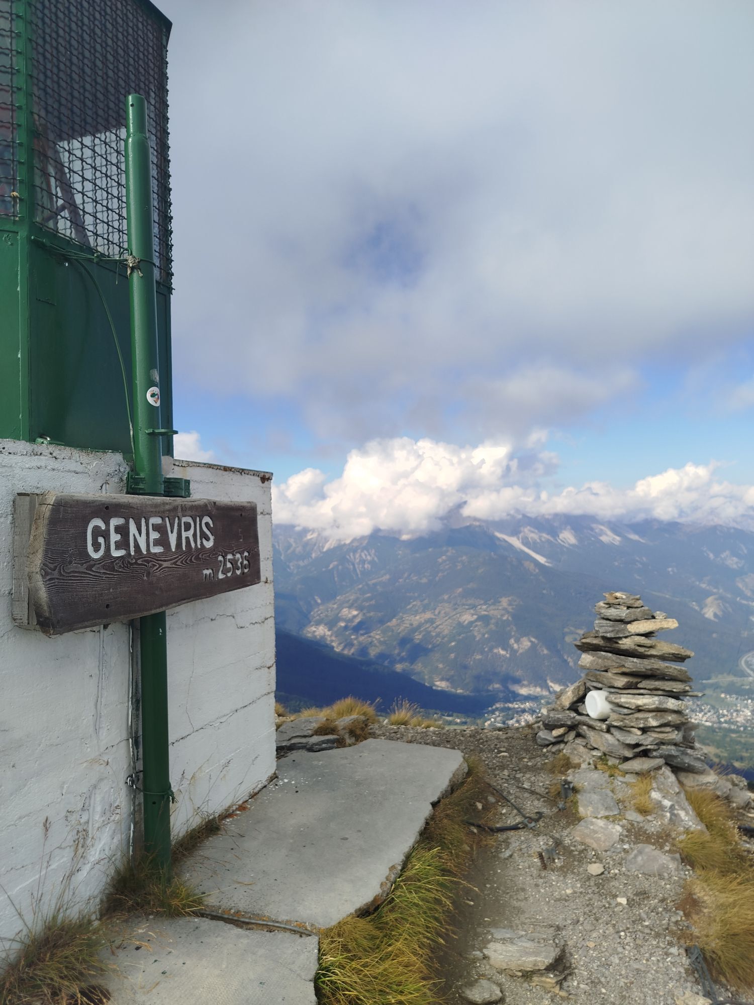
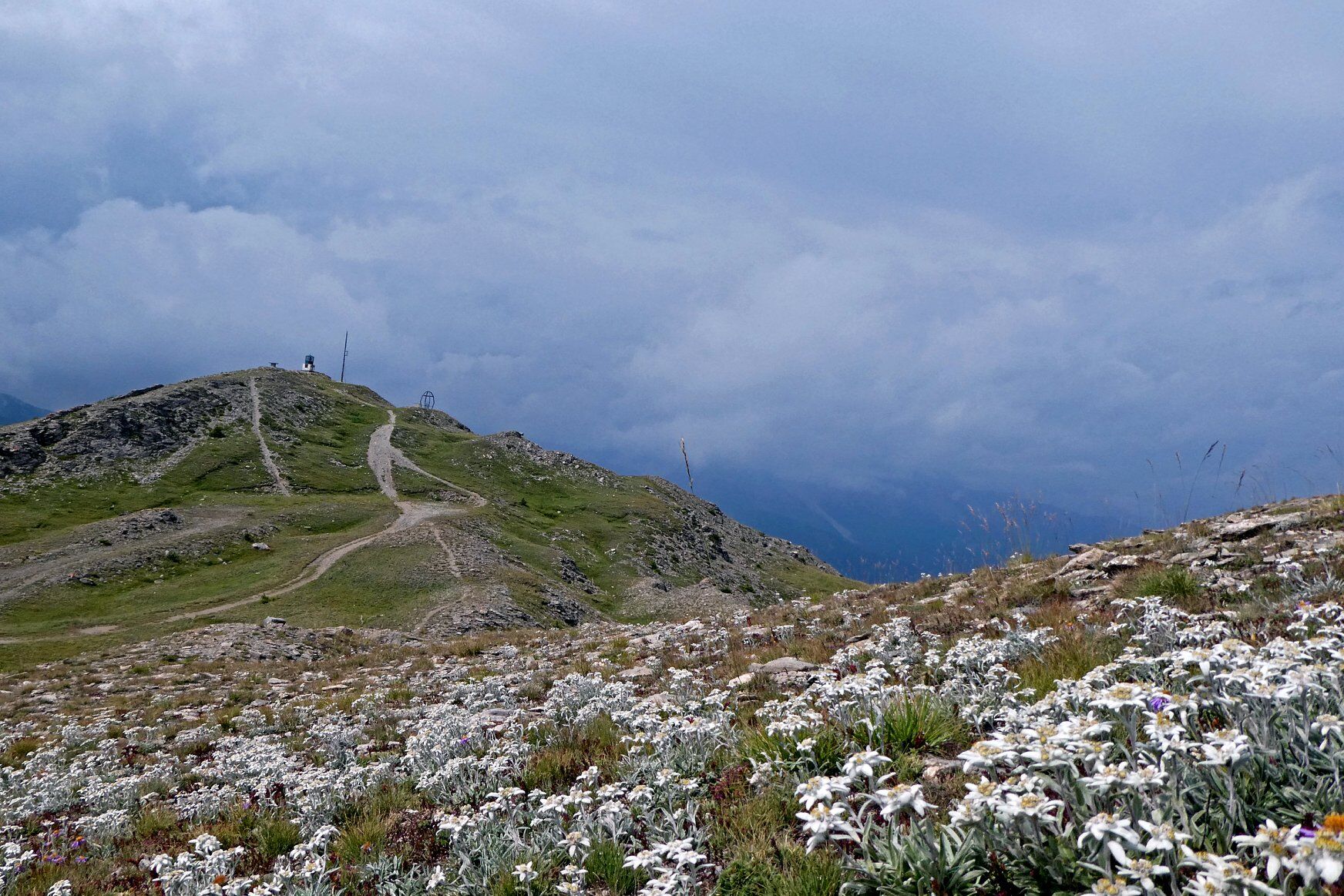
It starts from the hamlet of Richardette and leads to the Faro degli Alpini/Monte Genevris, passing the Colle di Costa Piana. The itinerary crosses a rather steep, densely wooded comba and then follows the route of the now abandoned tracks to the Colle di Costa Piana, where the Assietta road crosses. The final stretch follows the ridge, with views to the left of the Susa Valley and to the right of the Chisone Valley. Now above the wooded area, surrounded by alpine meadows and fields of edelweiss and alpine flowers, you reach Monte Genevris - Faro degli Alpini. From here, on the watershed, there is a panoramic view of the mountains of the upper Susa and Chisone valleys, as well as those of neighbouring France.
Assistance and technical description by Barbara Demonte - environmental guide.

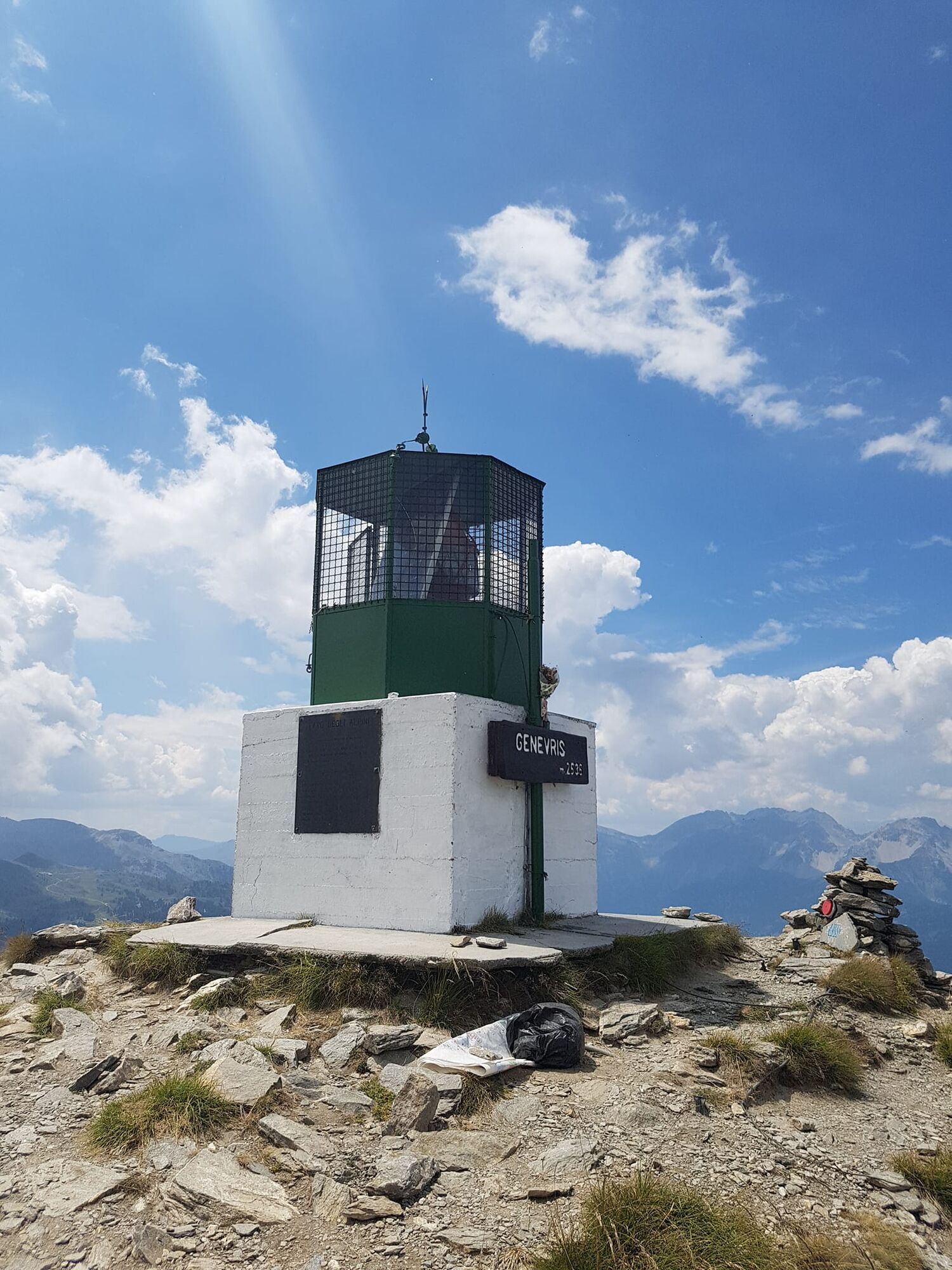
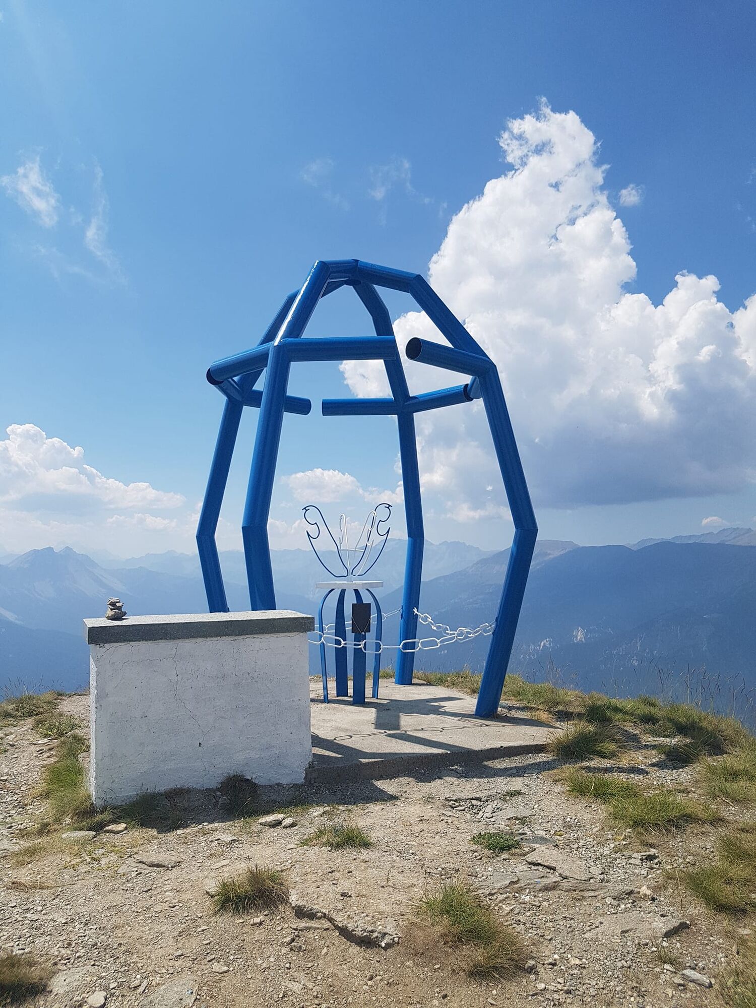
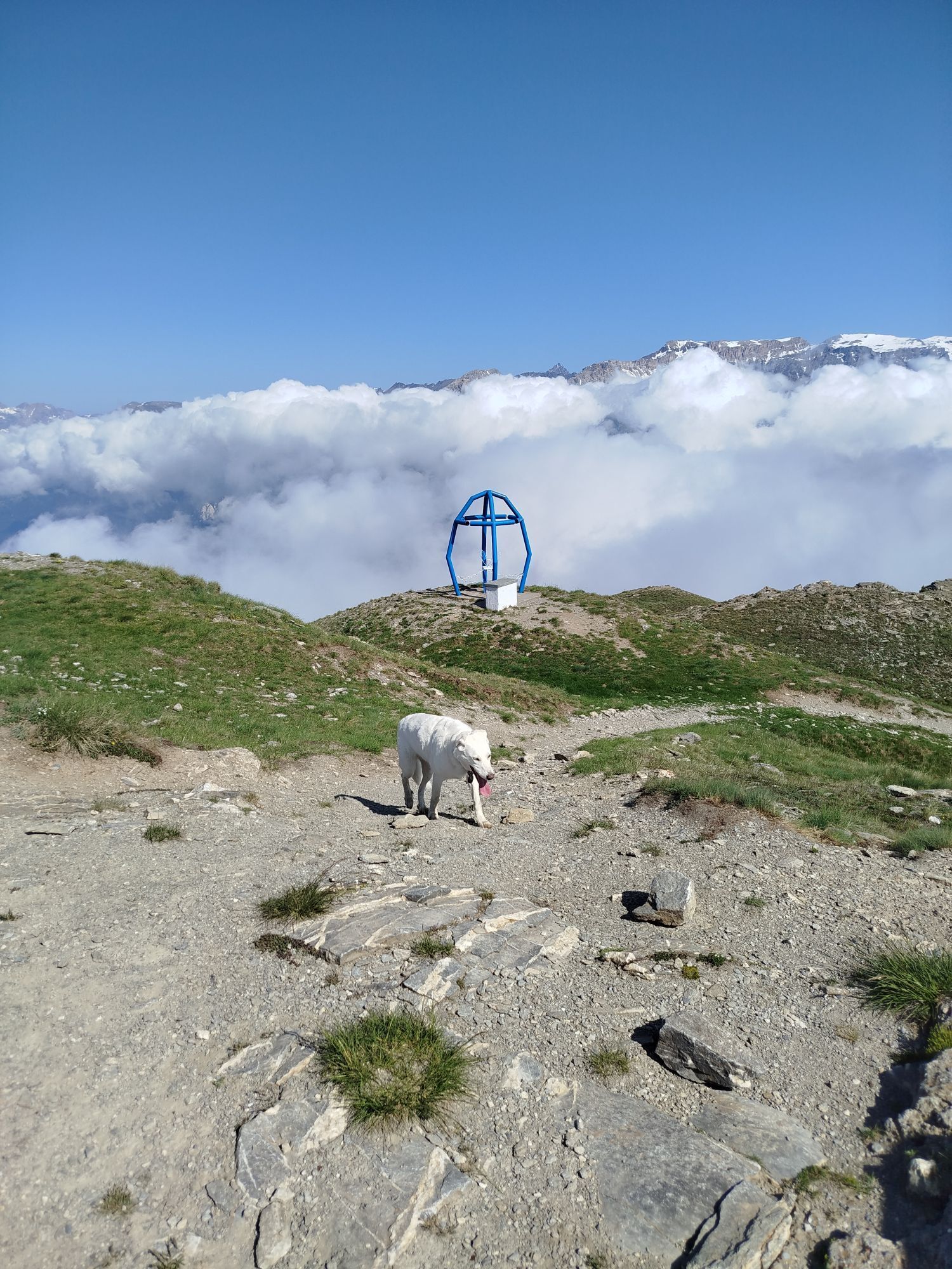
The itinerary starts at Richardette, at an altitude of 1,700 metres, near the chapel and the fountain. Coming from Sauze d'Oulx, at the bend just before the chapel, a path starts on the right with indications for Monte Genevris. The first stretch passes in front of a splendid chalet and therefore seems to be a private road. Past the refuge, after a gentle stretch and after crossing the first stream, the path begins to climb steeply through the woods until, at about 1900m, it crosses the road coming from Clotes. Turn left and, after about 200 metres, cross the dirt road for Sportinia and go straight on along the path signposted for the Faro degli Alpini lighthouse. After a short straight stretch, ignore the track that climbs steeply to the right and continue to the left. The short flat stretch immediately turns uphill and, after a few hairpin bends, you pass an artificial reservoir (on the right) known as the Diga Ciaudano at an altitude of around 2070 metres. The path continues to the left of the dam along a steep slope (former track no. 40). After passing the station of the disused ski-lift (on the right), you go through a few more hairpin bends to reach the Colle di Costa Piana, still on dirt road, at an altitude of about 2,320 m. Ignoring the Strada dell'Assietta, turn left and follow the ridge path, which passes near a bunker at 2,360 m, to reach Monte Genevris or Faro degli Alpini at 2,535 m. Not far from the top, towards the east, the famous Assietta road crosses the Colle di Costa Piana, which can be partly followed if you decide to make a loop on the way back, passing by Col Blegier, Ferro di Cavallo and Lago Laune.
Да
Да
Wear clothing and footwear appropriate to the environment and season.
By car from Turin: the exit from A32 Frejus- Turin motorway is at Oulx Circonvallazione. Follow the SP 214 and the signs to Sauze d’Oulx upon leaving the motorway.
By car from France: From the UK take the A 43 through the Frejus Tunnel (toll) then A32 motorway as far as Oulx.
By airplane: Turin airport is just over one hour away and is connected to Sauze d’Oulx and Oulx by private transfer or by public transport - bus to the main railway station in Turin, Porta Nuova; train to Oulx (railway line Torino/Bardonecchia); bus to Sauze d’Oulx. Train times and fares can be viewed and booked at trenitalia.com. The bus company web site is www.torino.arriva.it
By train: the mainline railway which connects Paris to Milan by TGV has a station in Oulx. Public transport and taxis services operate from Oulx station to Sauze d’Oulx. See also: www.snowcarbon.co.uk.
Locality Richardette near the small church
Before starting out on any excursion, it is advisable to consult weather bulletins or ask the local Tourist Offices for information. It is good practice not to undertake a hike alone, always inform yourself of your destination.
Do not throw rubbish into the environment but take it with you, collecting any rubbish left by others.
The hiking times given are approximate and may vary depending on weather conditions and your own abilities.
The ascent is not particularly difficult, but does have some slightly steep sections.
It is possible to complete the excursion with a round trip by descending, along the Assietta road, to the Blegier pass.
At the pass, cross the barrier signalling the entrance to the Gran Bosco Nature Park and descend until you reach the Ferro di Cavallo.
Turn left and then left again as far as Lake Laune. Continue along the carriage road that leads to the former Vezzani Institute and return to the car along the tarmac road.
There are no fountains along the route
Веб-камеры во время экскурсии
Популярные экскурсии по окрестностям
-
5,0
BARDONECCHIA Decauville
светПоход 7,29 км -
BARDONECCHIA Colle Sommeiller
среднийГорный велосипед 25,4 км -
5,0
CESANA T.SE To Fenils (No. 48)
светПоход 4,29 км -
SESTRIERE Assietta Road
среднийГорный велосипед 43,3 км -
CESANA T.SE Val Thuras Valley
среднийПоход 7,58 км -
La Via dei Saraceni (Sauze d'Oulx)
среднийГорный велосипед 33,6 км -
BARDONECCHIA Punta Colomion - Puys - Beaulard Ring
среднийГорный велосипед 24,7 км -
BARDONECCHIA Decauville - Rifugio Scarfiotti Ring
светГорный велосипед 34,0 км -
SAUZE DI CESANA Argentera Valley
среднийГорный велосипед 30,7 км -
Val Thuras and Tornior bivacco (Cesana T.se)
среднийГорный велосипед 37,5 км

Походы и трекинг


Не пропустите предложения и вдохновение для вашего следующего отпуска
Ваш адрес электронной почты был добавлен в список рассылки.