


Cima Bosco ( Sauze di Cesana)


Departure from the village of Sauze di Cesana, in the area adjacent to the Ripa stream: from here via a dirt road begins the ascent to arrive at Cima del Bosco, a mountain located at the confluence of...
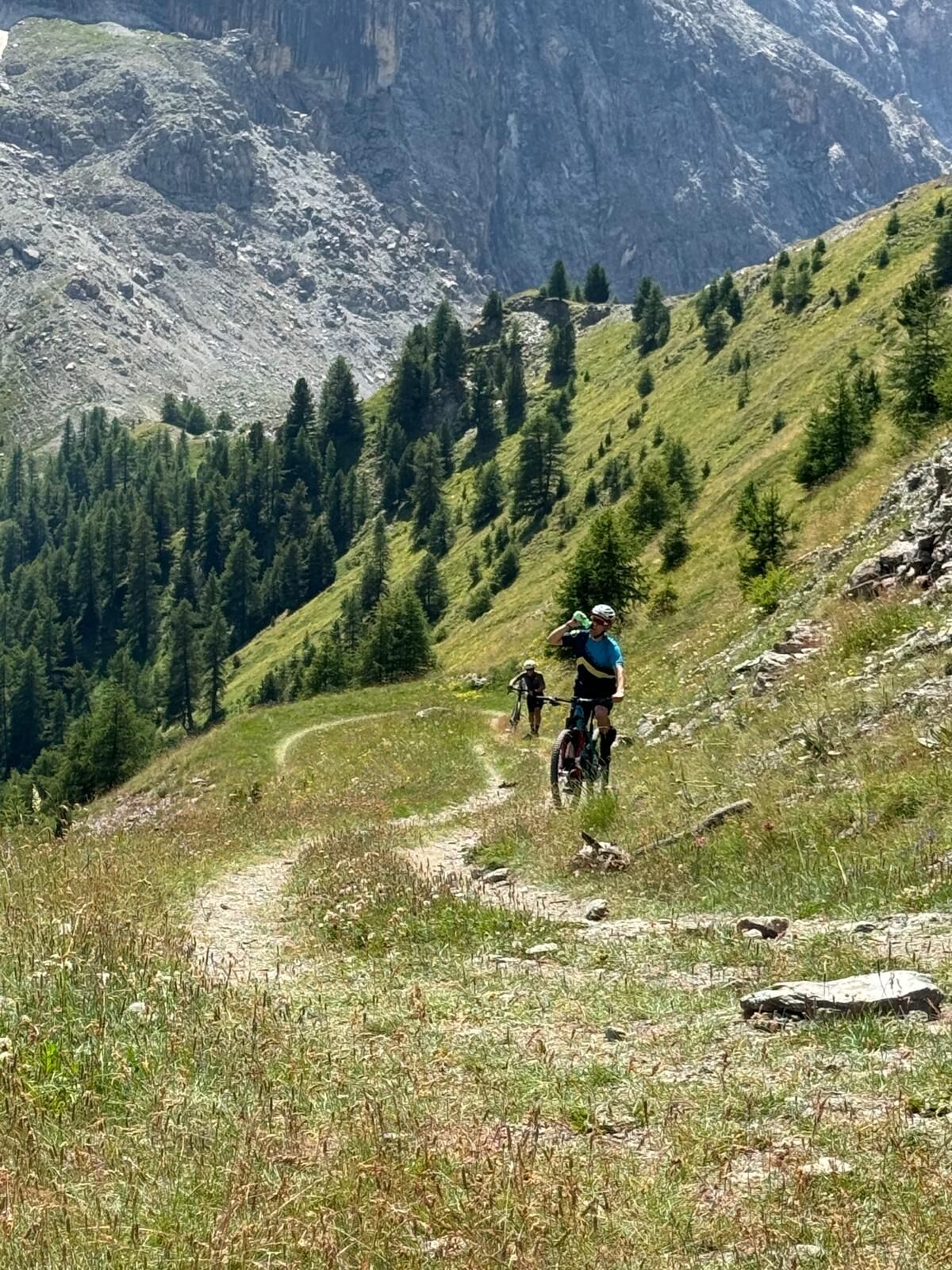
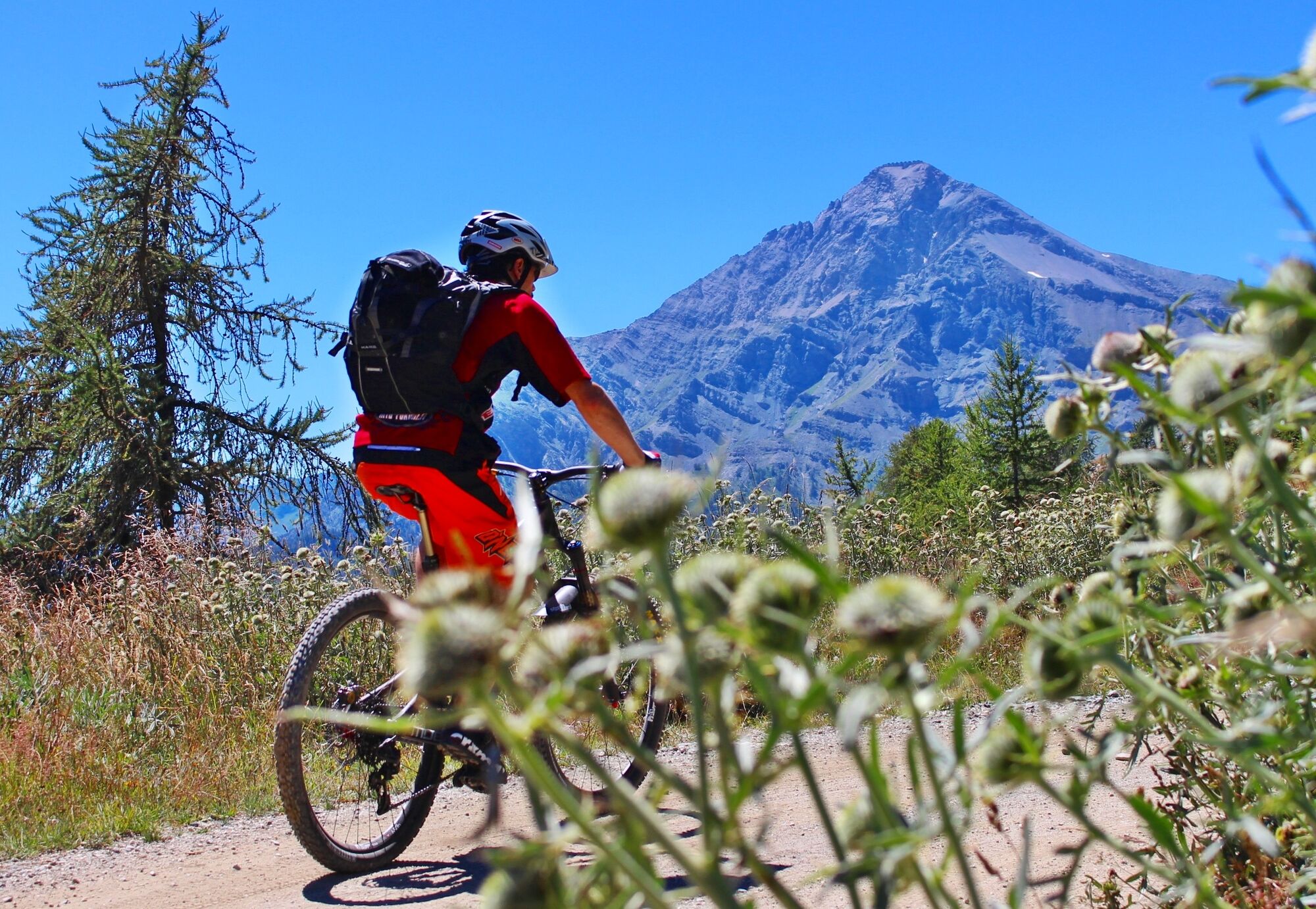
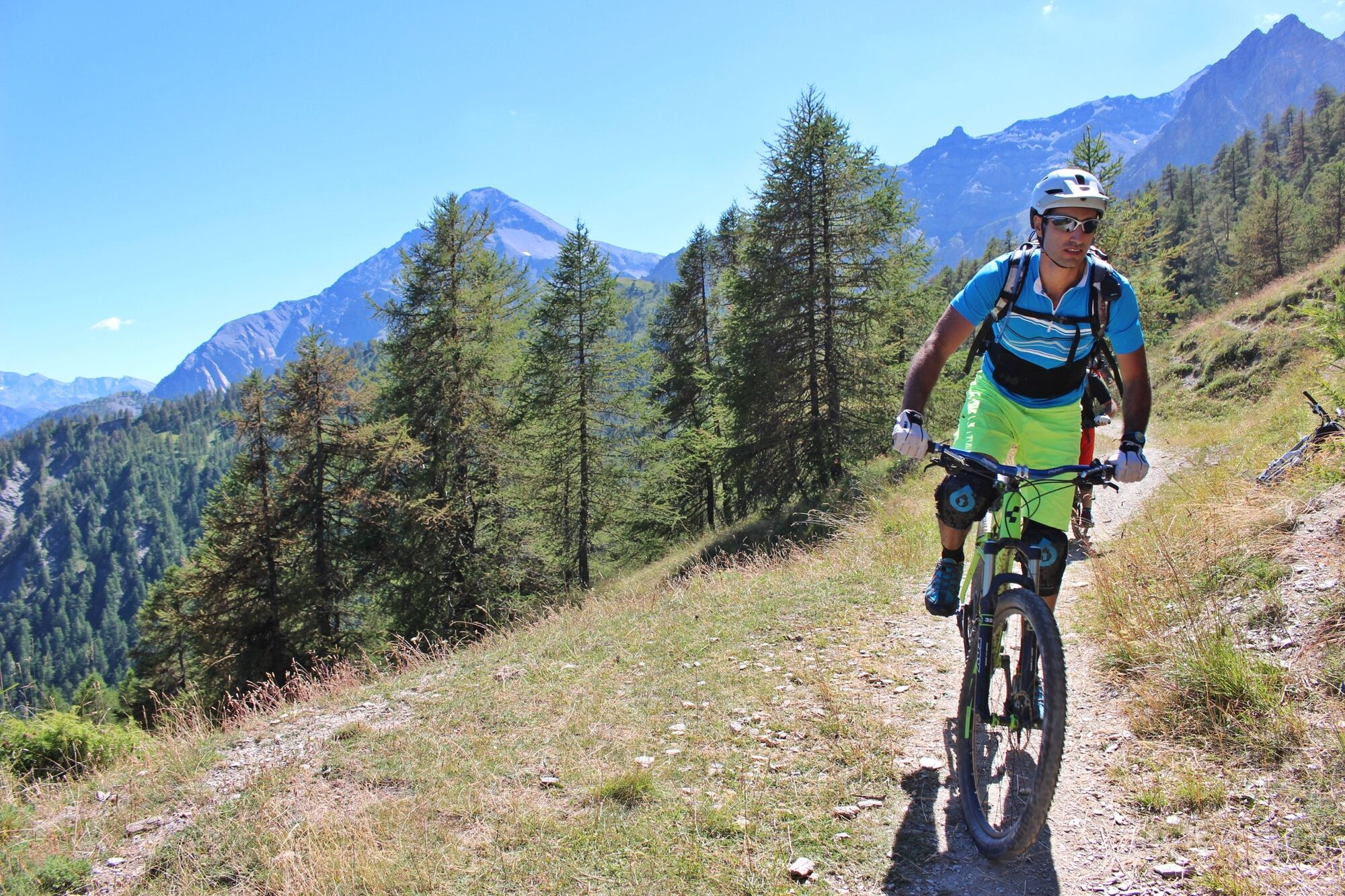
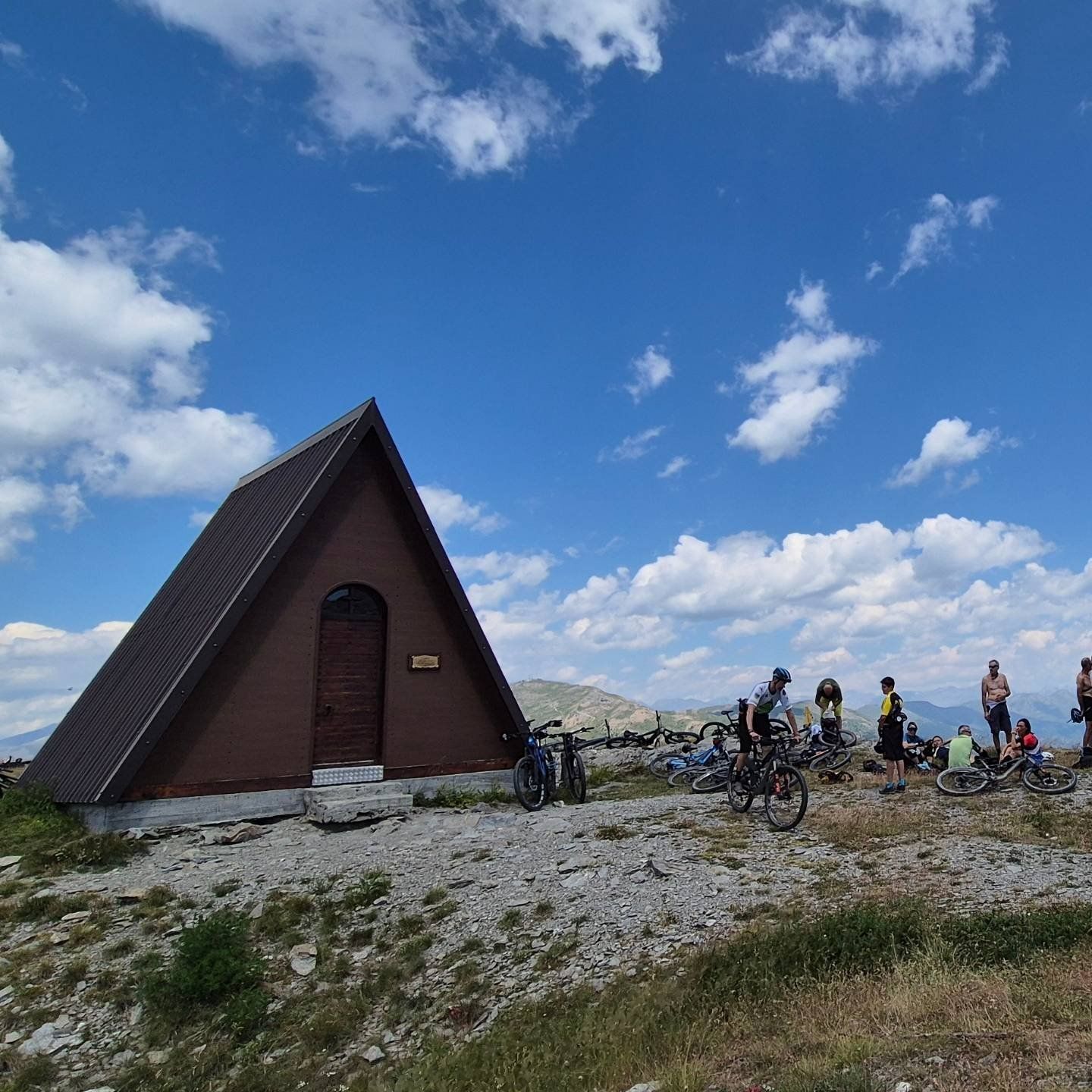
Departure from the village of Sauze di Cesana, in the area adjacent to the Ripa stream: from here via a dirt road begins the ascent to arrive at Cima del Bosco, a mountain located at the confluence of the Argentera and Thuras valleys. The route maintains a constant slope for a good part inside a forest, offering us shelter from the sun in warmer seasons. The climb ends at 2380 meters, having reached the chapel located on the top of the mountain.
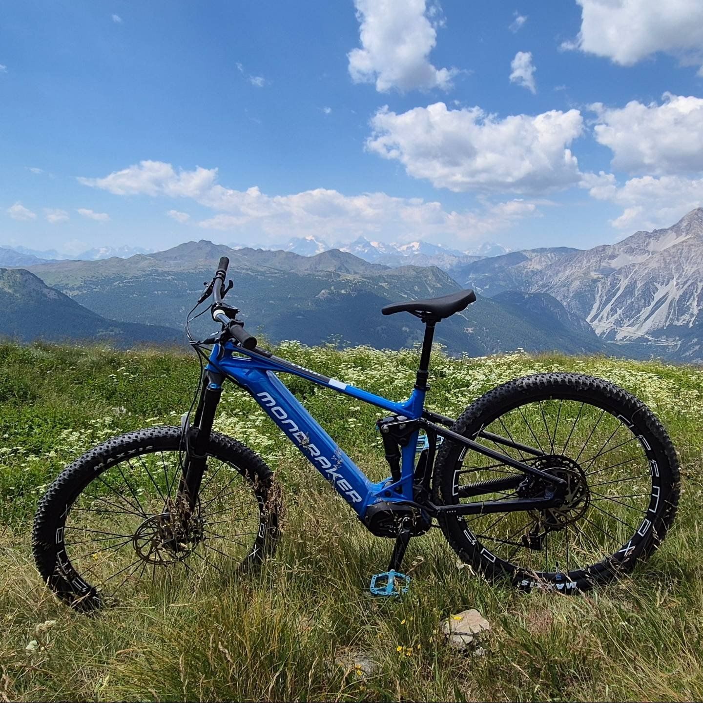
The position of this summit allows free space all around us, as if we were on a balcony to admire the panorama of the upper valley.
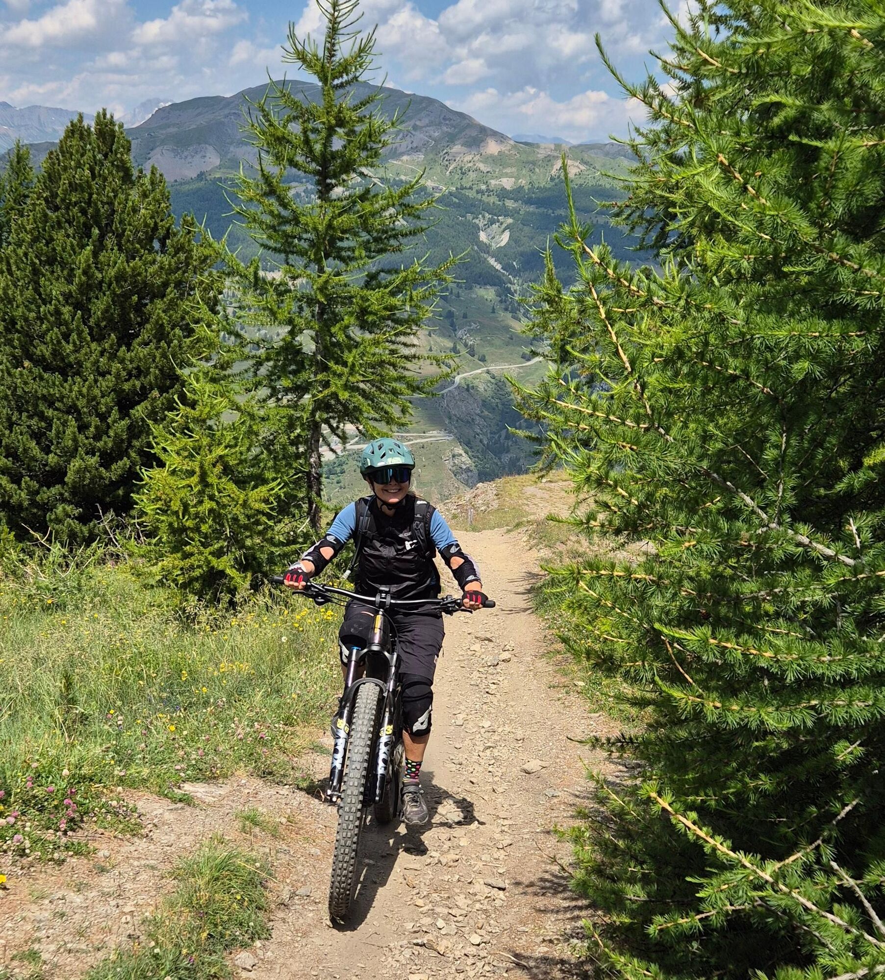
The descent takes place on a path that gives fun and reaches the pretty village of Thures, from where along the asphalt road we reach Bousson and with a last stretch of a few kilometers returns to the starting point
Departure from the village of Sauze di Cesana, in the area adjacent to the Ripa stream: from here via a dirt road begins the ascent to arrive at Cima del Bosco, a mountain located at the confluence of the Argentera and Thuras valleys. The route maintains a constant gradient for a good part inside a forest, offering us shelter from the sun in warmer seasons. The climb ends at 2380 meters, having reached the chapel located on the top of the mountain.
The position of this summit allows free space all around us, as if we were on a balcony to admire the panorama of the upper valley.
The descent takes place on a path that gives fun and reaches the pretty village of Thures, from where along the asphalt road we reach Bousson and with a last stretch of a few kilometers returns to the starting point
Да
MTB / E-bike
CAI Classification: BC
Route also frequented by hikers on foot - adjust speed and pay attention.
From Turin, follow the signs for Tangenziale Nord in the direction of Trafori - Frejus. Take the A32 highway towards Bardonecchia and exit the highway at the Monginevro Sestriere exit. At the tunnel exit, continue to the right in the direction of Cesana and then Sauze di Cesana
Reachable by public transportation.
Train from Turin P.N to Bardonecchia (Oulx-Cesana-Claviere-Sestriere stop) + Bus Arriva line 285from Oulx to Cesana, Sauze di Cesana stop
Possibility of parking near the start of the route, in the area Ristornante "Il Ristorantino di Rollieres"
There is a free-access e-bike charging point near the Sauze di Cesana town hall, you can use your charger to connect it to this point and charge your e-bike
Популярные экскурсии по окрестностям
-
5,0
CESANA T.SE To Fenils (No. 48)
светПоход 4,29 км -
SESTRIERE Assietta Road
среднийГорный велосипед 43,3 км -
CESANA T.SE Val Thuras Valley
среднийПоход 7,58 км -
La Via dei Saraceni (Sauze d'Oulx)
среднийГорный велосипед 33,6 км -
CESANA T.SE Thures - Cima Bosco
среднийПоход 10,6 км -
Sentiero Italia: Salbertrand - Bardonecchia
среднийПоход 19,5 км -
Val Thuras and Tornior bivacco (Cesana T.se)
среднийГорный велосипед 37,5 км -
SAUZE DI CESANA Argentera Valley
среднийГорный велосипед 30,7 км -
CESANA T.SE Ring Cesana - Sauze di Cesana
среднийГорный велосипед 14,7 км -
Jouvenceaux-Gad/Cotantin (n°9)
светПоход 2,82 км
Походы и трекинг


Не пропустите предложения и вдохновение для вашего следующего отпуска
Ваш адрес электронной почты был добавлен в список рассылки.