


Collioure Heights


Discovery the heritage of Collioure between forts, vineyards and bay of Collioure. An exceptional family walk which takes 3 hours
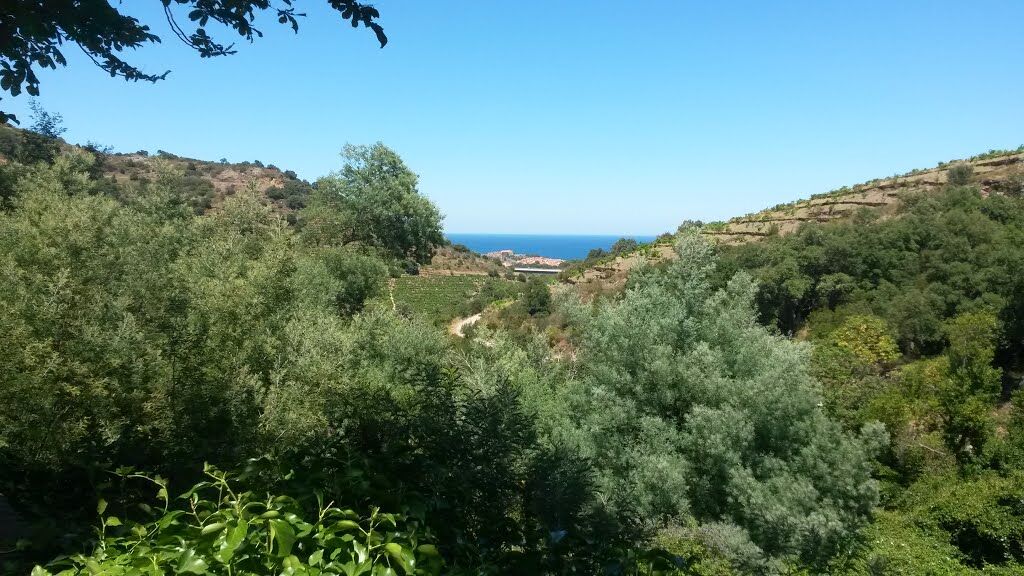
From Glacis car park, get off at the roundabout. Take Temple street, which goes up on the left. Go under the railway and continue facing rue de la Galère. Go straight at the crossroad by the path of Consolacion (arrow "Consolation"), to a fork Go up to the left following the small road that leaves the village and arrive in the middle of terraced vineyards. Go under the road viaduct and continue straight on.
After about 120 meters, pass the Saint-Therese oratory on left . Carry on until Notre-Dame-de-Consolation retreat by the paved ramp which starts hard on the right . Make a return-trip from this point to discover the site of Notre-Dame-de-Consolation.…
Go back down to the bottom loop of the paved ramp by taking the same itinerary “route in reverse”. Then turn right to climb to the Molló Coll .
Go left towards Port-Vendres. After 400 meters, at the Col de Mara Cara (view of Port-Vendres), take left on the track DFCI-AL 45.
Pass the summit. Then take along slope on the main path after Coll d'en Raixat towards Fort Dugommier .
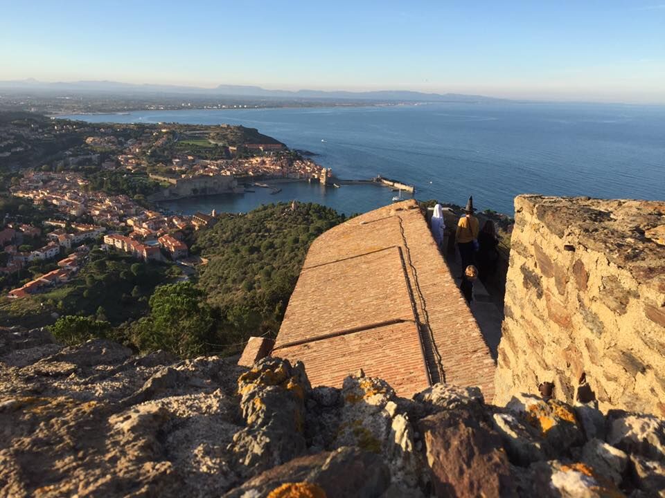
After the rock, notice on left a path. Take quick left along small wall. This “balcony of Collioure” joins the Saint-Elme fort.
At the bottom of the fort, go down to Collioure by a path on left headed for a mill.
At the level of the paved ramp, reach the mill and bypass it on right, then carry on right lower in the slope.
A series of stairs then leads to the corner of the Museum of Modern Art. Return left to the quays of Anse de la Balette. Go up the Démocratie street, then the Avenue du Général de Gaulle to resume your starting point (car park).
In case of emergency, dial 112
Collioure: 28 km at the south-east of Perpignan by the D 914.
Bus stop : Marceau Banyuls Square
Le Glacis carpark up the Royal Fort (fee for the carpark)
You enjoy nature, You like it, take care of it...
Along the hiking trail, rubbish bins are at your disposal.
Every month over tens of thousands of hikers and walkers visit this exceptional site. Please do not litter and use the rubbish bins (glass, plastic, rubbish etc...). Also, please dispose of any litter you might find along the trail.
Help keep this site clean with simple yet essential gestures. Lets give back to nature what nature gave us.
Популярные экскурсии по окрестностям
-
Hauts des Forts Trail (Long Version)
среднийТрейлраннинг 21,8 км -
[Connection] Elne-Argelès-sur-Mer
среднийДорожный велосипед 12,3 км -
Rallye-enquête : Le linteau millénaire de Saint-Genis-des-Fontaines
среднийДорожный велосипед 28,6 км -
Madeloc
среднийПоход 8,83 км -
GR10 Pyrenäenweg Etappe 55
среднийПешеходная тропа большой протяженности 23,2 км -
[Stroll] "the balconies" of Cosprons
светГорный велосипед 6,77 км -
Catalan Getaway in the Pyrenees Mediterranean
среднийДорожный велосипед 62,4 км -
From Lavail to Valmy via the Tour de la Massane
среднийПоход 10,3 км -
"La Retirada" and the paths of exile
среднийПоход 5,26 км -
orienteering course of Laroque-des-Albères
светТрейлраннинг 3,71 км
Походы и трекинг


Не пропустите предложения и вдохновение для вашего следующего отпуска
Ваш адрес электронной почты был добавлен в список рассылки.