


Bird Watching Route - Eifel National Park
Уровень сложности: T1


Фотографии наших пользователей
-
 © GrizzliСоздано на 11.10.2025
 -
 © GrizzliСоздано на 11.10.2025
 -
 © GrizzliСоздано на 11.10.2025
 -
 © GrizzliСоздано на 11.10.2025
 -
 © GrizzliСоздано на 11.10.2025
 -
 © Jako KoelСоздано на 27.06.2025
 -
 © Jako KoelСоздано на 27.06.2025
 -
 © Jako KoelСоздано на 27.06.2025
 -
 © Jako KoelСоздано на 27.06.2025
 -
 © Jako KoelСоздано на 27.06.2025
 -
 © Jako KoelСоздано на 27.06.2025
 -
 © Jako KoelСоздано на 27.06.2025
 -
 © Jako KoelСоздано на 27.06.2025
 -
 © Jako KoelСоздано на 27.06.2025
 -

 © Les aventures de GhislainСоздано на 09.05.2024
 -
 © Les aventures de GhislainСоздано на 09.05.2024


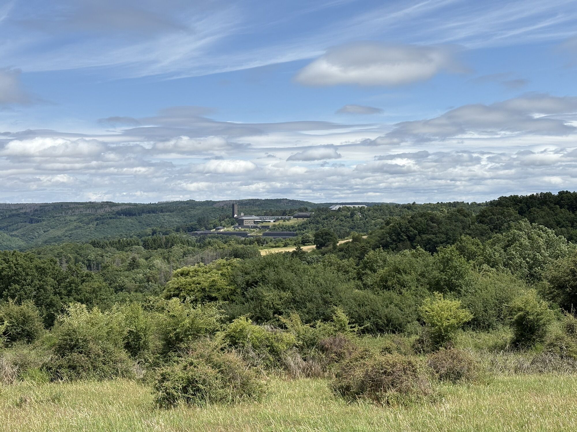


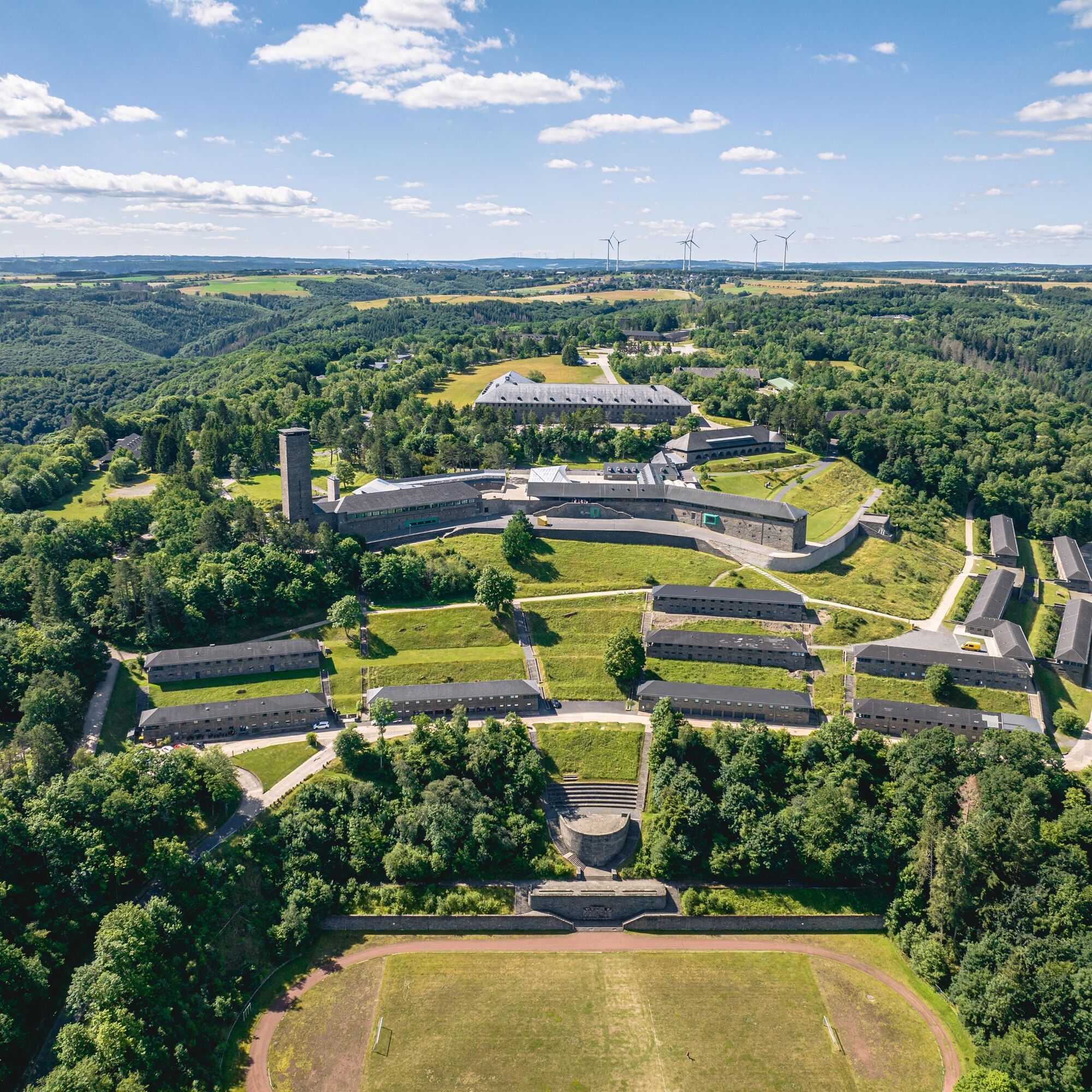
At the starting point of this moderately difficult hike are the Eifel National Park Center with its interactive exhibition "Wildnis(t)räume" and the International Place Vogelsang IP, which can be explored....
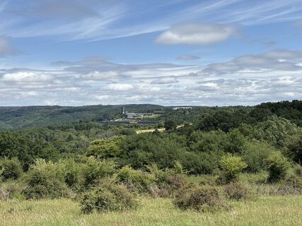
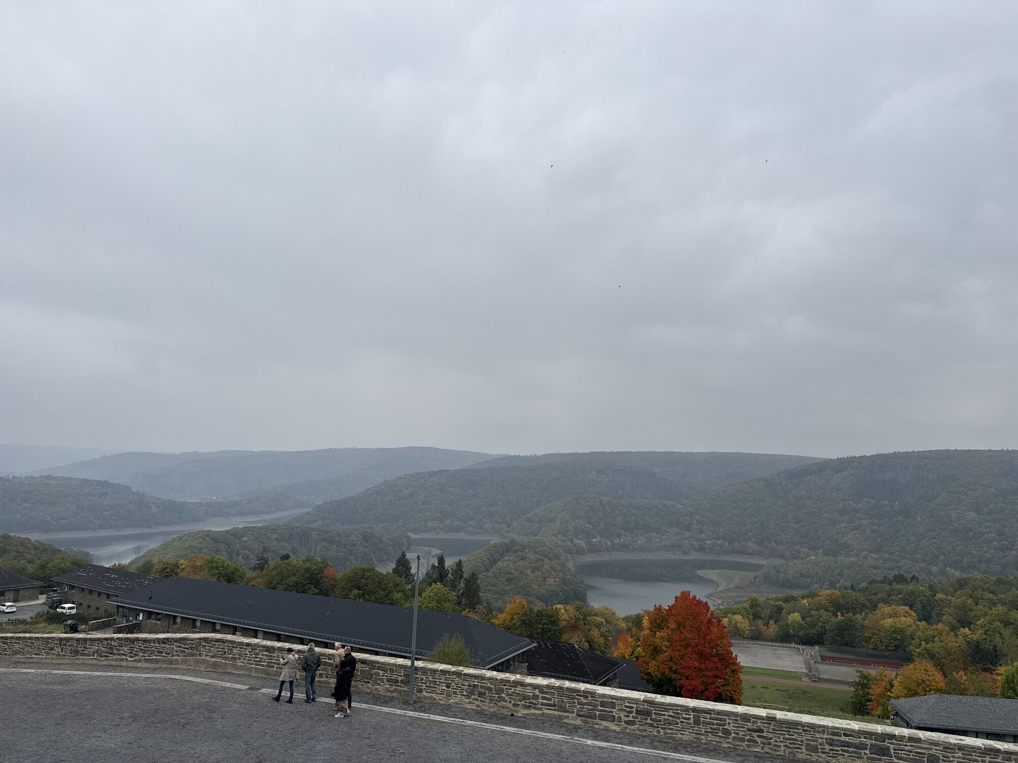
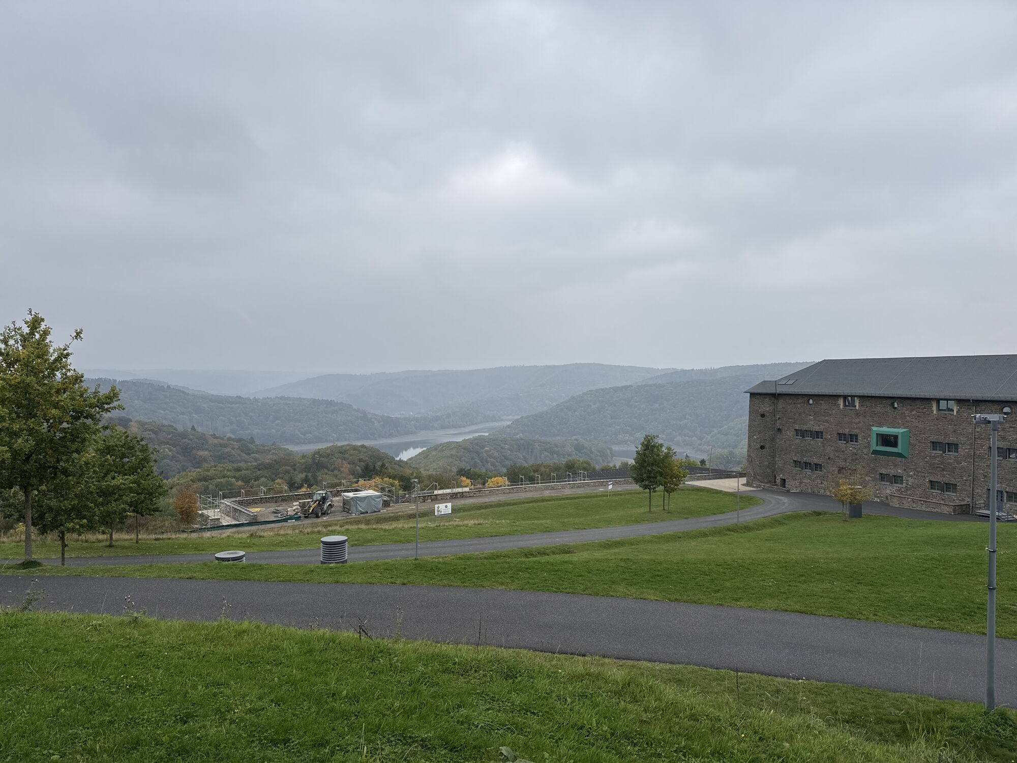
At the starting point of this moderately difficult hike are the Eifel National Park Center with its interactive exhibition "Wildnis(t)räume" and the International Place Vogelsang IP, which can be explored. Here, nature meets a place that responsibly reflects and processes its past. In addition to deep insights into the former Nazi Ordensburg, there are also wide views over the Kermeter forest, which forms the core of the national park.
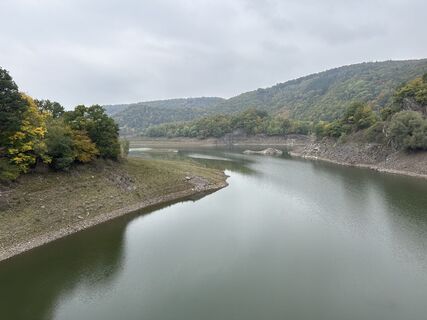
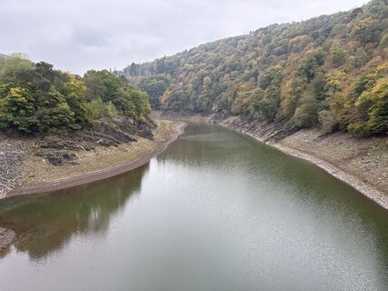
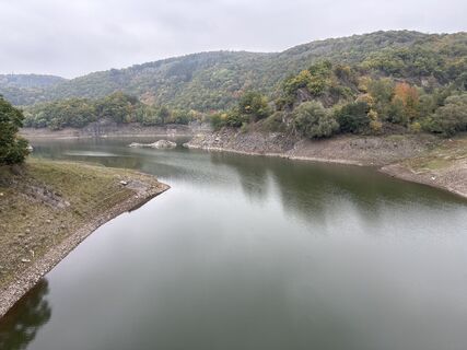
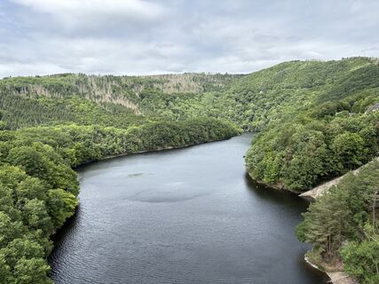
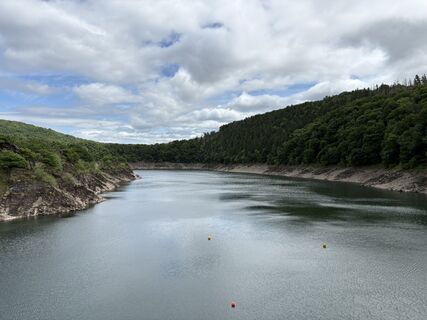
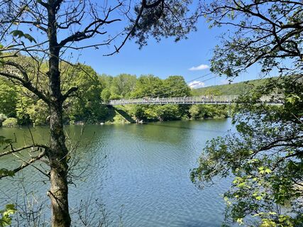
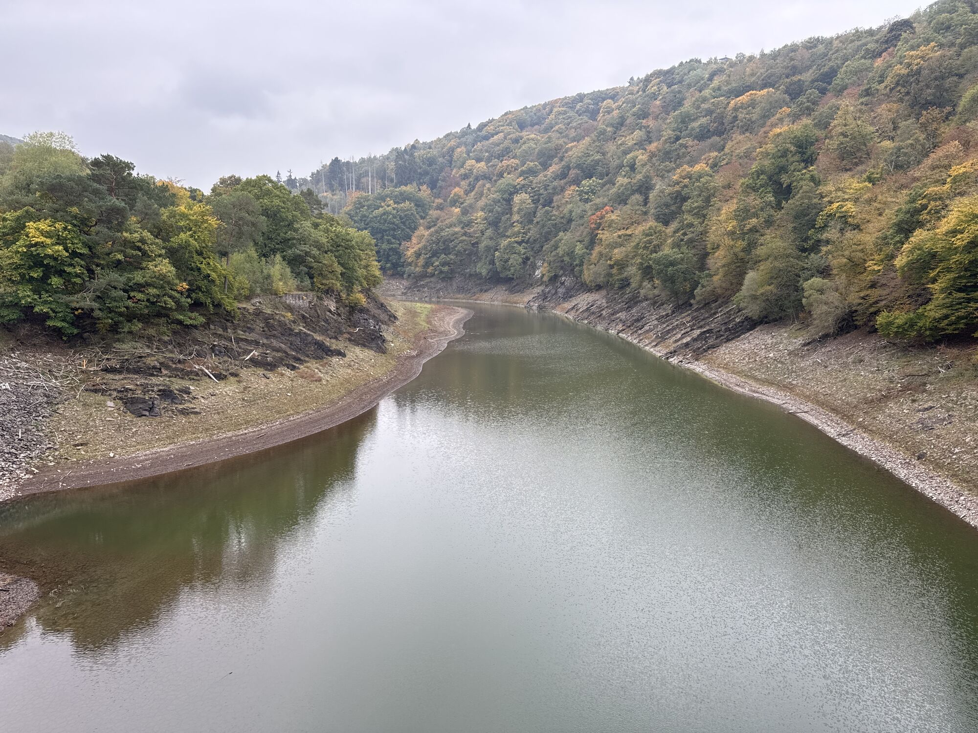
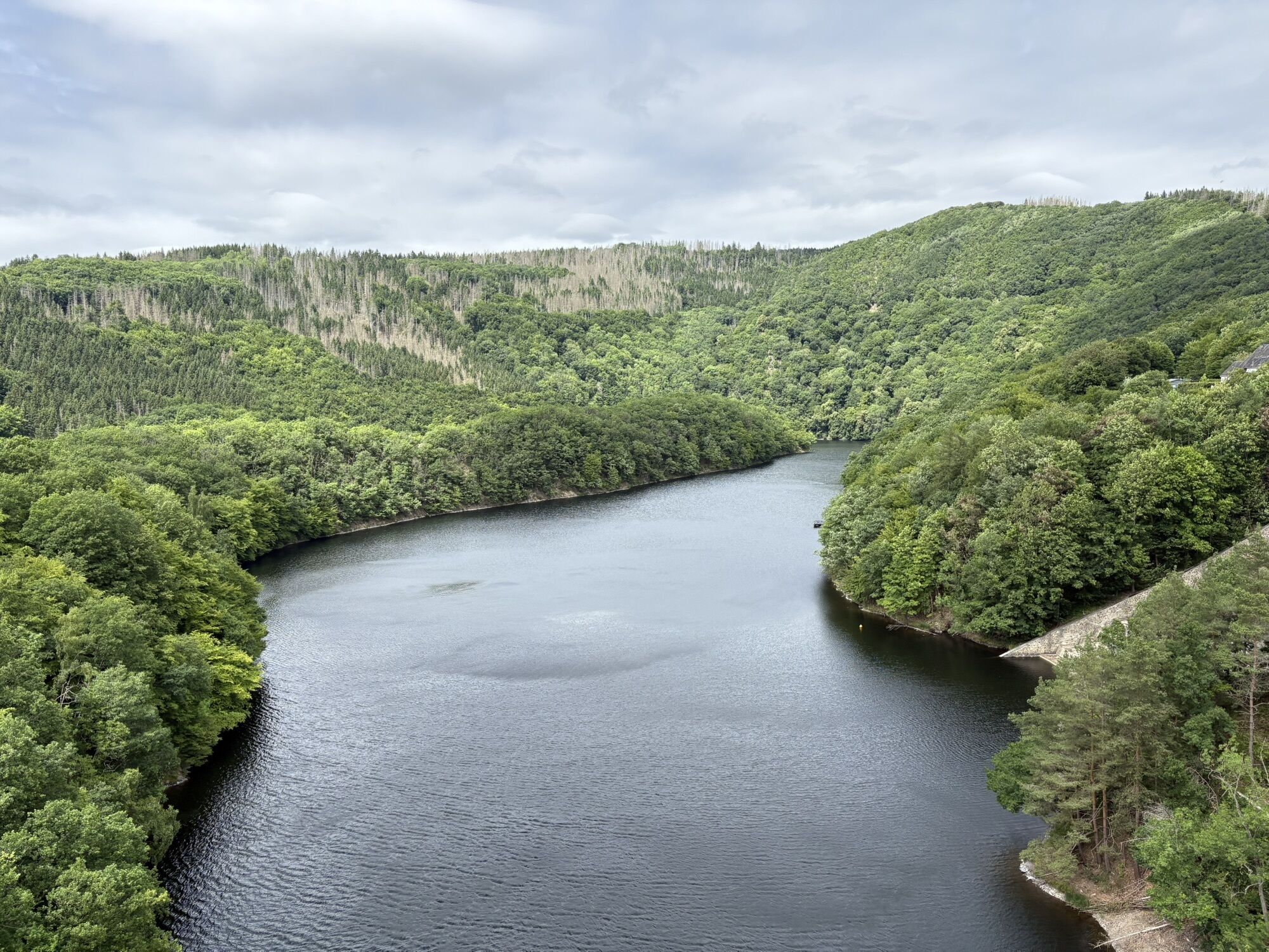
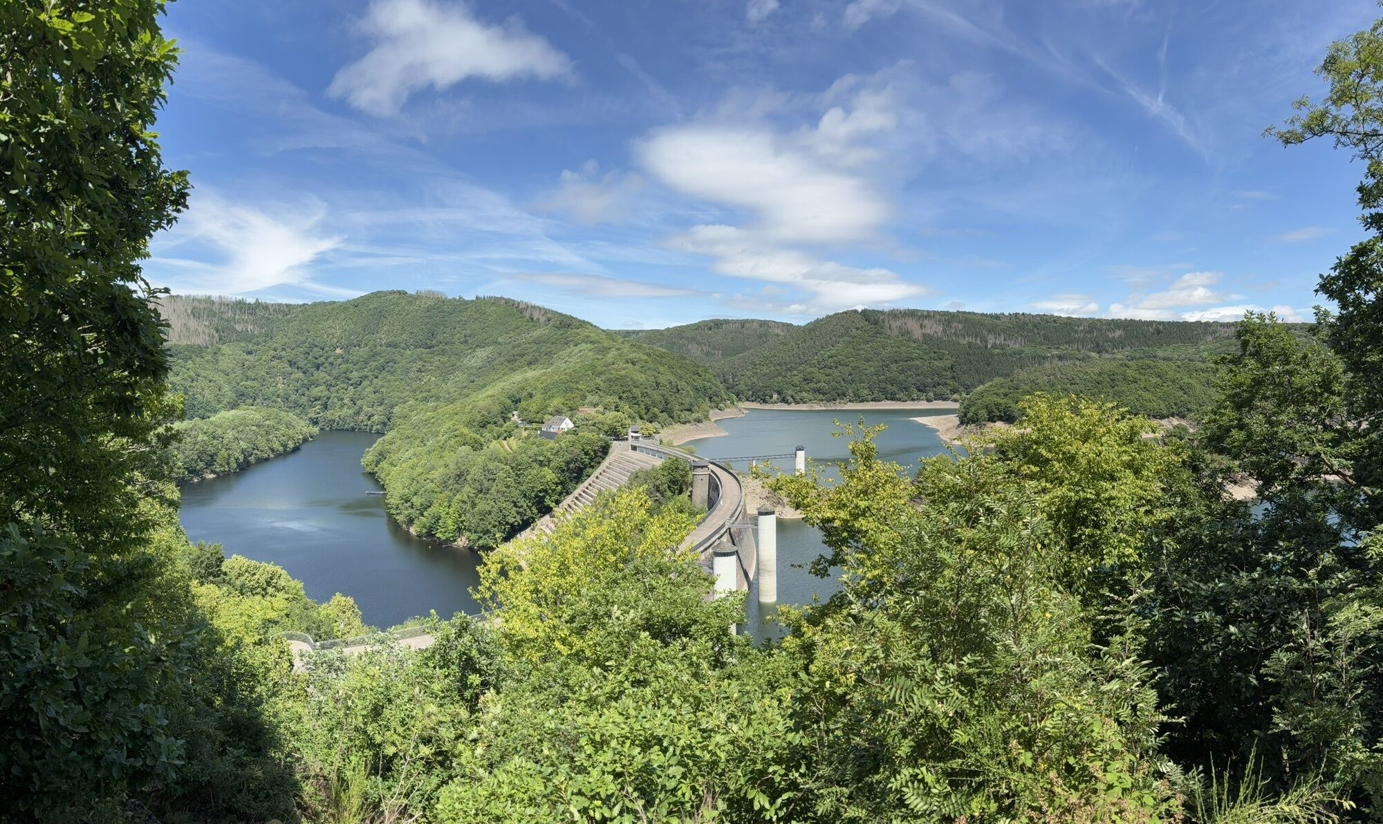
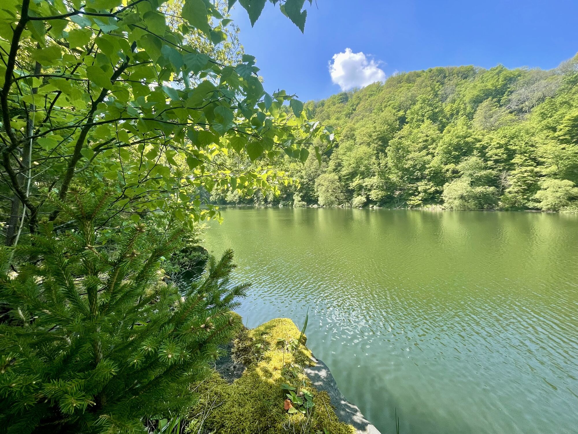
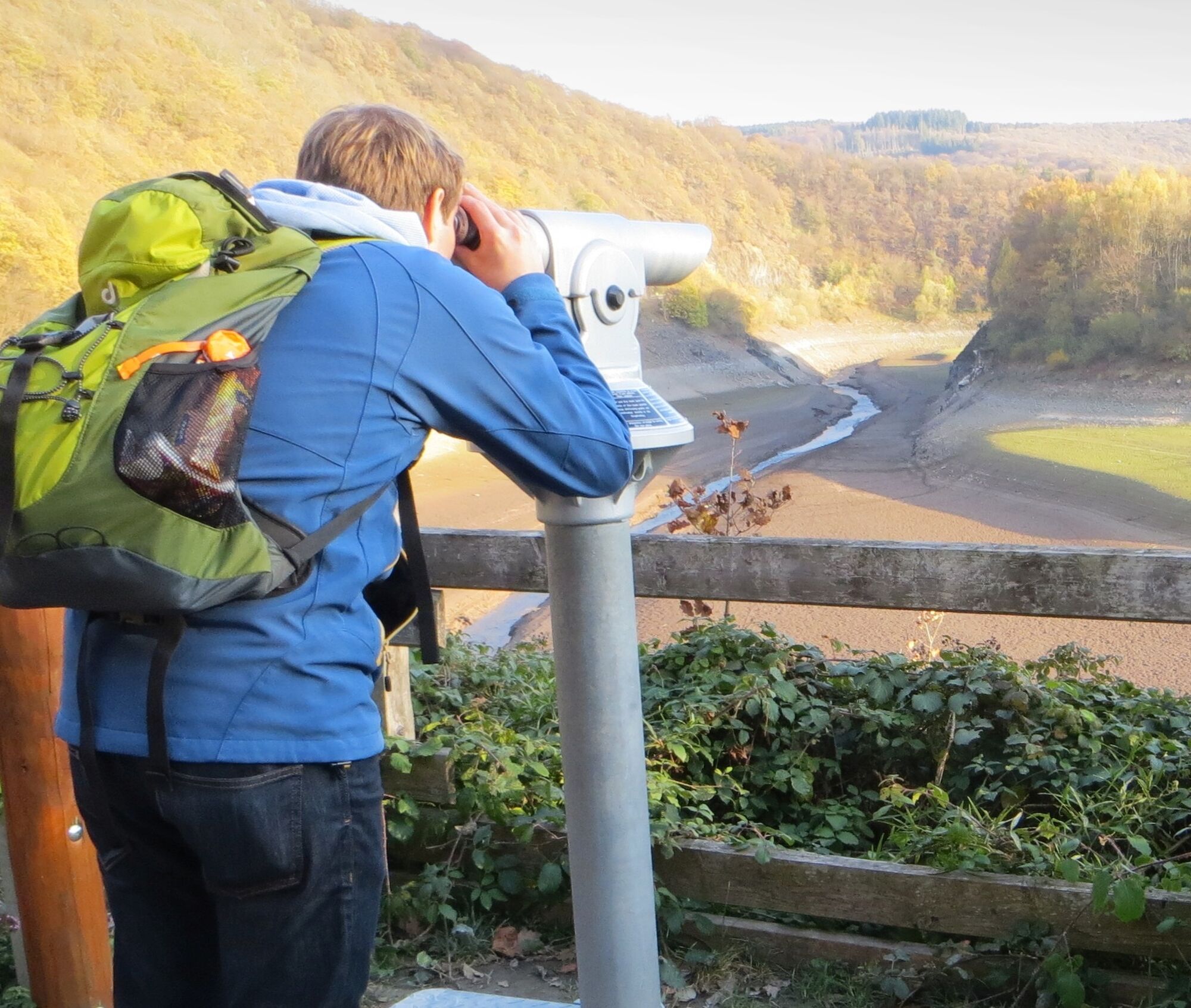
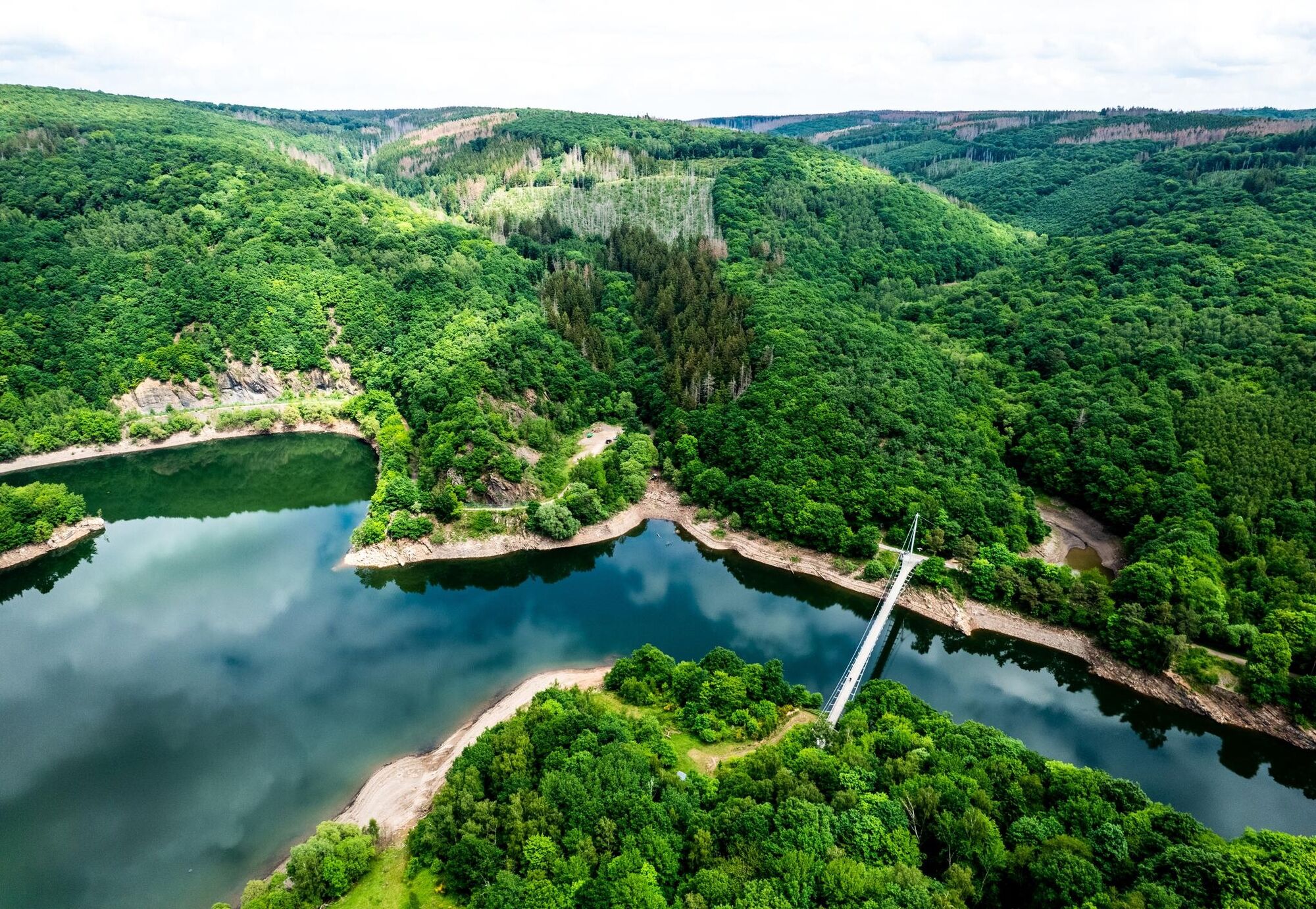
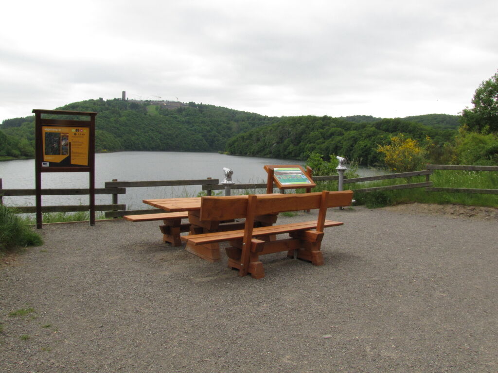
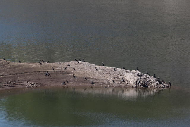
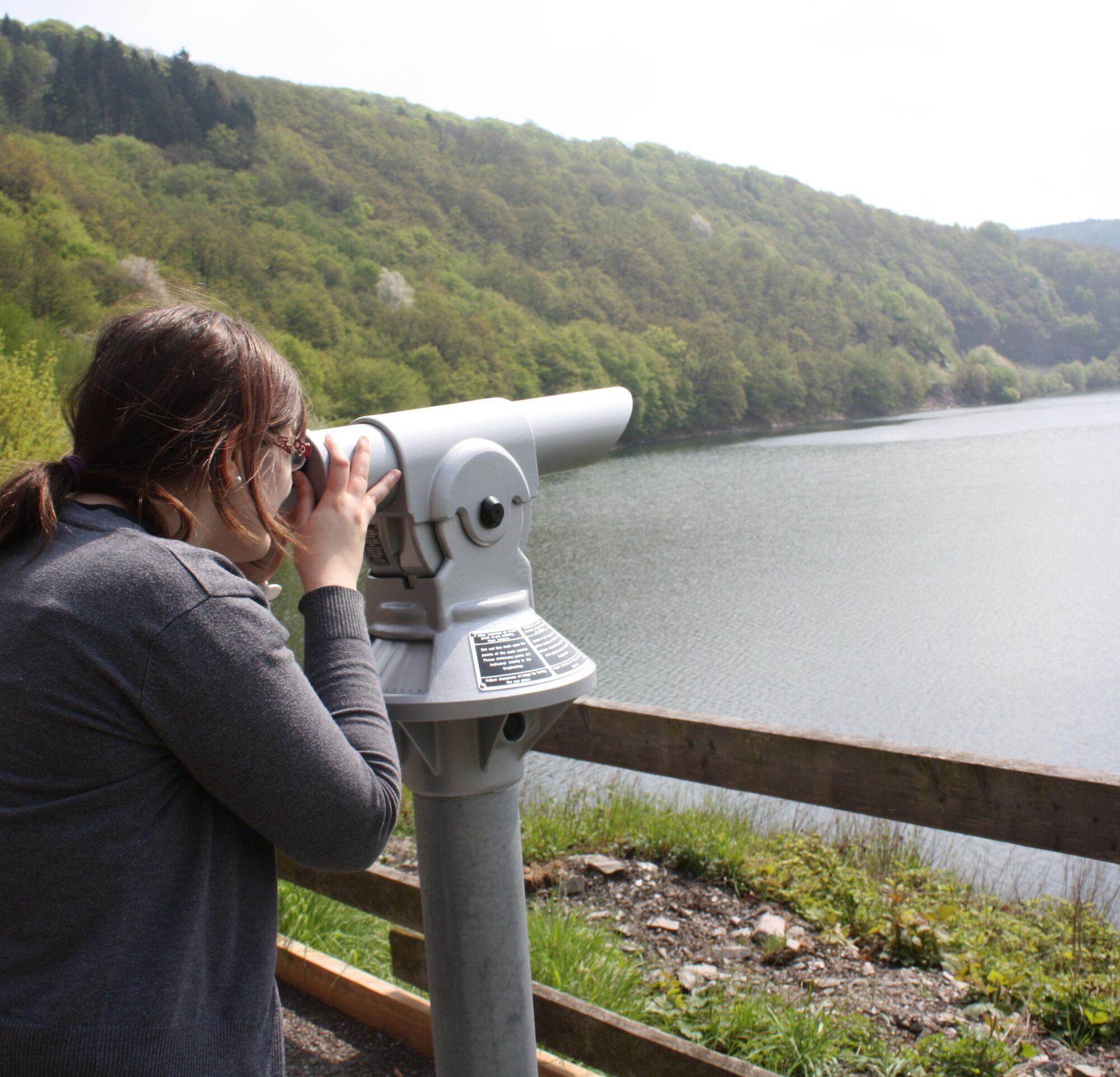
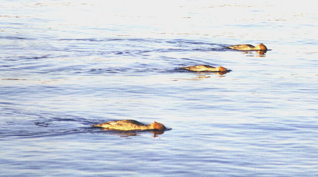
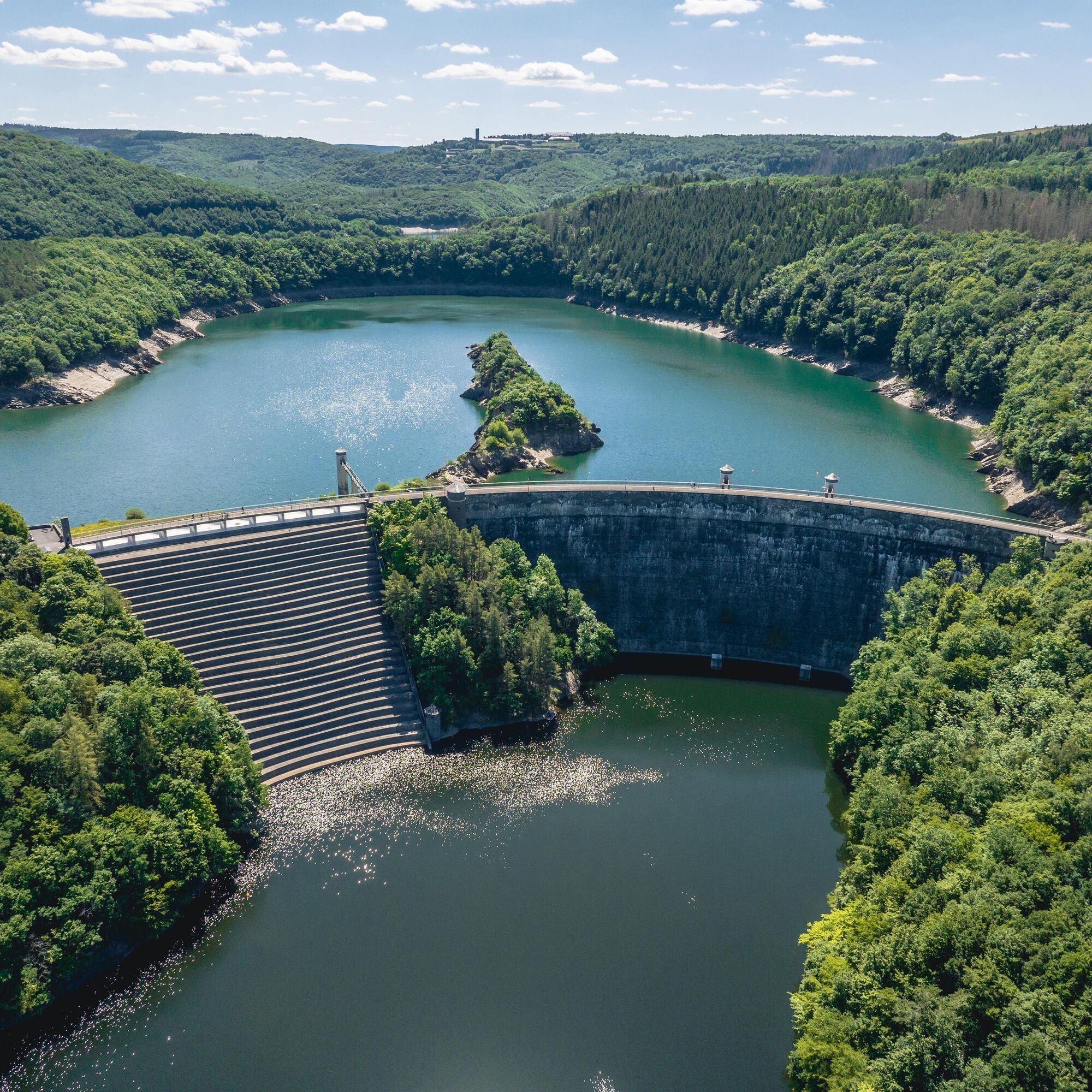
From Vogelsang, the route goes over the Victor-Neels Bridge and downstream along the Urft River. After a short time, the Bird Watching Station is reached. With some luck, not only grey herons, great crested grebes, and ducks can be spotted from there, but also cormorants.
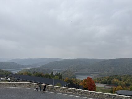
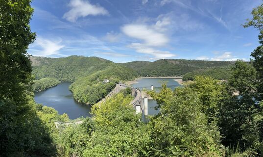
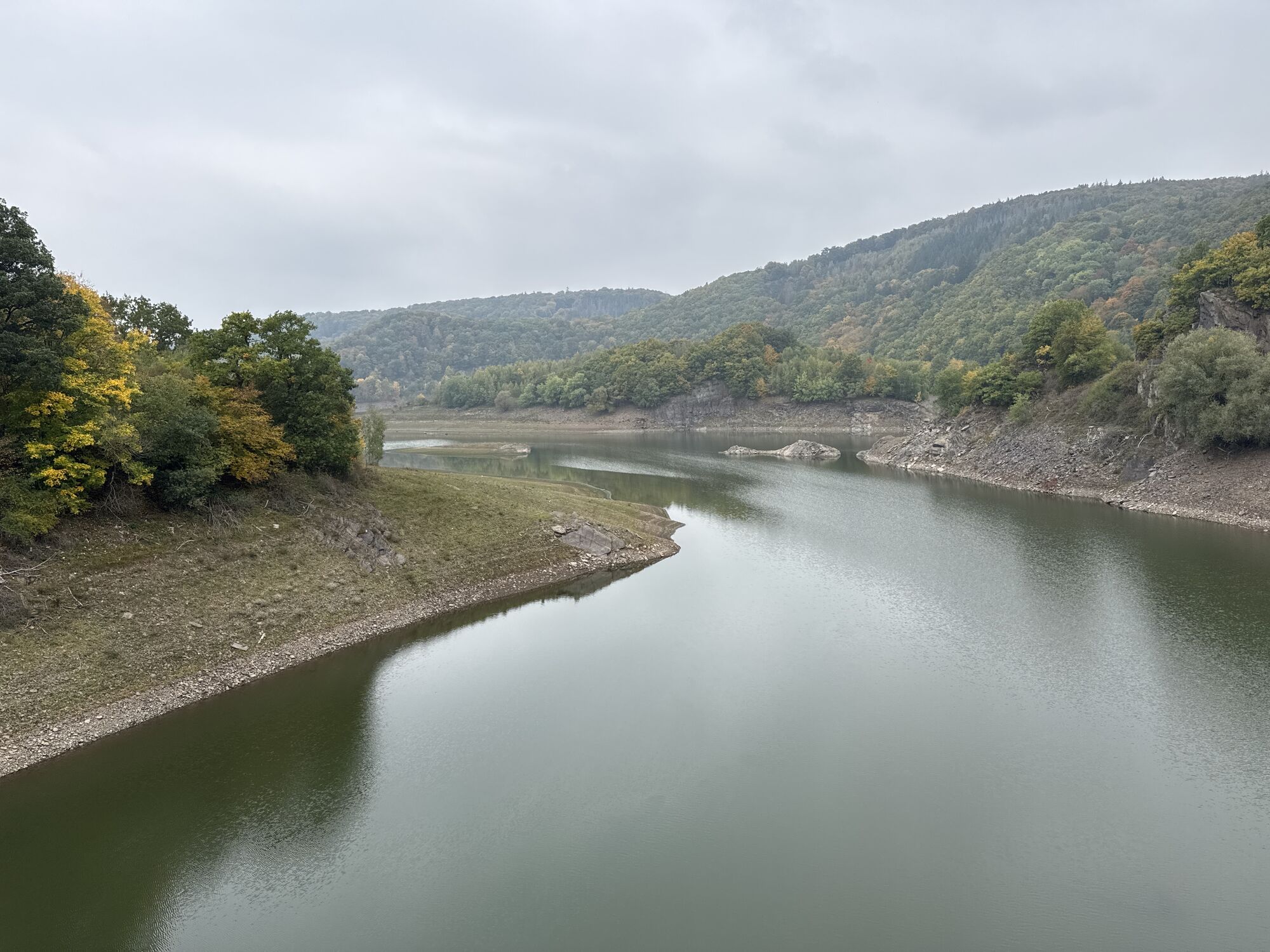
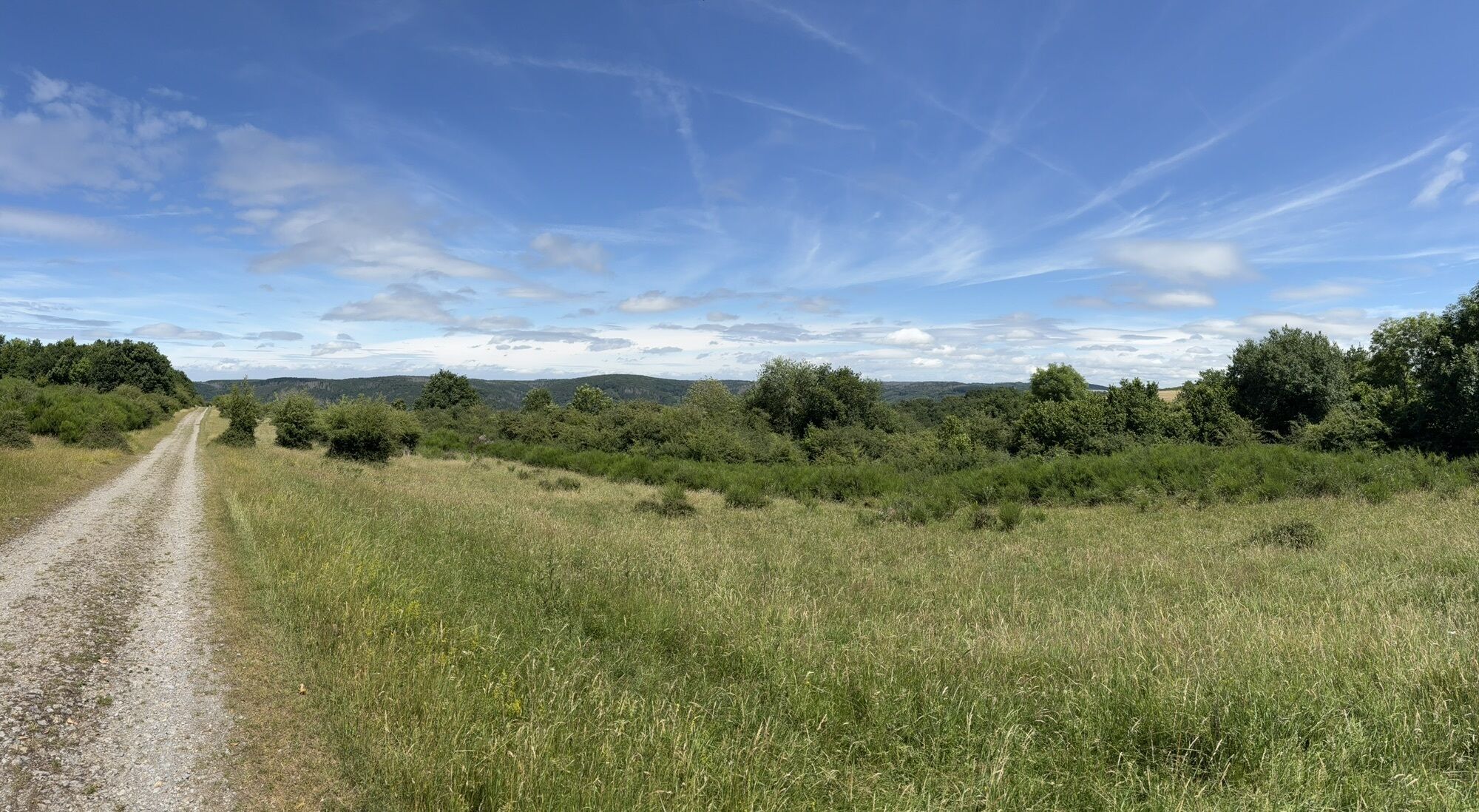
The hike continues towards the Urft Dam, where an excursion restaurant invites visitors to rest. Well strengthened, the path leads further up to the Dreiborn plateau, offering a wide view into the distance. After passing through the deserted village of Wollseifen, a short stretch leads back to Vogelsang.
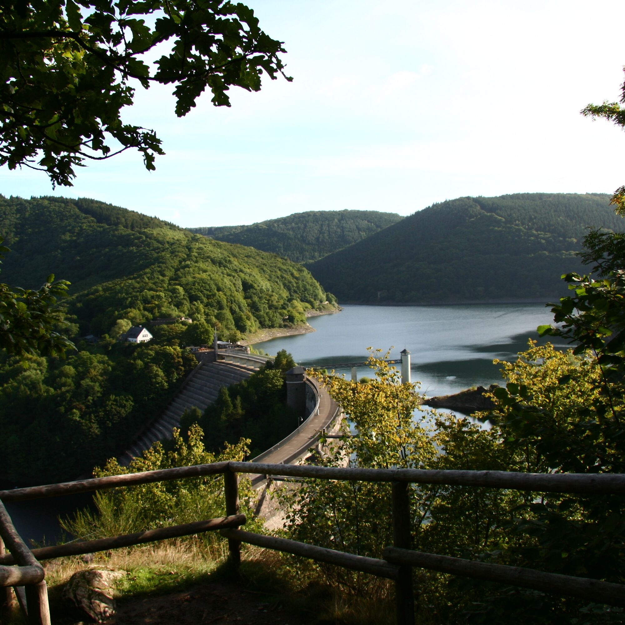
The route begins on the grounds of Vogelsang IP. The path leads steeply downhill to the Victor-Neels Bridge. Then it continues to the left towards the 'Bird Watching Station'. After a short break, the hike continues downstream along the Urft River to the Urft Dam. At the halfway point is the Urftseemauer excursion restaurant, inviting you to take a rest. From here, the route continues over the crest of the Urftsee Dam and then along a narrow path alongside the rocks up the hill to the left towards Wollseifen. Following the signs, after some time you reach the deserted village of Wollseifen. In the village, there are various opportunities to learn more about the eventful history of Wollseifen. The hike passes to the left of the old church and continues from there towards Vogelsang. Initially, the path goes a bit steeper downhill again and, after crossing the Neffgesbach stream, back uphill to the grounds of Vogelsang IP. Here, the Vogelsang IP gastronomy invites you to stop for another meal.
We recommend: sturdy footwear, weather-appropriate clothing, sufficient drinking water, and provisions from your backpack 🎒
It should be noted that the Dreiborn plateau is subject to harsher weather conditions than the protected forest. Therefore, special attention should be paid to protection against sun and heat as well as cold and wet weather. The weather forecast should be included in your route planning.
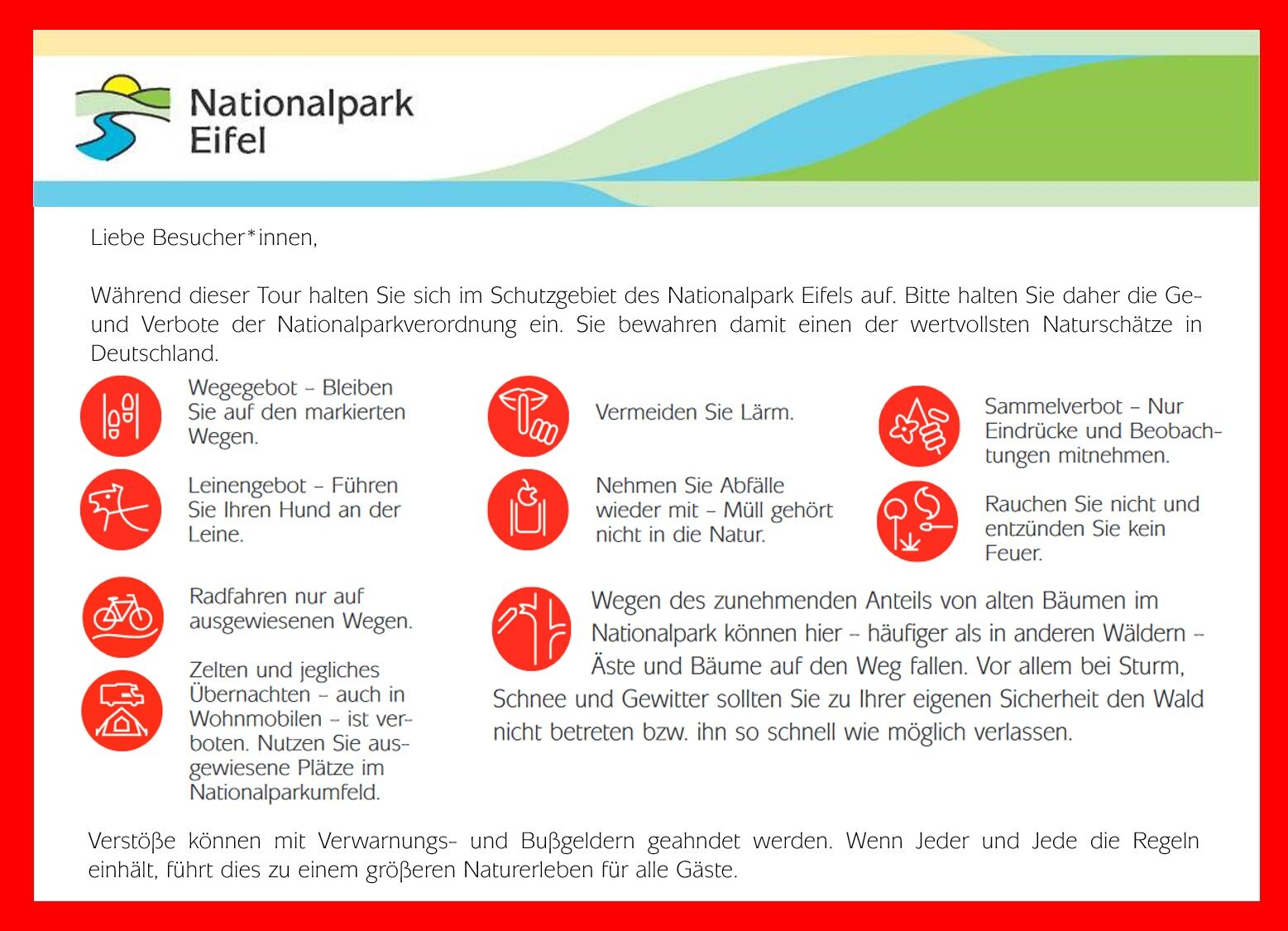
Due to the increasing proportion of old trees in the national park, branches and trees may fall onto the path here more frequently than in other forests. Especially during storms, snow, and thunderstorms, the forest should not be entered or should be exited as quickly as possible for your own safety.
Participation in events and entry into the national park is at your own risk.
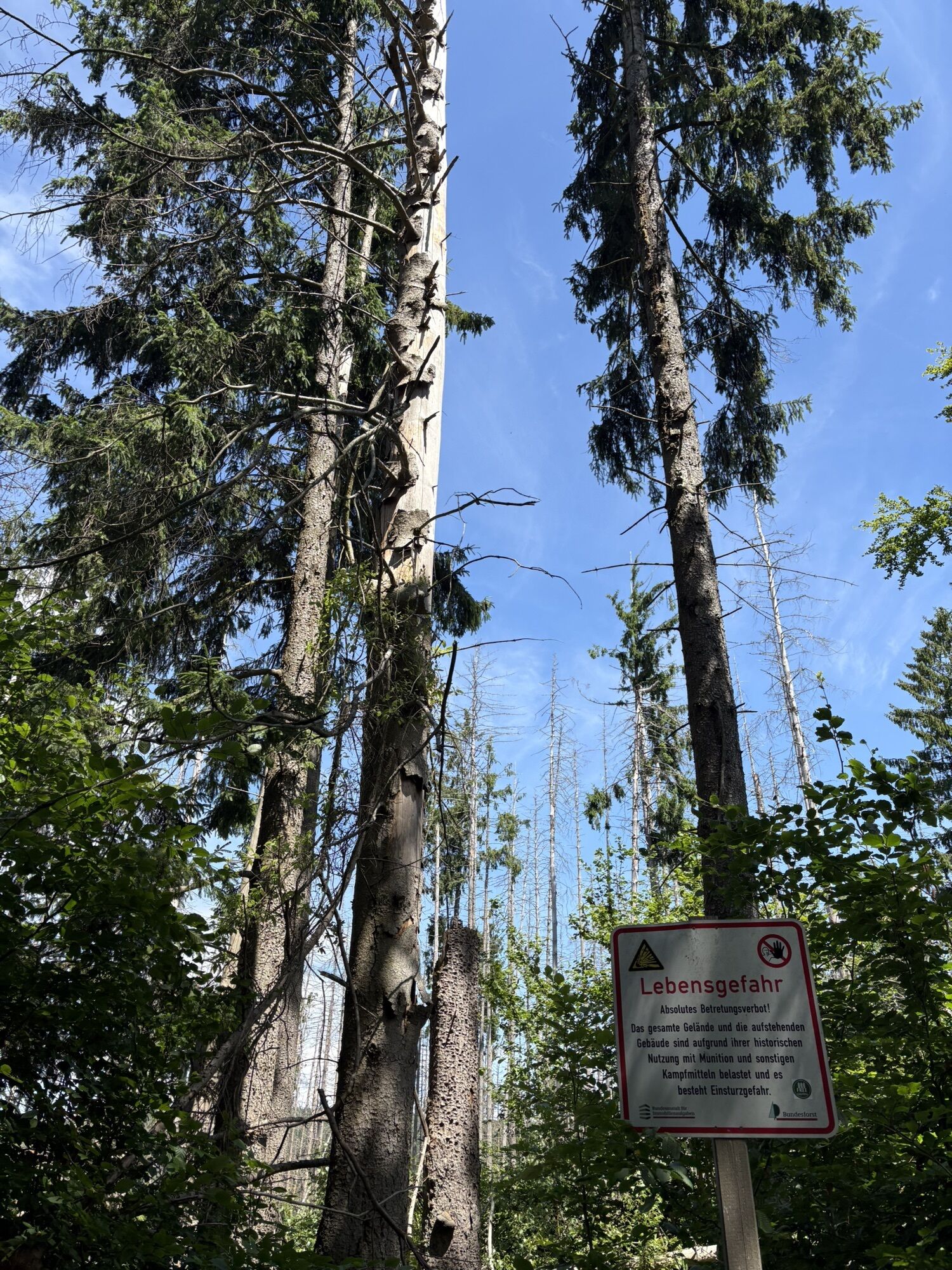
Additional caution is required on the Dreiborn plateau, as it was actively used as the "Vogelsang military training area" until the end of 2005. Leaving the marked paths is prohibited because there is a danger to life from explosives or unexploded ordnance off these paths.
From the direction of Cologne via B553 and A1 towards Euskirchen, then via B266 through Mechernich, Kall, and Schleiden-Gemünd towards Einruhr. Vogelsang IP is located directly on B266 on the Dreiborn plateau.
From the direction of Aachen via B258 past Roetgen, then turn left onto B266 via Lammersdorf, Kesternich and Einruhr. Vogelsang IP is located directly on B266 on the Dreiborn plateau.
From the direction of Cologne by train to Kall station and from there by bus SB82 to Vogelsang IP.
Timetable information from Cologne: www.vrs.de/fahrplanauskunft
From the direction of Aachen by bus SB63 to Simmerath bus station and then change to bus 63 to Vogelsang IP.
Timetable information from Aachen: www.auskunft.avv.de
Sundays between June 15 and All Saints' Day, you could also take bus line 814 from Kall station to the Urft Dam/Haftenbach and start the hike from there to Vogelsang IP. This approximately halves the distance and offers two options for the hike: 1. A relatively long, leisurely walk along the water and then steeply uphill to Vogelsang IP, or 2. Steeply uphill over the dam wall to Wollseifen (historically very interesting) and from there through the Neffgesbach valley to Vogelsang IP.
Vogelsang IP offers paid parking facilities. The small hiking parking lot at Walberhof opposite the entrance to Vogelsang IP is free of charge. From there, it is about 2.4 km to the visitor center.
T1
Eifel National Park Administration
Urftseestraße 34
53937 Schleiden-Gemünd
Tel.: +49 (0) 24 44. 95 10-0
Fax: +49 (0) 24 44. 95 10-88
Email: info@nationalpark-eifel.de
Homepage www.nationalpark-eifel.de
Eifel National Park Center
Forum Vogelsang IP
Vogelsang 70
D-53937 Schleiden
Administration Tel.: +49 (0) 2444 91574-0
Administration Fax: +49 (0) 2444 91574-28
Booking Tel.: +49 (0) 2444 91574-11
Booking Fax: +49 (0) 2444 91574-29
Email: info@nationalparkzentrum-eifel.de
Homepage www.nationalparkzentrum-eifel.de
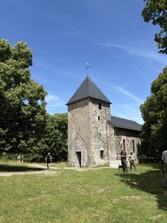
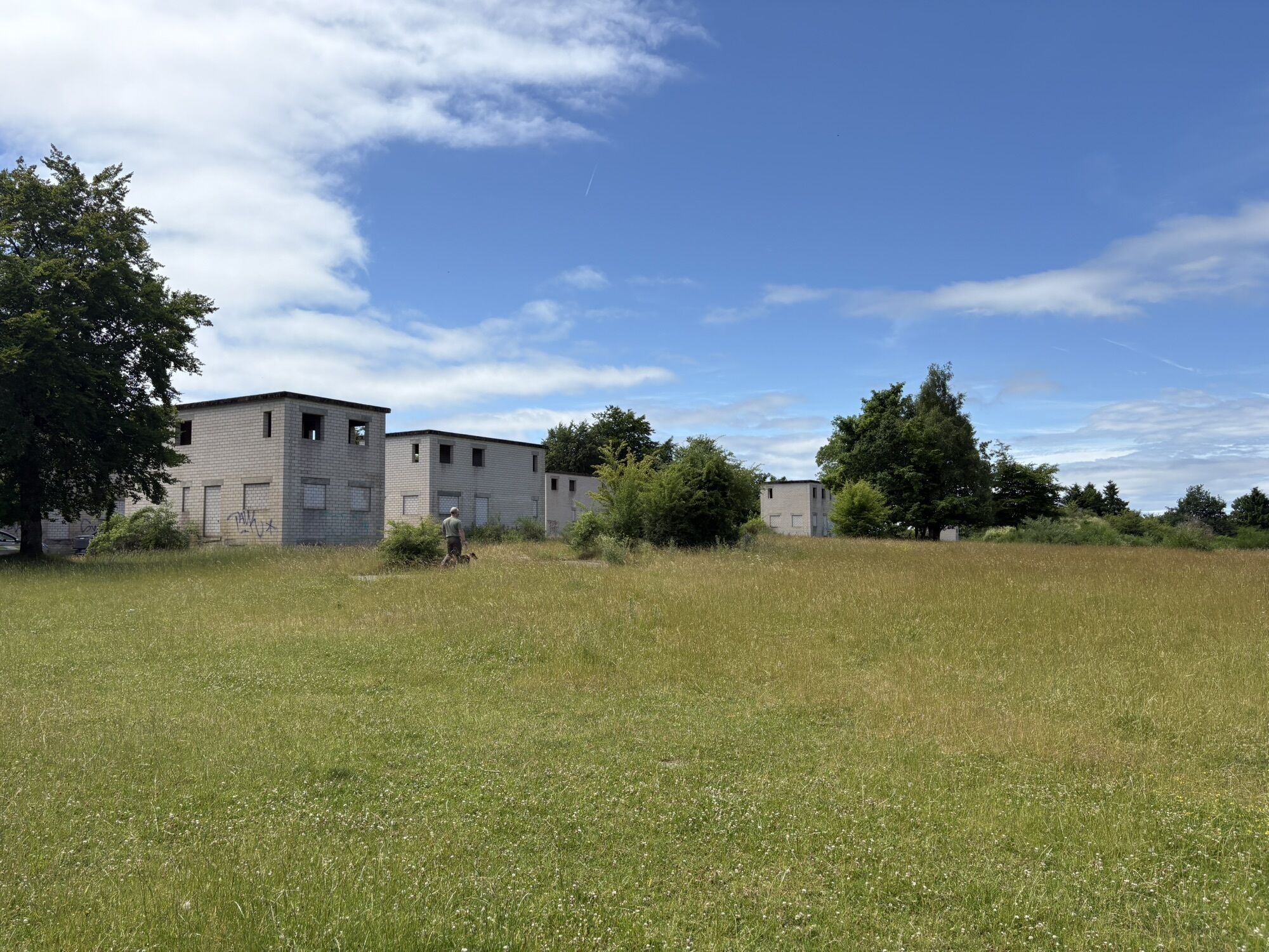
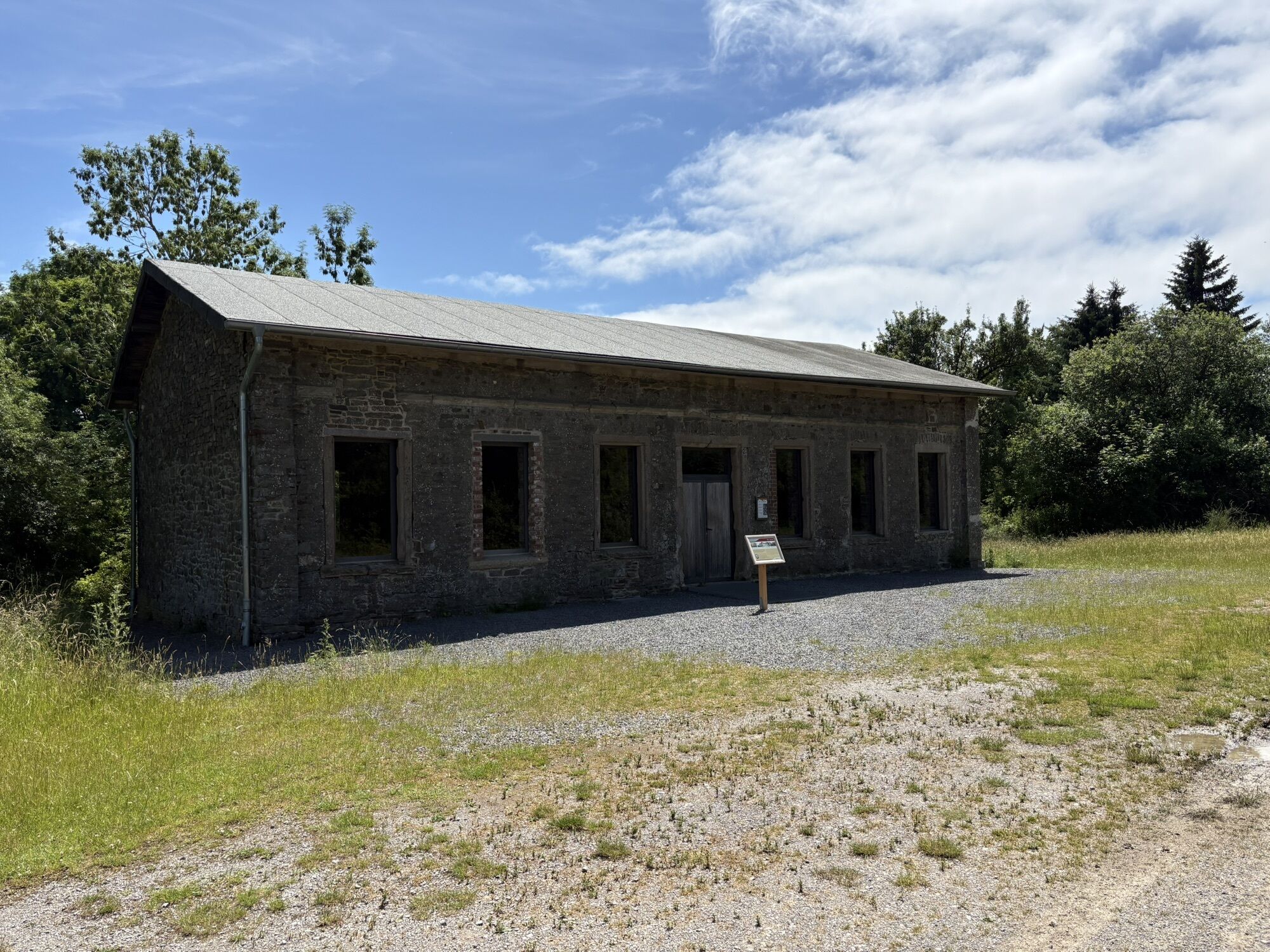
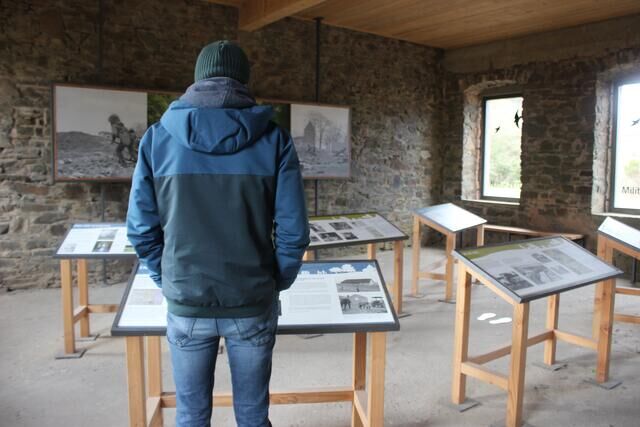
Shortly before the end of the hike, you pass through Wollseifen. The former village was incorporated into the Vogelsang military training area after World War II, forcing all residents to leave Wollseifen. Today, the tragic history of the village, which was almost completely destroyed by military exercises, can be explored at various stations: structural remains such as the old village church are freely accessible, and a visit to the exhibition in the "Old School" offers even deeper insights.
Популярные экскурсии по окрестностям
-
4,0
Von Vogelsang über die Urftseebrücke
среднийПоход 13,4 км -
4,5
Zuschauerwanderung - Nationalpark Eifel
среднийПоход 14 км -
5,0
Der Wadenbeißer - Nationalpark Eifel
тяжелыйПоход 25,2 км -
4,8
Bird Watching Runde
среднийПоход 11,8 км -
Vergangene Zeiten und zukünftige Wildnis - Nationalpark Eifel
среднийПоход 6,34 км -
4,5
Themen-Tour 2 - Buchenhallen und Eichenhänge - Nationalpark Eifel
среднийтематический маршрут 13,6 км -
Nationalpark auf einen Blick - Nationalpark Eifel
светПоход 4,94 км -
5,0
Wildnis-Trail (Etappe 2) - Nationalpark Eifel
тяжелыйтематический маршрут 19,9 км -
4,0
Eifelsteig Etappe 3
среднийПоход 24,5 км -
Eifelfjorde – Von Einruhr zur Urftstaumauer - Nationalpark Eifel
среднийПоход 7,73 км
Походы и трекинг


Не пропустите предложения и вдохновение для вашего следующего отпуска
Ваш адрес электронной почты был добавлен в список рассылки.