


Trail to Ouillon des Arcelins through the canopy of the peaks


After an effortless ascent thanks to the lifts, you begin your escape at 2565m altitude. The temperature immediately contrasts with that of the valley, which you left just 15 minutes earlier. Climb even...
After an effortless ascent thanks to the lifts, you begin your escape at 2565m altitude. The temperature immediately contrasts with that of the valley, which you left just 15 minutes earlier. Climb even higher to the Col de la Met. What an exhilarating panorama from the belvedere at 2740m! On a clear day, you're guaranteed to be immersed. In front of you, 9 remarkable peaks share the limelight with Lake Mont Cenis. Can you identify them on the unusual orientation table?
Tackle the descent to the Col de la Tomba with care, so that your legs don't suffer too much from the laws of gravity.
On the Ouillon des Arcellins, the well-marked path alternates between alpine grass and unstable rock. You'll need sure-footedness and experience of aerial passages to fully savor the magic of this ridge, which is nonetheless without specific danger. If you're afraid of aerial passages, take the carriage path and temporarily deviate from the route.
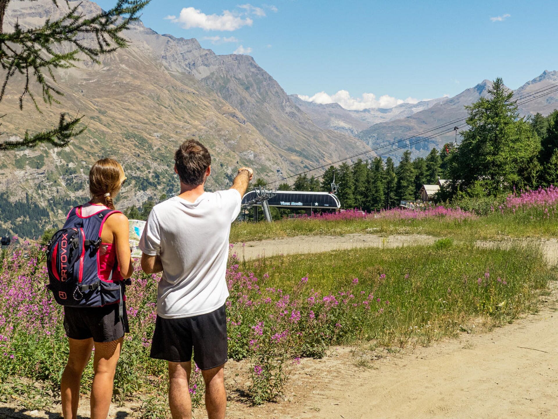
A playful path cut through the high moor gradually leads to the top of the Vieux Moulin gondola.
End your escapade by sharing a wide track with regular mountain bikers. Boarding the Vieux Moulin gondola is now imminent. Unless a gourmet break awaits you at the Fema high-altitude restaurant...

To guide you in the field, consult the "step-by-step" directional diagram provided in pdf.
The duration of hiking trails is calculated using reference paces: 300 m/h ascent, 500 m/h descent and 4 km/h on the flat.
As hazards may occur at any time on the routes, the GPX tracks provided are not contractual. They are given for information only. Riders use them at their own risk, depending on their level of technological proficiency and their understanding of the terrain.
Популярные экскурсии по окрестностям
-
4,7
Rocciamelone partedjo dalla Riposa. Mompantero, Piemont/Italien
среднийПоход 10,6 км -
The White Lake
светПоход 4,42 км -
Col du Mont Cenis from Lanslebourg
тяжелыйДорожный велосипед 9,84 км -
Sentier pédestre des Sculptures - Land Art Montagne
светтематический маршрут 5,16 км -
Col du Mont Cenis from Modane
тяжелыйДорожный велосипед 34,8 км -
Little ascent of Plan d'Aval
тяжелыйДорожный велосипед 6,37 км -
5,0
Goldtoni - Alpenbogen A068 Refuge de la Leisse-Termignon Val Cenis
среднийПешеходная тропа большой протяженности 28,7 км -
Col de l'Iseran from Termignon
тяжелыйДорожный велосипед 38,3 км -
Petit Mont-Cenis pass
тяжелыйДорожный велосипед 18,0 км -
Walking in the heart of the village of Bessans
светтематический маршрут 1,74 км
Походы и трекинг


Не пропустите предложения и вдохновение для вашего следующего отпуска
Ваш адрес электронной почты был добавлен в список рассылки.