© Skiinfo & Bergleben

- Краткое описание
-
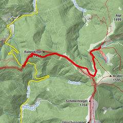
An extended, but through the numerous stations comfortable hike to the highest peak on the eastern edge of the Alps, the Stuhleck. The panoramic view extends from the summit as well as on parts of the ascent from Hochschwab over the Gesäuse, the Rax massif to the Pannonian lowlands with the offshore eastern Styria.
- Трудность
-
сложный
- Оценка
-
- Маршрут
-
RetteneggSticklberg0,6 kmStuhleck (1.782 m)6,8 kmRennbauerhöhe (1.369 m)10,7 kmForellengasthof Joglland15,1 kmRettenegg15,9 km
- Лучший сезон
-
янвфевмарапрмаяиюниюлавгсеноктноядек
- Самая высокая точка
- 1.769 m
- Место назначения
-
Stuhleck / Alois Günther House
- Профиль возвышения
-


-

-
АвторТур In the footsteps of Peter Rosegger - On the Planet Trail используется outdooractive.com предоставлен.
GPS Downloads


Общие сведения
Закусочная
Культура/Исторический
Флора
Фауна
Многообещающий
Другие туры в регионах
-
Hochsteiermark
4066
-
Waldheimat
2182
-
Rettenegg
452