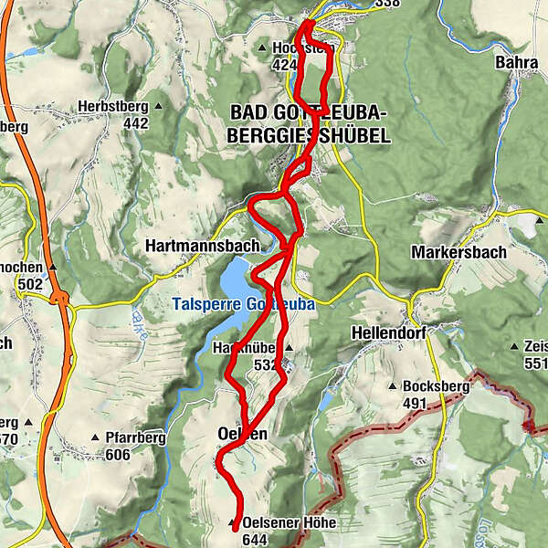
Hike on the Montanhistorischer Wanderweg: from Berggießhübel via Bad Gottleuba to Oelsener Höhe and back


© Tourismusverband Sächsische Schweiz - Touristinformation Bad Gottleuba-Berggießhübel

© Tourismusverband Sächsische Schweiz - Touristinformation Bad Gottleuba-Berggießhübel

© Tourismusverband Sächsische Schweiz - Mario Scheinert

© Tourismusverband Sächsische Schweiz - Mario Scheinert

© Tourismusverband Sächsische Schweiz - Mario Scheinert
- Краткое описание
-
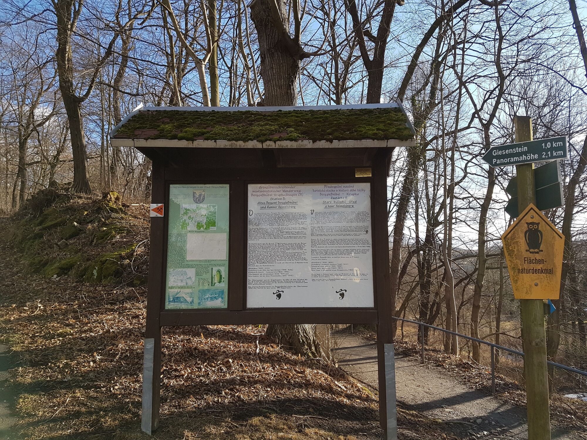
...from Berggießhübel via Bad Gottleuba to the Oelsener Höhe and back.Historical events up close - that's what awaits the hiker on this tour. Especially on the way from Berggießhübel to Bad Gottleuba and further to the Kulmer Steig, you will be transported back into mining history. The highlight in the truest sense of the word is the ascent to the Oelsener Höhe, the highest elevation in Saxon Switzerland. The route back is slightly different via the Hohlen Stein and the Panoramahöhe.
- Трудность
-
средний
- Оценка
-
- Маршрут
-
Sächsisches Haus0,3 kmBerggießhübel0,4 kmGiesenstein1,6 kmBad Gottleuba-Berggießhübel2,3 kmParkcafé „Alter Bahnhof“2,8 kmBad Gottleuba3,4 kmGasthof Hillig3,7 kmHammergut Haselberg5,0 kmOelsen9,5 kmOelsener Höhe (644 m)11,3 kmOelsener Höhe (644 m)11,5 kmOelsen13,5 kmBad Gottleuba19,5 kmParkcafé „Alter Bahnhof“20,2 kmBad Gottleuba-Berggießhübel20,6 kmPanoramahöhe (437 m)21,5 kmBerggießhübel23,0 km
- Лучший сезон
-
янвфевмарапрмаяиюниюлавгсеноктноядек
- Самая высокая точка
- 643 m
- Место назначения
-
Berggießhübel
- Профиль возвышения
-
 © outdooractive.com


- Автор
-
Тур Hike on the Montanhistorischer Wanderweg: from Berggießhübel via Bad Gottleuba to Oelsener Höhe and back используется outdooractive.com предоставлен.
GPS Downloads


Общие сведения
Закусочная
Культура/Исторический
Внутренний совет
Многообещающий
Другие туры в регионах
-
Sächsische Schweiz
1405
-
Erzgebirge
629
-
Bad Gottleuba-Berggießhübel
268